 It looks like the blogging app I used to use is back? This is a test to see if it really works.
Monday, September 22, 2025
Back to blog touch?
It looks like the blogging app I used to use is back? This is a test to see if it really works.
Sunday, July 13, 2025
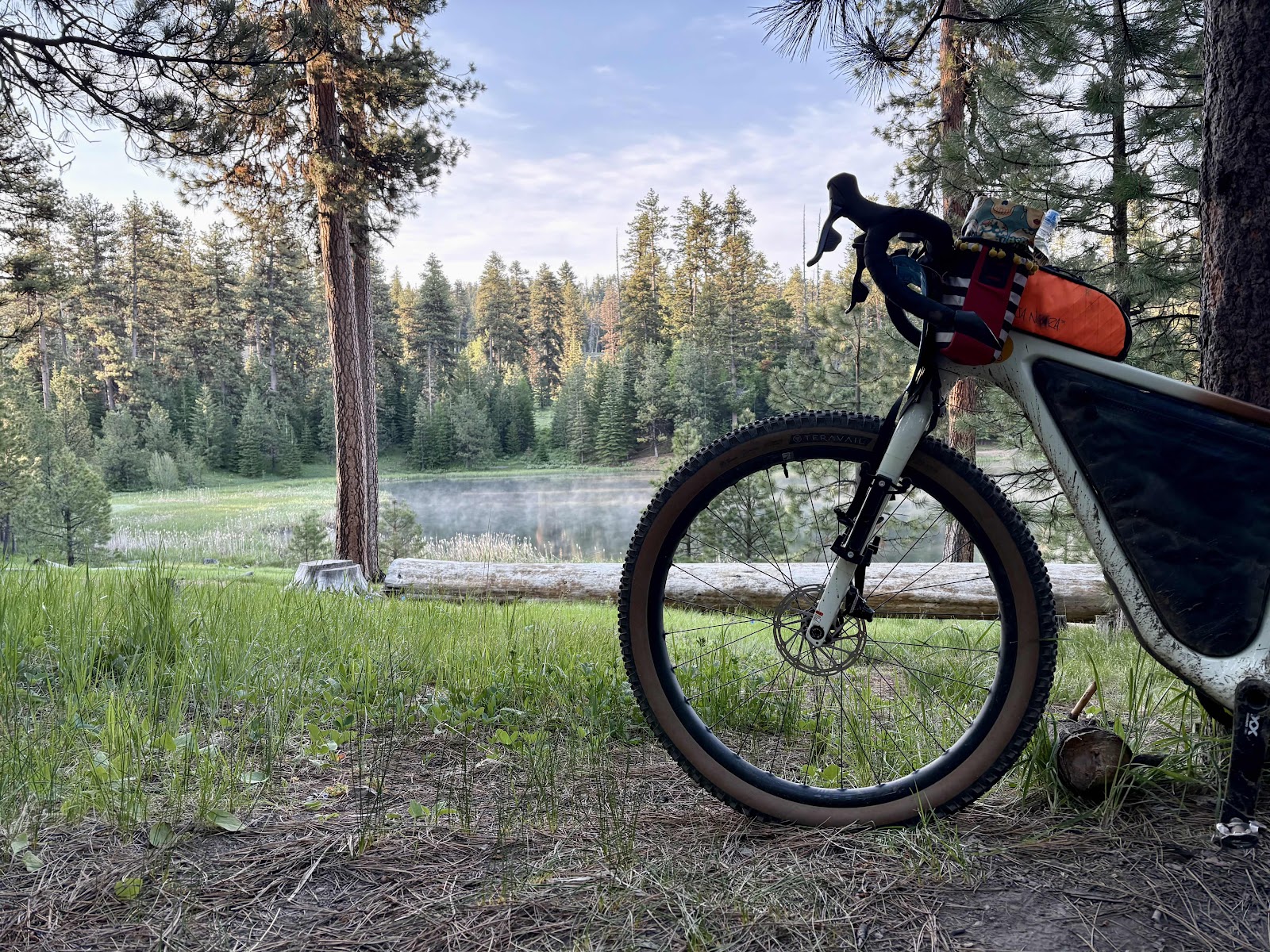
(Temporary Backup) Fire and Ice and Mosquitos and Dust-Day 3
Laying in our tents last night, we were observing the large number of insects wishing they could join us. We knew that they would be patient little bloodsuckers, knowing we would have to come out sometime. Sure enough, when I got out to pee at about 5:00am, they were right there waiting. I did manage to get back inside without letting any in (that I know of).
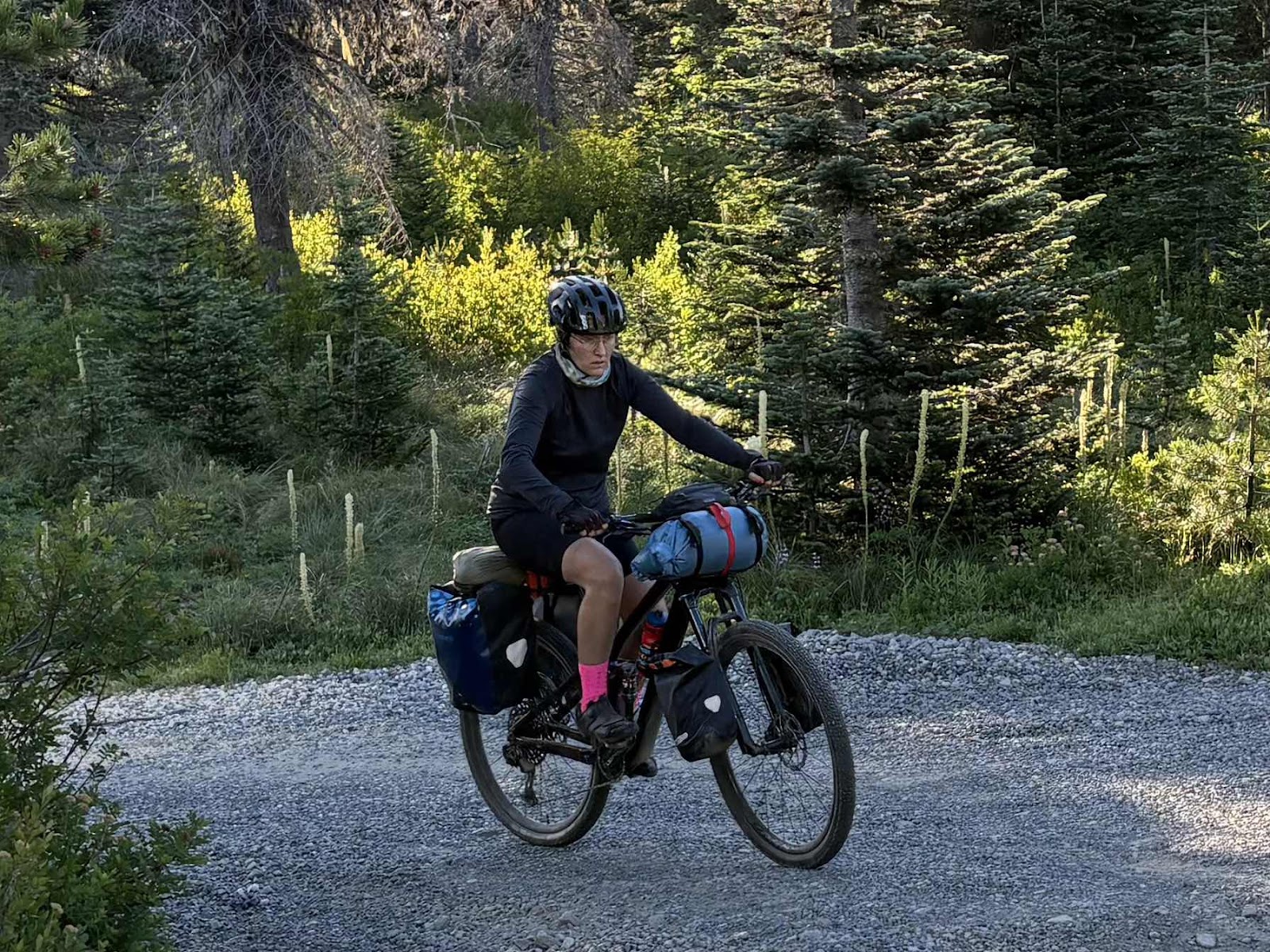
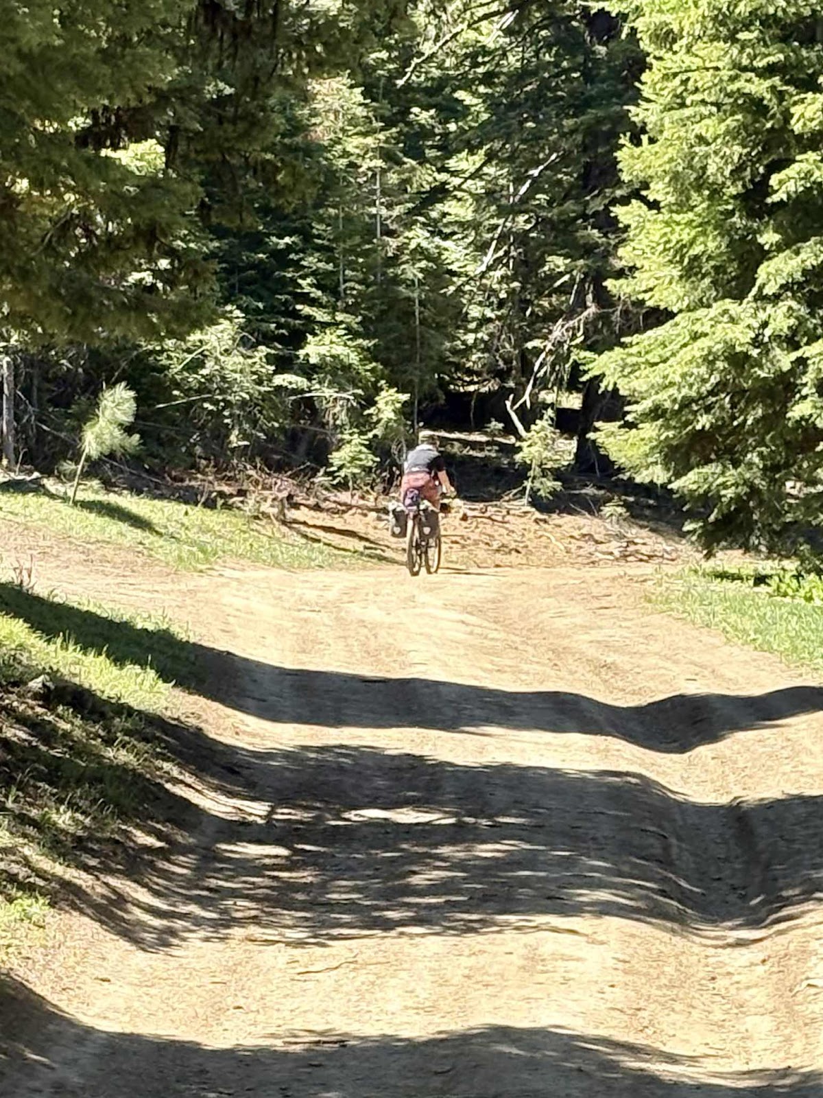
Katie returning to the road.

Onward for the last day.

Morning shadows!

Photo by Katie
Not much snow there!

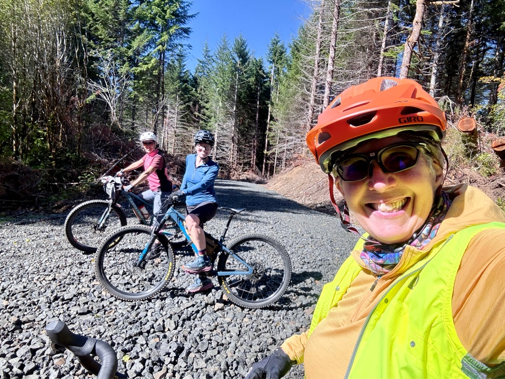
Selfie time!

Those cyclists up ahead were out for a 50 mile ride from Carson called the Lava Fire Loop. The van is just up there!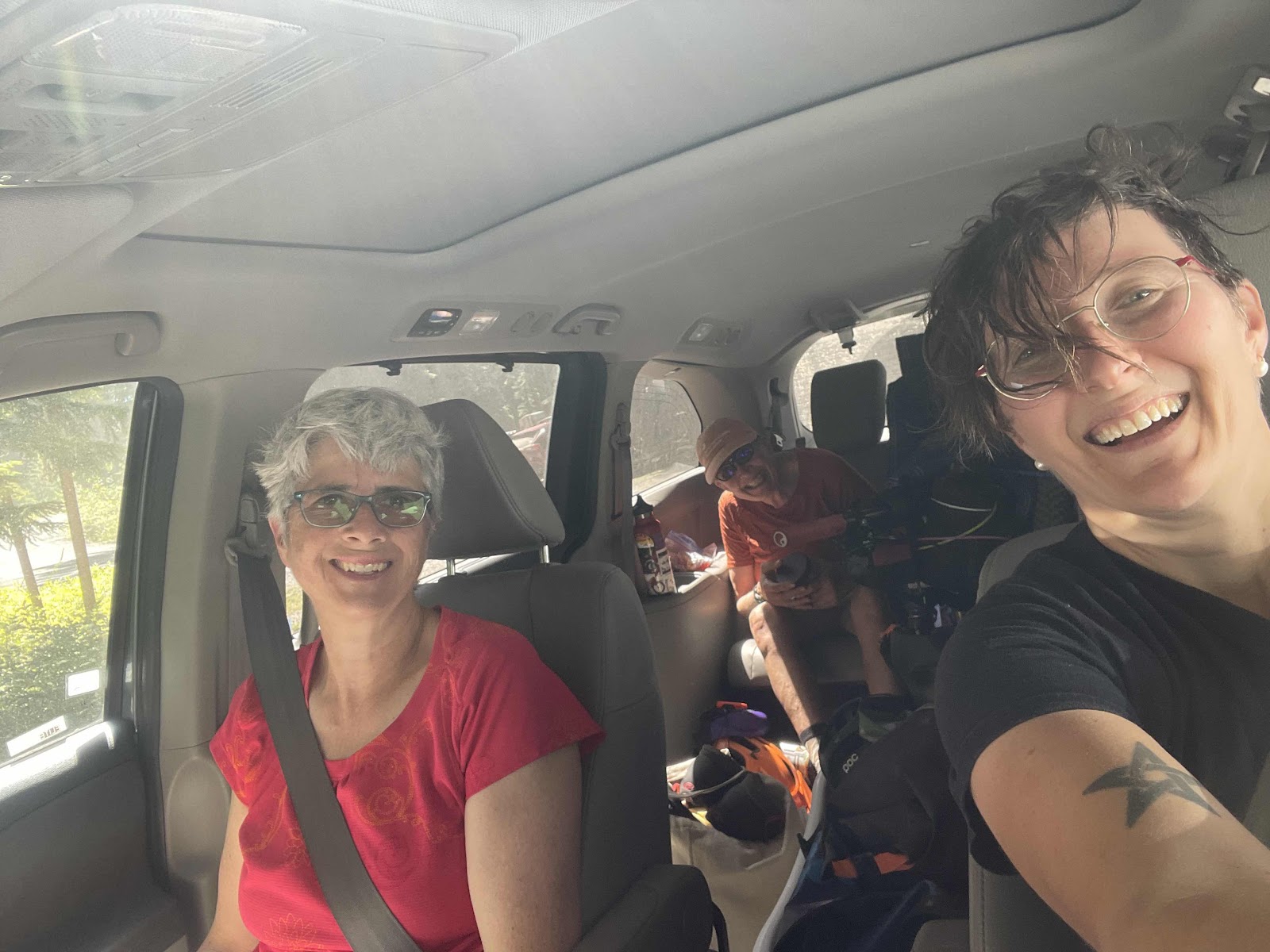
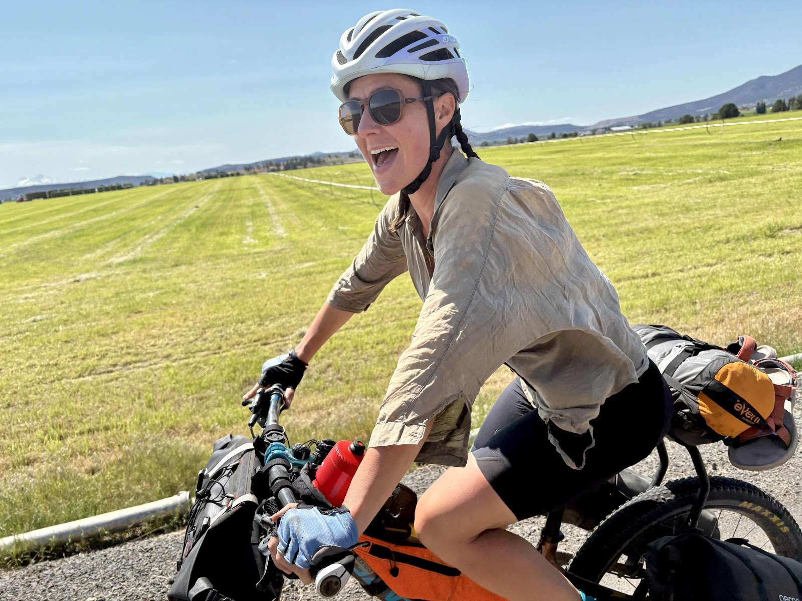
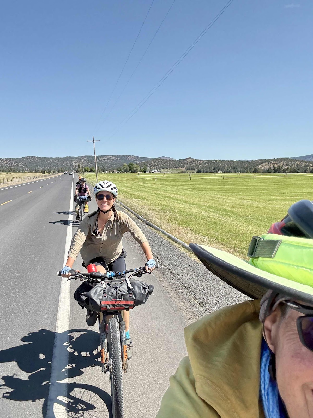
Loaded up, changed, and ready to head home.

Photo by Katie. Waiting for our food.
Normally when I get up, I get dressed in my cycling clothes first thing. I did do that, but I also put my long pants on. Once everything was packed up, then and only then did I take my pants off, and immediately spray bug spray on my legs.
We left the campsite at 7:00! I chalk it up to the mosquito motivator!
Katie returning to the road.
Onward for the last day.
It was a nice downhill to a section of pavement on FS 30.
Morning shadows!
Photo by Katie
We made quick work of the first several miles as there was only one short climb. I pointed out the shelter that Makaela and I only found the morning after we camped just across the creek in the rain.
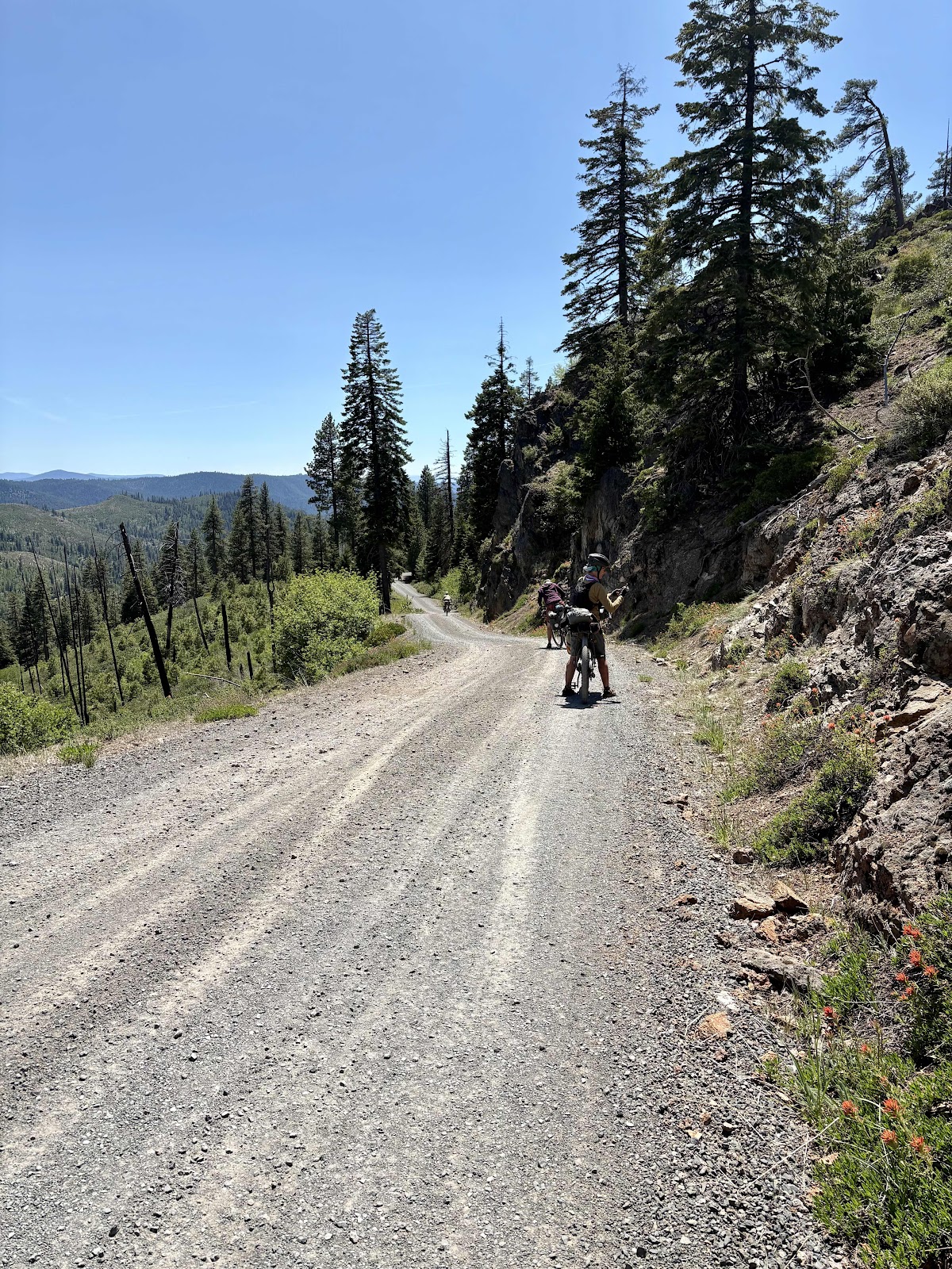
Not much further, we made the turn onto Outlaw Rd, and the longest climb of the day. It was 3.1 miles with an average grade of 5%. Of course, Geraldine and Katie, strong climbers that they are, shot right up the road. Me…not so much. There was even a spot where I ended up walking a 10% grade because my rear wheel was spinning out in the gravel, and I was running out of steam.
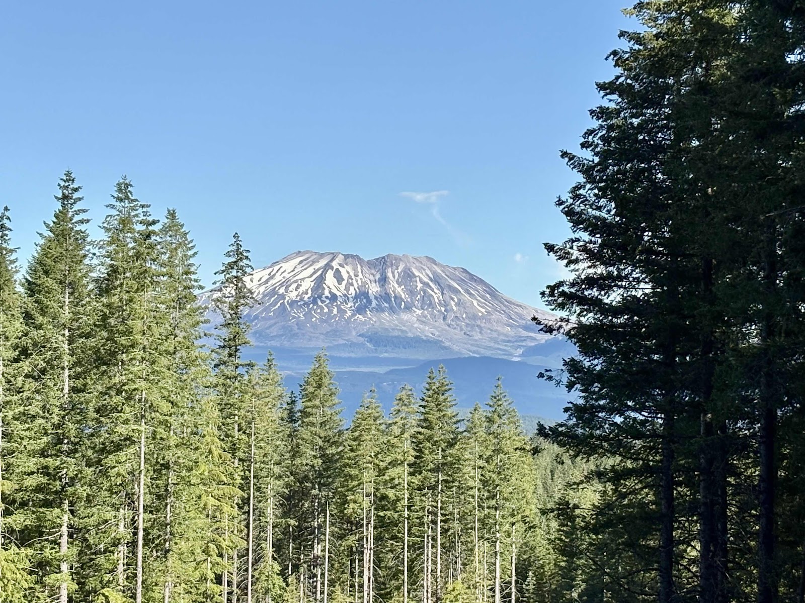
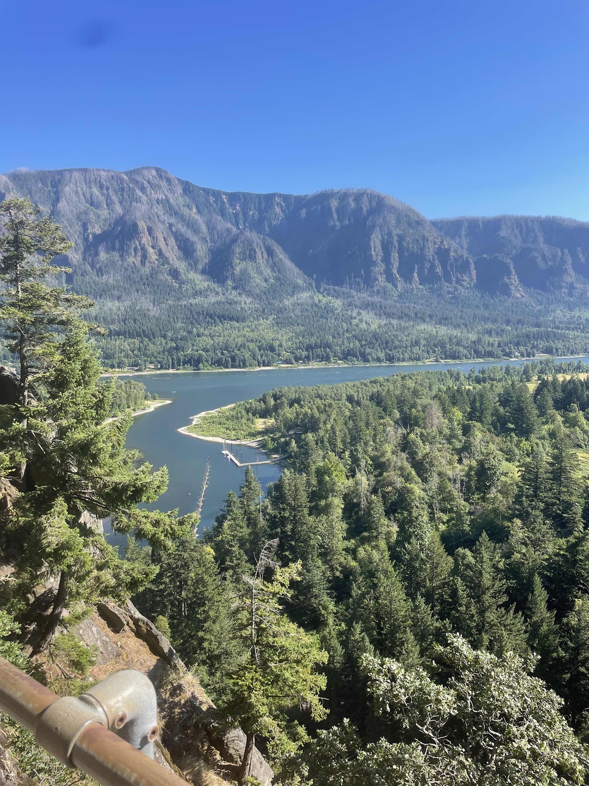
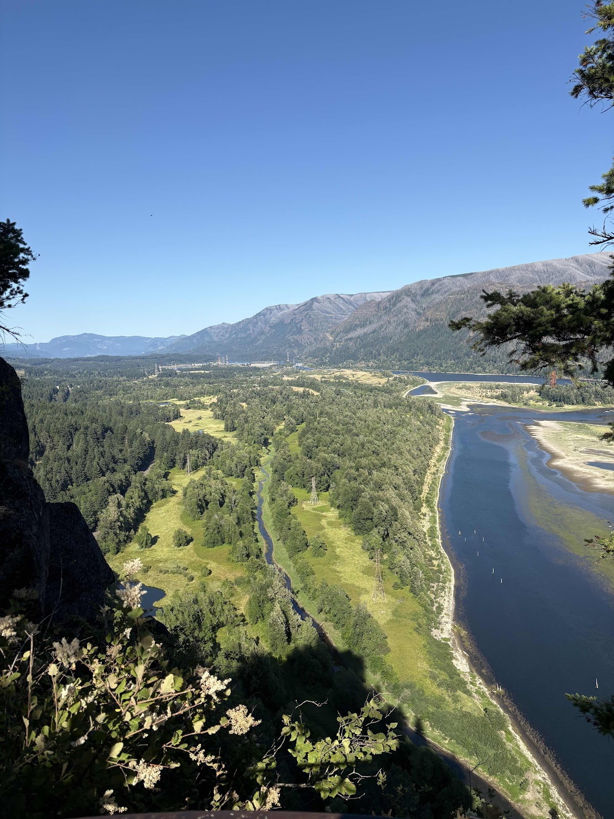
Geraldine (who has now also been given the “trail name” Extra Credit) passed me going back down. When she caught up to me, we looked to our right and saw Mt. St. Helen’s!
Not much snow there!
Selfie time!
We finished the climb, and caught back up to Katie. We had another short climb, then a long long descent. The road was the roughest we had experienced on this route. Just before we were to turn back onto Carson Gular Rd, Katie noticed one of my fork bags was missing. Fortunately, it didn’t have much in it…just a few bars (when I got home I realized it also had my long spoon). Geraldine talked about going back. There was no way I was going back up the hill, who knows how far, to maybe find the bag. Besides, Ortlieb has come out with a 5.8 liter version (mine are 4.1) that I was planning to get because the 4.1 size is really too small. Both Katie and Geraldine have the 5.8 liter version. With that size, I might be able to fit my cook set in them.
Back on Carson Gular Rd, we had a final 2 mile climb. There were a fare number of vehicles kicking up massive amounts of dust. It was also quite toasty. Still, I wore my buff to keep from inhaling too much dust. Near the end, Geraldine and Katie rode back to me, so we could finish all together.
Those cyclists up ahead were out for a 50 mile ride from Carson called the Lava Fire Loop. The van is just up there!
Loaded up, changed, and ready to head home.
We made a stop at my brother and sister-in-law’s place called The Cabin. Got to see my sister-in-law, Lori, but my brother was out of town. Got some great food!
Photo by Katie. Waiting for our food.
Now I’m home, and most of my stuff has been unpacked. My lower legs are covered in mosquito bites, but at least they are clean now.
This was a very fun bikepacking trip. Geraldine and Katie did great! I think they are hooked now! Time to plan the next one!
Fire and Ice and More Dust Day 1
I started my day coughing from all the dust. We ate our breakfasts, and packed everything on the bikes. We were able to leave stuff we didn’t need, in the van.
We hit the road just before 8:00. I was impressed as I figured it would be at least 8:30. For being bikepacking newbies, Katie and Geraldine got ready pretty quickly. There were a couple of adjustments once we got going, but not much.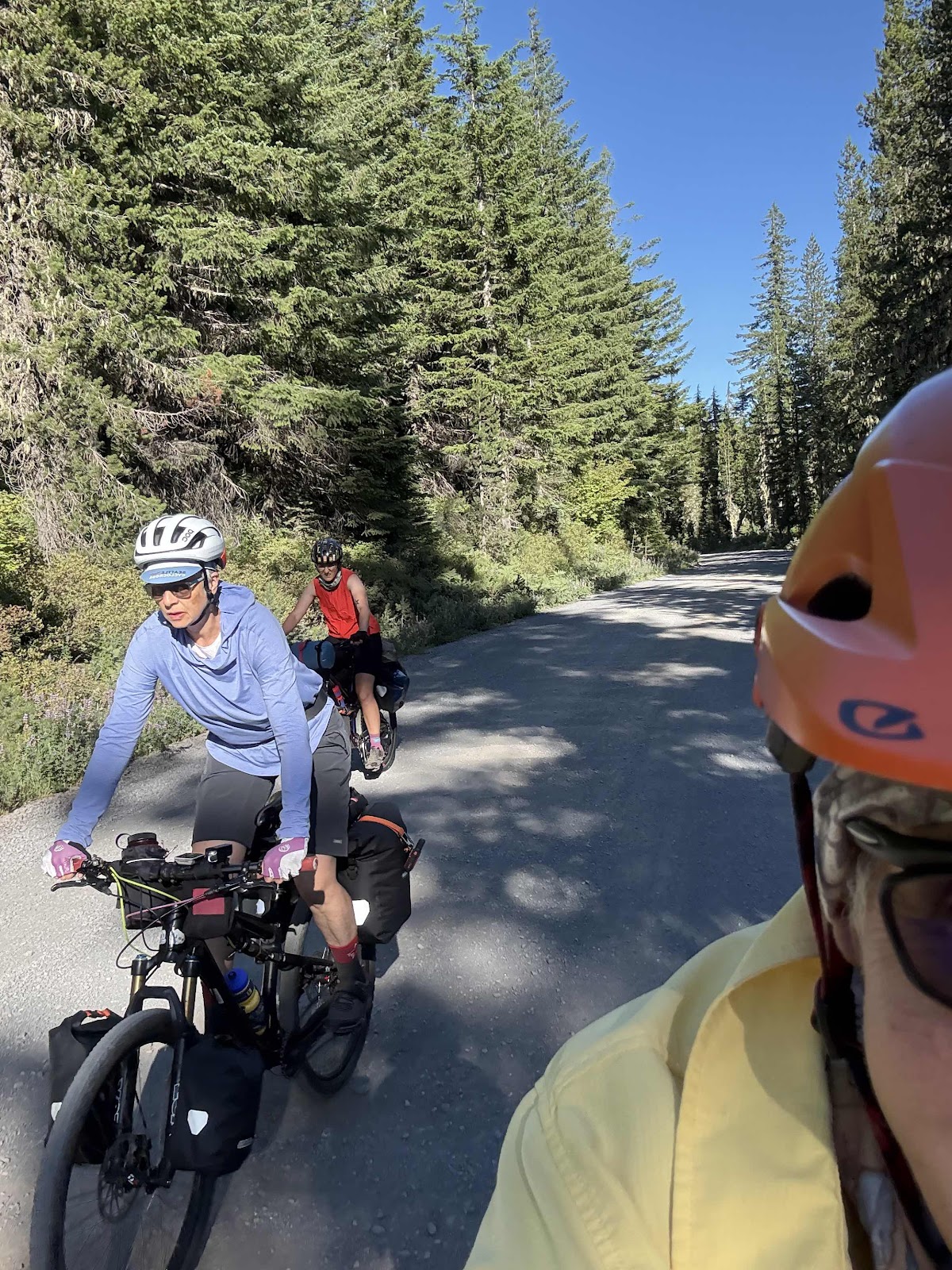
And we’re off!

We did a good chunk of trail around the main bridges.

Another bridge.

Such a cool area!

And there were even some ripe huckleberries!

They were delicious!

Well…we had lights.

Old snow at the entrance.

Geraldine.

Ice ice baby!
Geraldine went the furthest.

Ice ribbon.

Coming back out.

We drank a bunch and refilled our bottles. It was quite hot out.

Good view of Mt Adams.

Me, Wanda, and the mountain.
In the berry fields area.

We are actually above the lake pictured below. It was way too buggy by the water.

We did 29 miles of the route today. Geraldine and Katie agreed it was not easy. The route wasn’t bad, but the heat made it seem harder.
I found a kickstand for Wanda!

Funky kitchen structure not far from camp. We almost considered camping there.
We had Carbs take our photo.
We hit the road just before 8:00. I was impressed as I figured it would be at least 8:30. For being bikepacking newbies, Katie and Geraldine got ready pretty quickly. There were a couple of adjustments once we got going, but not much.
And we’re off!
I struggled with coughing, and I made sure to use my buff a lot of the time. The mornings are still always the worst.
Our first side trip was to Natural Bridges.
We did a good chunk of trail around the main bridges.
Another bridge.
Such a cool area!
And there were even some ripe huckleberries!
They were delicious!
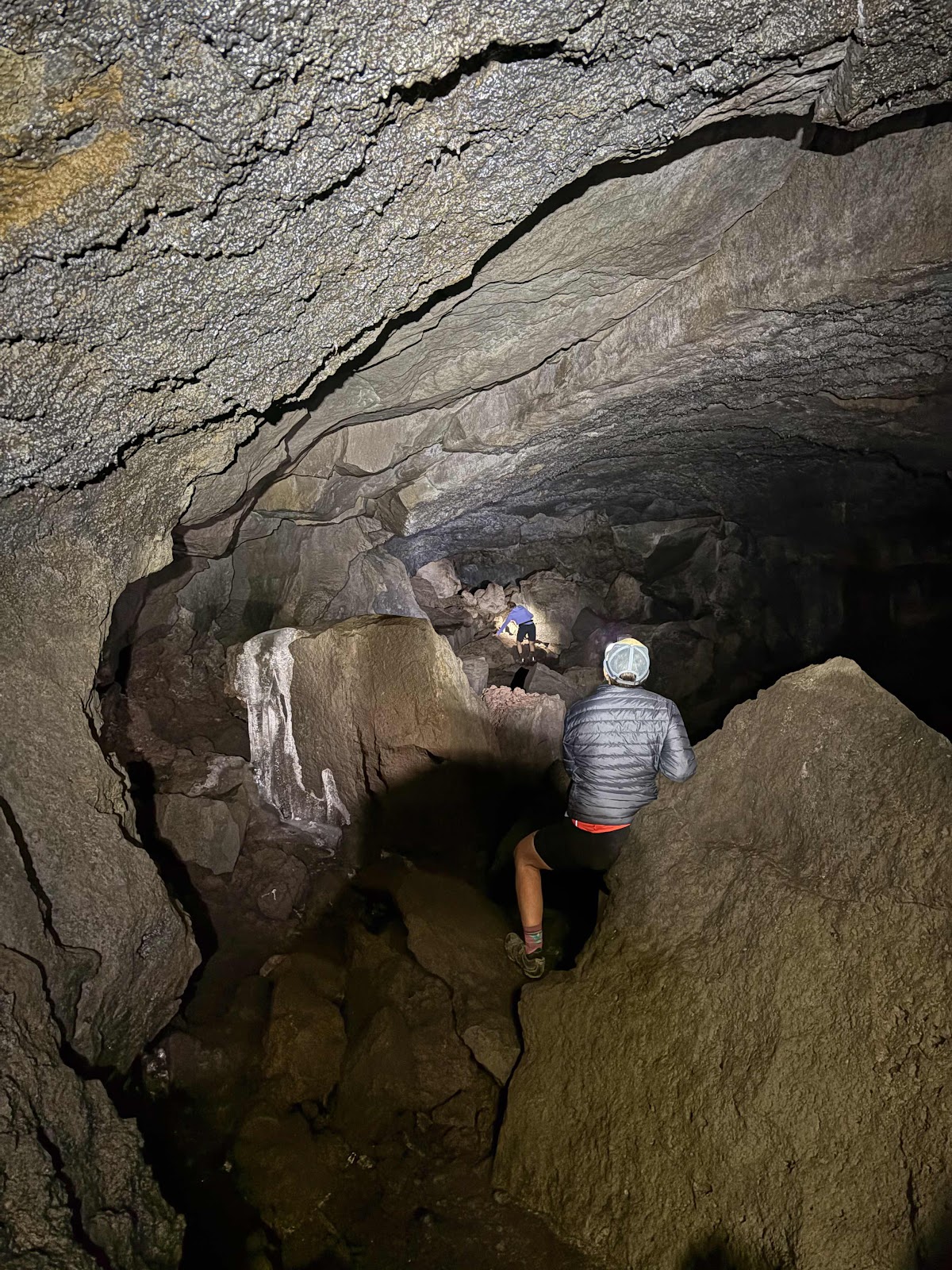
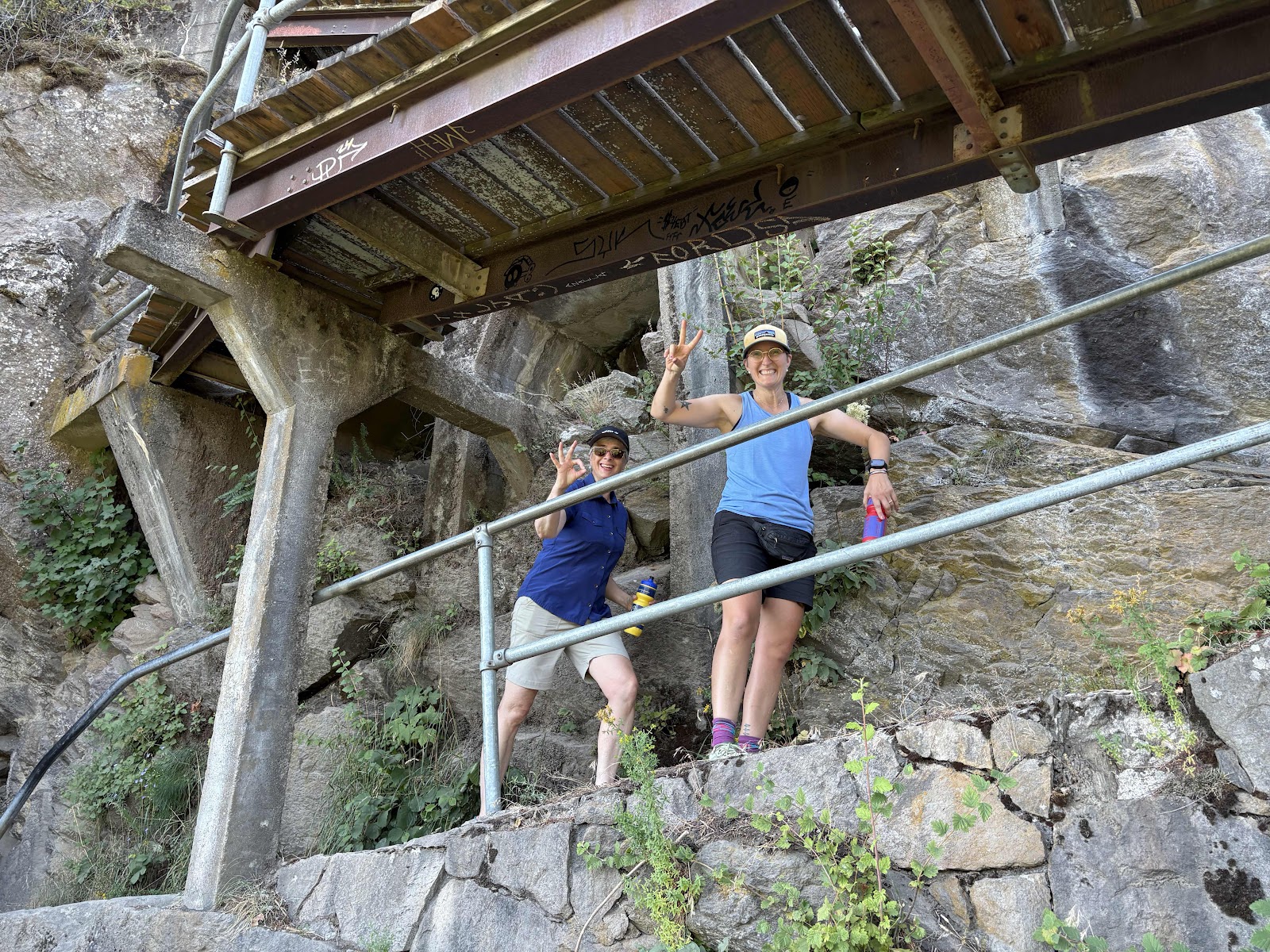
Not far down the road was our second feature…the Gular Ice Cave. Last time Makaela and I were here, there was no ice. This time there definitely was ice!
Well…we had lights.
Old snow at the entrance.
Geraldine.
Ice ice baby!
Geraldine went the furthest.
Ice ribbon.
Coming back out.
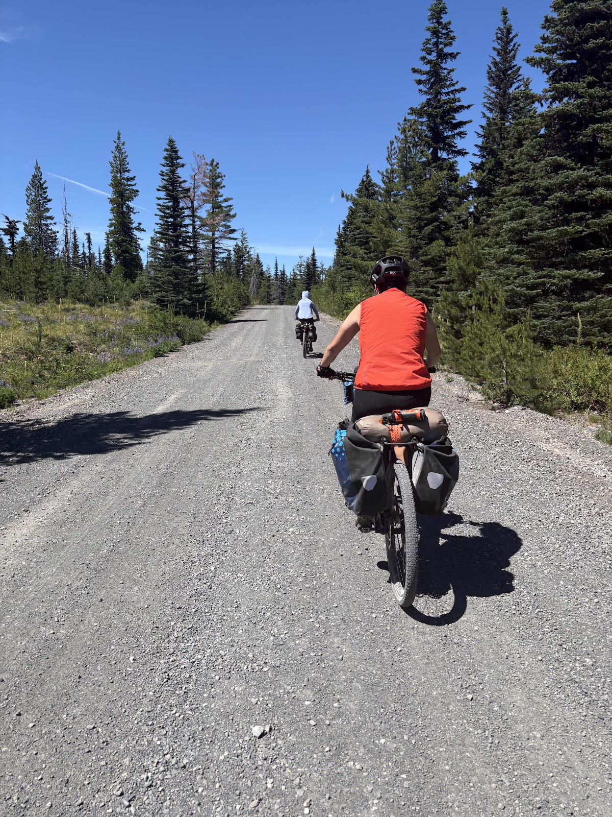
We ate some lunch, then continued on our way. We stopped at Peterson Prairie and spied this.
We drank a bunch and refilled our bottles. It was quite hot out.
We had a 2 mile climb up toward the berry fields. This is where there is the handshake agreement that the right side of the road huckleberries are reserved for the Native Tribes. Now we were up to 4000+ feet. The huckleberries are not even close to ripe yet.
Good view of Mt Adams.
Me, Wanda, and the mountain.
In the berry fields area.
We made it to the turnoff to Surprise Lakes (almost missed it as there was no sign, except on my Garmin). It took awhile for us to find a good spot, but we did.
We are actually above the lake pictured below. It was way too buggy by the water.
We did 29 miles of the route today. Geraldine and Katie agreed it was not easy. The route wasn’t bad, but the heat made it seem harder.
I found a kickstand for Wanda!
Funky kitchen structure not far from camp. We almost considered camping there.
We’ve all been bitten by the ever present mosquitoes. We all finally gave up and dove into our tents at 8:00. Tomorrow we will finish the loop.
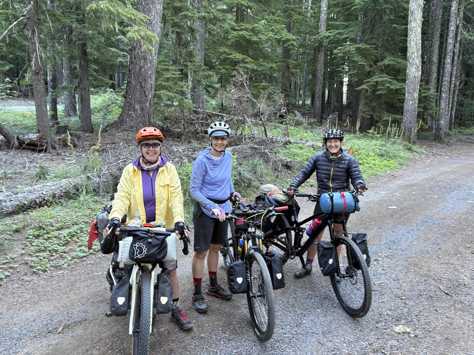
Fire and Ice and Dust Day 0
It’s finally happening! Geraldine, Katie, and I are doing a bikepacking trip! We were originally going to do the Olympic Bridges Overnighter plus the out and back to Wynoochee, but due to an uncertain fire situation, we switched to Fire and Ice. Makaela and I did this route a few years ago in October. It rained the entire time. This would be different.
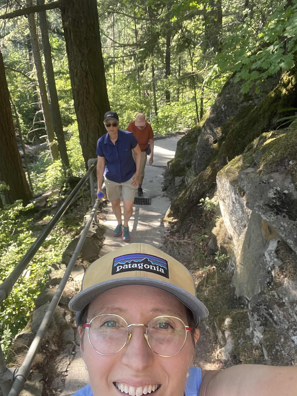
Photo by Katie.

It was very toasty on the exposed side.

Got this guy to take our photo at the top.
We met at my house at about 2:00, loaded all our stuff into Katie’s van, and headed south. On the way up the Gorge, Geraldine convinced Katie to stop at Beacon Rock for a “20 minute climb up the rock”. Well, it was a bit more than 20 minutes. More like a little over an hour, but we all agreed it was worth it. I hadn’t been up the rock since 2011 when I was doing the ACA Sierra Cascades Route.
Photo by Katie.
It was very toasty on the exposed side.
Got this guy to take our photo at the top.
We made it to Crest Campground about 7:00ish. We ended up camping nearly right on the PCT. It was okay as no hikers were coming through. A trail angel named Carbs said there were just a couple of section hikers. We later met Speed Queen, a German woman, who was kind of section hiking, but had started out as a thru hiker. We chatted with them for awhile, then hit the sack.
Unfortunately, we were quite close to the road, and there was a remarkable amount of traffic. The road is gravel, and the amount of dust was terrible. Tomorrow we will start our ride on the Fire and Ice Loop.
Tuesday, June 3, 2025
Ochoco Day 5-The Final Day Bringing Us Back to Paradise
The view from my tent this morning.
It was another chilly morning in the high country. This time I pulled out my long fingered gloves! We were a little slower getting packed up (it’s hard to get moving when you are cold).
We had a screaming good paved downhill as soon as we left the campground. Soon enough we were on the first of three climbs which warmed us up nicely.

The top of the first climb.
The next section took us down to Hwy 26 (Ochoco Hwy). That was an awesome descent, even if it was a bit scary going somewhat blind into the shade…potholes lurking and all). At the Hwy, there was a sign that said 18 miles to Mitchell (go right), and 29 miles to Prineville (to the left). So, we could have gone back to Mitchell and the Spoke ‘n Hostel, or we could take the shortcut to Prineville. We turned right. Not because we were going to Mitchell. No, we were going back over to McKay Rd to get to Prineville and my cousin’s house, the hard way.
The climb started on the Hwy, then continued on paved Forest Road 27 for a total of 6.5 miles. It was a doozy of a climb. I even turned on my music which is not something I usually do in the morning.

Ginny had found some morels a couple miles from the top.
There was still a ways to go when the road turned back to gravel. It was much more narrow, and quite steep in places, but I managed to make it without pushing.
Deb continuing up.
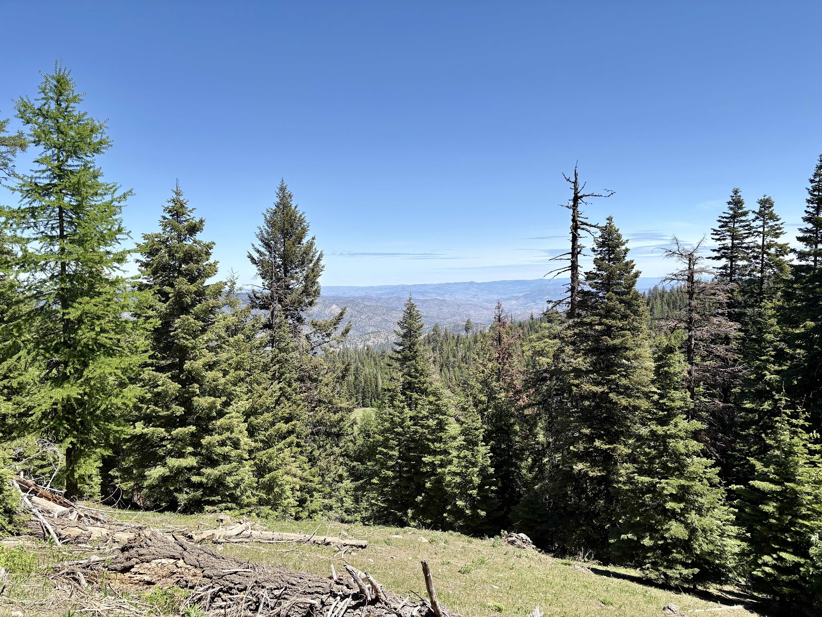
One of the few expansive views.
At the top of the climb, Deb and I stopped for lunch. Ginny and Makaela arrived later after some more successful morel hunting.
There was one more short climb (on pavement), then the long descent down to McKay Rd.

Makaela’s morel finds.

At the top of the final gravel descent.

Going down down down.

Nice view.
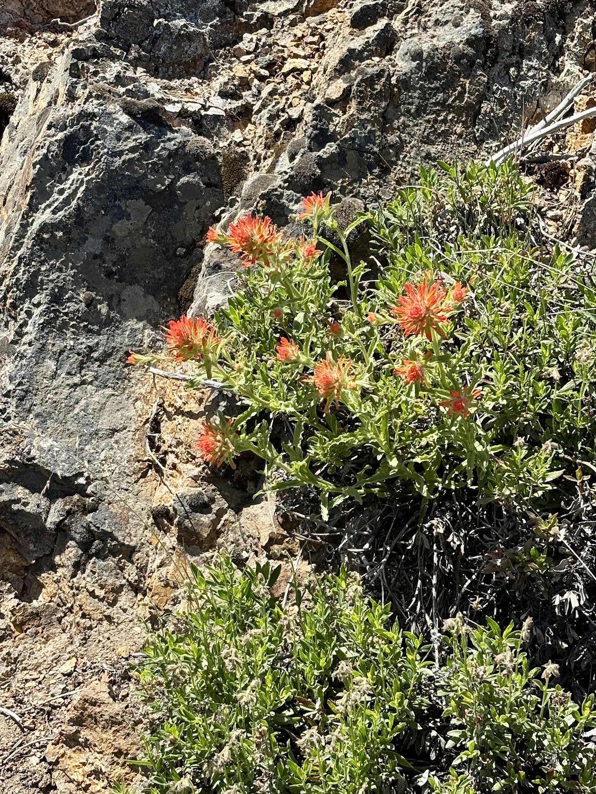
Some Indian Paintbrush growing out of the rocks.
Taking photos of the flowers.
And just like that, we were back to McKay Rd.
McKay to the left, and what we came down to the right.
Now it was just the “stick” of this lollipop route back to Debbie and Brian’s. There was a bit of a headwind, so Makaela and I were taking turns on the front. Well, we kind of ramped up the pace (it was downhill). Before we knew it, we were back to where the road had been flooded on our way out.

Where the mud slide came from.

At least the road is open now. No 4 mile detour today!

Three Sisters in the background.
My Makaela!
Took a photo like this on Day 1. Now Day 5!

And we are back to Paradise! A little more tired, and a lot more dirty!
Debbie fixed an awesome dinner, and we finished the day with a soak in the hot tub. It doesn’t get any better than that!
I think we all really enjoyed our time on the Ochoco Overlander. I would also highly recommend the amount of time we took to do it. Day 2 is going to be tough no matter what, because there is not really any camping between Skookum Rock and Burnt Ranch (except maybe Ashwood if you happen to be able to ask Frank), but it is definitely doable. Of course, we are very lucky to have my cousins in Prineville, and I am so grateful we have been able to reconnect. Counting two times on this trip, this is the 4th time I’ve been here. I’m looking forward to the 5th time! Now, to plan another route…
Subscribe to:
Comments (Atom)