Friday, July 31, 2015

Day 45--A Wrap-up of Chapter 4

Tomorrow I leave the cabin. It seems the week has gone by far too fast. Here's a wrap-up of what we did. 

Sunday--Day 40
We finally did what I've wanted to do for a long time. We rode Camp 12 Road from the Ponderosa to Chumstick Hwy. It's a primitive road that, for a section, is actually closed (not that it stopped us). We were high above the Wenatchee River on a rutted dirt road. We finally got to come down an awesome descent where we popped out onto the Chumstick Hwy. From there it was about 9 miles back to the cabin. 

Monday--Day 41
The weather had been chilly over the weekend. Monday was finally a bit warmer. We took out the road bikes (Lorraine had brought KITT with her) and did Chiwawa Loop. It's a favorite that we've done every time we've come to the cabin. I was quite squirrelly until I got used to not having any weight. It felt great to be back on KITT and flying along!

On the way, we stopped at Mountain Springs Lodge to inquire about their Ziplines. Reservations had to be made online, and when we got back to the cabin, we found there was nothing available. Too bad...maybe next time. 

Tuesday--Day 42
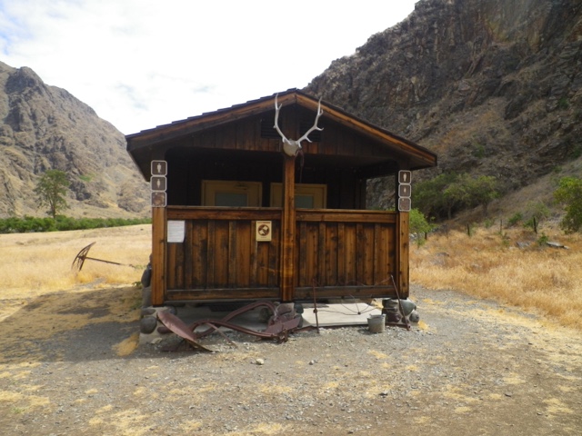
The pool is always closed for cleaning on Tuesdays, so we, once again, took the road bikes. This time we headed into Leavenworth via Tumwater Canyon (US 2). It's a great, mostly downhill ride along the Wenatchee River. 
The river is really quite low. 
I hope I don't catch any flies with that gaping mouth!

We took a nice break at the new Starbucks in Leavenworth before heading back up the Chumstick (mostly up as...what goes down, must go back up). 

Wednesday--Day 43
Swimming and ice cream. That's it. 

Thursday--Day 44
Shopping at Plain Hardware (not your average hardware store), swimming, and ice cream. A full day!

Friday--Day 45
Today was the hottest day yet...over 100. So, of course, we decide to go for a bike ride. We thought we had picked a shady route. Not so much. We rode to the end of the road on the other side of the river (accessed by a bridge closed to cars--motorcycles and snowmobiles are allowed) and back. Not many miles, but it was hot hot hot!
The bridge over the Wenatchee. 

When we got back, we went down to the pool (I know, it's a tough life).
Don't worry, we did go swimming. 

Then, as has become tradition this week, after dinner we went for ice cream (at the grocery store, but it's the good stuff).

So, that's been Chapter 4. Tomorrow, I begin Chapter 5 by riding over Blewett Pass. 
Here's a parting shot of the tattoo I got on my ankle. 


Saturday, July 25, 2015

Day 38--Chapter 4, the Shortest Chapter

We have arrived via pickup truck to the cabin. I probably won't do much posting for this week, unless there is something worthwhile for you all to read about (I know, I'm making the assumption that all my other posts are worthwhile to read). So, just because you may not see a post, don't worry, I'm probably not dead. Regular posts will resume in a weeks time. 

Friday, July 24, 2015

Day 38--A For Real Rest Day!

We leave tomorrow for the cabin, so today has been a rest day. So much so, that every time I've sat down, I've ended up falling asleep! 
Okay, not really asleep here, but I'm sure that's what I've looked like. 

We did have to give the dog a bath because she smelled like skunk. Not that she had been sprayed, but she had probably nosed around in the bushes where the skunk had been. Problem was, Annette didn't have enough, or the right ingredients, for any of the methods of deskunking a dog. She had hydrogen peroxide, but not enough. She had vinegar, but not cider vinegar. So, we thought the hydrogen peroxide method might work because Pearl wasn't completely skunked. Well, it didn't. So, Nic went and got more peroxide, and Pearl is now getting her second deskunking. 

I have to say, it has been nice having a day of truly resting. Tomorrow we'll be off to Chapter 4--A Week at the Cabin. 

Thursday, July 23, 2015

Day 37--Chapter 3 Goes Out With a Stink

There's a song on my playlist called, "Dead Skunk in the Middle of the Road". I'll get to that...

I left the lap of luxury (aka Carla's) at about 8:30. I worked my way back to the Centennial Trail.
How nice to build a little tunnel under the railroad trestle!

I let Google do my route finding, and today was good. No dead ends. I even got to go on two additional trails besides the Centennial Trail. One that I've seen before, but never been on was called the Children in f the Sun Trail.
It's a trail amidst all these highway overpasses. 

The other was a short trail that was called something like FSRV Trail. I have no idea what the letters stood for.

Eventually, I knew where I was. I just had to go on Hwy 395 for about a mile or so before turning off to go the final couple of miles to Annette's. I arrived just before noon.
Last bit of gravel to finish Chapter 3.

I took a shower and did all my laundry. Later in the evening, we were coming back from Costco when we saw a skunk walking up the hillside as we were coming up the driveway. They've been having problems with skunks. We continued up to the house and got everything unloaded. Then, as we were sitting in the house (with the windows open), Annette asks if I smell skunk. Why yes, yes I did! Annette got the dog in the house (Pearl smelled faintly of skunk, but had clearly NOT been sprayed), and we closed the windows. Fortunately, in the room I'm sleeping in there was no skunk smell. We think it maybe just walked by the house where the windows were open. 

Of course, the lyrics to the Dead Skunk in the Middle of the Road song came to mind. So, here they are...it's by Jimmy C. Newman

Crossing the highway late last night
You shoulda looked left and you shoulda looked right
You didn't see the station wagon car
Skunk got squished and there you are

Chorus:
Dead skunk in the middle of the road
Stinkin' to high heaven

Take a whiff on me that ain't no rose
Roll up your windows and hold your nose
You don't have look and you don't have to see
You can feel it in your olfactories 

Chorus

Well you got your dead cat and you got your dead dog
On a moonlight night you got your dead toad frog
You got your dead rabbit and your dead raccoon
The blood and the guts are going to make you swoon

Chorus

Whew! It's enough to make you sick!

Total miles today: 28
Average speed: 9.23


Day 36--Goodbye Idaho, Hello Washington, Hello Idaho Again

Last night it was too late for me to write this post, so I'm doing it this morning as I sit in the beautiful kitchen of my friend Carla's house. Yes, that's right, I slept in an actual bed, in a house last night!

After leaving Beauty Creek yesterday, I only had 2.5 miles until the junction with I-90. When I did this part before, I remembered getting on I-90 for a short bit then getting on the Centennial Trail. Well, both Google maps and my Garmin had me cross I-90, and go on Yellowstone Trail Rd. So, I did. Again with climbing! Of course Yellowstone goes up and over!
That's I-90 below as I am climbing up Yellowstone.

It thought it was okay. I had plenty of time as I didn't want to arrive at Carla's until 3:30, and it was only 36 miles. I got to the top of the first hill, and the road turned to gravel. That, too, was okay (although, I realized why the Tour d' Lac did not come this way). I came down, around the end of another lake (can't remember the name), and began climbing again. As I got part way up the next hill, I came to a road called Molsted Ln. This rang a bell, even though Garmin was saying to continue on Yellowstone. I pulled out my phone. Sure enough, Google had me turning on Molsted and going down to pick up the Centennial Trail. Yippee.....except there was that "Dead End" sign...nah, there must be a way through for bikes. Down the gravel road I went...straight to the dead end to...no trail...nothing...*sigh*...once again Google fails me. I apologized to Garmin for shutting him down, and restarted him. 

I returned to Yelłowstone, and continued climbing. As I began to come down, I saw another road (you are questioning my sanity...right?) I looked on the Garmin. This road appeared to go down to the road that the Centennial Trail went alongside. There was no dead end sign. I went down. Sure enough, it came down to the trail. I said a little, "Ah ha, there you are Centennial Trail!" Of course, not 100 feet down the trail, Yellowstone Rd. also came down to the trail. Oh well...

Finally on the trail.

I rode into Couer d'Alene. I was hoping to go by a bakery or a Starbucks, but no. I continued through on the trail (I was too lazy to get off the trail and find one). The trail went by...I think...North Idaho College, then continued out of Couer d'Alene. I finally stopped and ate a Payday bar as I wasn't going by anyplace where I could buy something.

I rode through Post Falls, where the trail is on the roads, and one has to be careful to watch the signs (a guy at a park in CDA had warned me about this section). I didn't miss any, and was soon back on the bike path. 

The trail is not exactly flat. However, there are signs letting you know exactly what percentage grade is coming (only for downhill though).
An example.

I reached the State Line rock. Strangely, there was a helicopter hovering not far from the trail.
There was a line dangling below.
A State Line selfie.
A nice welcome.

I took the opportunity to check in with Google (I had forgiven his earlier transgression) to see where I would be getting off the Centennial Trail to go to Carla's. It was a good thing I did, because I switched to the Liberty Lake Trail not much further. 
I rode this trail to the next road.

Once I was on the road, I thought I would look for a Subway and have some lunch (and kill more time). Of course, I couldn't find one. But, I did find a lovely cafe called Twisp that had delicious crepes. I had a savory one called Tuscan that had chicken, pesto, tomato, artichoke, and balsamic. It was quite tasty. 

I consulted Google again to see that I had just 5 more miles to go. It was about 2:00. Still early, but one can only sit at a restaurant for so long. I continued on my way. What do you suppose I saw not a mile down the road? A Subway...oh well, my lunch was much better than Subway!

I made it to Carla's without any problems. Shortly after, she arrived home. We haven't seen each other for a long time, so we had some catching up to do. Then it was a great shower (you know...the best shower ever!!!) where I washed my hair for the first time in 10 days. 

We decided to go to dinner. But where? Carla said we could go to...Couer d'Alene! So, I went back to Idaho! We went to the CDA Resort (where I had ridden by that morning). We had superb dinners! Carla treated which was way too nice!

Back at the house we said our goodnights. Carla had to be up at the butt-crack of dawn for work. Unfortunately, I did not take a photo of us. I guess I'll have to come back again...

Now, I'm off to Annette's in Colbert (28 miles according to...Google).

Total miles: 40.1
Average speed: 8.9


Tuesday, July 21, 2015

Day 35--Reverse Karma Strikes Again!

This morning as I was getting ready to leave, I told Kathy I was done with the major climbs. Ha! I should not have said that! Because, you know what always happens...

I rode the trail down from the campground to return to the Trail of the Couer d'Alenes. It popped me out right at the bridge over the lake.
In the middle of the bridge.
Headed down the little rampy part.

I rode to Harrison on the trail. At Harrison, I wasn't sure if I had to get off the trail there, or if I could continue further. I went to the library (as I had no service on my phone) and used the wifi to Google the directions to Beauty Creek Campground (I could have just stayed on Hwy 97). Yippee! I could stay on the trail...well, for three more miles anyway. So, I returned to the trail. This was a part I had not been on before (the Tour d' Lac always exited at Harrison). Here's what I saw.
Lots of Lilly Pads (the photo doesn't really show the pretty pink flowers).

At East Blue Lake Rd, I got off the trail and went over this old wooden bridge.
I followed E. Blue Lake to E. Thompson Lake Rd. I thought it was just fabulous! Then the road turned to gravel. Of course, that was fine! No problem! Then I turned onto South Asbury Rd. Still gravel, the road began to climb...and climb...and climb some more. It was pretty loose gravel, so I stopped and let more air out of the tires. That was better. It was a really long climb! Okay, maybe it wasn't that long (2 or 3 miles), but, because I wasn't expecting it, it seemed really long.

I finally made to the top.
I thought I'd get to go down at least as much as I went up. Not exactly. The down was short lived, then it flattened out and was a bit rolly. Finally I started the long downhill. It brought me back to 97. Now I knew I had to ride on 97 for awhile. 

The next turn was onto E Burma Rd. I saw the road. I also saw the mountain. Hwy 97 continued around following the lake, nice and flat-like. I bet you can guess which way I went. Yep, I stayed on 97. I knew Burma would be the same as Asbury. It may have been shorter miles, but it took longer.

It was pretty warm, but cooler by the lake than the mountain route. I came upon a gas station that was more a shop and restaurant. I stopped and had a turkey and bacon club sandwich. It was delicious, but when I got back on the bike I felt like a slug. Turns out I was going uphill! At the top it was a 6% downgrade for 2 miles (basically, back to lake level). At the bottom was the turn for Beauty Creek. Staying on 97 seemed to add about 5 miles.

This is what Beauty Creek looks like.
No water, and dare I say, not that much of a beauty.

Total miles today 35.47
Afar age speed: 8.4

Day 34--Another Night Without a Shower...

...Or so I thought.

Remember how I said there was no water at the 4M park? Well, just two miles down the gravel road I came to a faucet that had a sign saying "Potable Water"! They need to update their sign at the entrance! I filled all my bottles.

The road through 4M park was quite winding. And, I was not at the top. I went up, then down, then up again. I thought I would never get out of there! Periodically, the views were pretty awesome.

At this point, I thought I was going all the way down for sure...nope.

Finally, just past milepost 13 (mile 7 for me), I came to King Valley Rd. from there it really was downhill the rest of the way. It was about 5 miles of great downhill. I came back to the pavement on De Smet Rd., which took me back to Hwy 95. I stopped in Tensed for a snack. From there it was still 13 miles to Plummer.

I had to go over a ridge, but I had a great tailwind, so it wasn't bad at all. When I arrived in Plummer, I stopped at a convenience store for some Gatorade. I asked the gal about the Trail of the Couer d'Alenes. She said it was just out of town and to the left. Left??? That's not where it was when I did the Tour d' Lac. I went the way I remembered, but it wasn't looking familiar. I asked another guy. I was told again that it was just out of town and to the left. Okay, maybe I wasn't remembering correctly. I went "just out of town and to the left". There was the trailhead.
I am absolutely positive this was not here in 2009. I think what they did is extend the trail to this area so they could build a nice trailhead. Anyway, I got on the trail. 
This part was not here in 2009. After the first bit, the trail began its 5 mile 3% downgrade. I coasted the entire way to the lake.
Going along Lake Couer d'Alene.

In my memory, I remembered there being the campground along the way. Well, I got almost to the bridge, and still didn't see a "campground". I stopped at the boat ramp and asked this gal where Heyburn State Park was. She said I was in it. Then she said the camping was "just up there". Great! I started to ride up the road, but all I saw were private cabins. I remembered passing the Day Use area when I was on the trail, so I went back there. Yep, that was just the Day Use area. I came out to the road because I figured there would be a sign. There wasn't, but when I continued on the road, I finally came to a sign for Chetcolet Campground. Ahhh...I've seen this before in Idaho State Parks. The whole park is Heyburn State Park, but there are differently named areas. Turns out there are 3 campgrounds here. Two are toward the south end of the lake. So, I finally made it to the campground. I found a spot where I could actually park MC, that also had a flat spot for my tent. This is the tent campground, but not all sites had good tent spots.

I didn't see any showers. I thought I'd go for a swim. I asked the people next to me if the trail went down to a swimming area. They said it did. I told them I hadn't had a shower for 3 days. They said they needed to go to the other campground to get ice, and there were showers there. They offered to give me a ride over there (it was quite a ways away). Woo hoo! A shower for Colleen!!! It was also where the park HQ was, so I was able to pay for my site too.

Afterward, we stopped at Plummer Marsh. We didn't see many birds. I think it was too windy.
The Marsh.

We came back and I set up the rest of my stuff. I went over to talk to Kathy, John, and Allie some more. We ended up playing cards. We played a couple of versions of Golf that I had never played. I'll try to remember them for the cabin.

I cooked my dinner and took it over to their table. It was nice to dine with some other people for a change.

So, that was my day. Pretty great, I think! Oh, and one more thing. Here's the toilet. Yeah you think Vault toilet, right?
Rustic, right?
Surprise! It's a flushie!!!

Total miles today: 43.3
Average speed: 9.24


Sunday, July 19, 2015

Day 33--A Great Trail, and More Gravel

To, as usual, finish off last night, the family with the 8 kids did come back. Actually, it was great! I met all the kids--Aterick--12, Natalia--10, LilÅ‚ian--8, Josiah--7, Tatiana--5, Oliver--4, Scarlett-–2, and Cortez--6 months. Four boys and four girls. I held Cortez for Kristin while they were setting up the trailer. What a cutie he was! Tatiana and Oliver talked my ear off. I pretty much got the low-down on everyone from Tatiana (they call her "Talkiana"). It was great fun! After they got everything set up, they went in search of pizza. When they came back, I was already in my tent. They were very quiet. I really couldn't believe all those kids could be so quiet. Unfortunately, I didn't get to say goodbye this morning as I left at 7:30, and they weren't out yet.

The first thing I had to do was climb the grade to Troy. It certainly wasn't the worst climb I've had to do. Since it's harvest, I decided to count the grain trucks. The full ones were coming toward me, and the empties were coming from behind. I counted 4 full and 3 empty. 
Wheat harvest

I came down the 9% grade into Troy. I pulled over at the park for a mid-morning snack. There I met Tom and Julia. They were out for a day ride from Moscow to Troy on this amazing trail called the Latah Trail. I'm so glad I met them because I would have had no clue this trail went all the way to Moscow (actually, it continues to Pullman--I did know about that one)! Tom also gave me his card. He runs the Palouse Clearwater Environmental Institute in Moscow. He said I could camp there if I wanted. He is also a Moscow City Councilman. 
Latah Trail
Tom and Julia (they passed me, of course)

I rode the 11 mile trail into Moscow. Once there, I stopped at Safeway and got a few groceries. I got back on the trail for a bit more, then got off to get on Hwy 95 (again) to head north. Google Maps said I had another 36 miles to get to where I was going to camp. Ahhh...another big mile day...

Hwy 95 was pretty busy, but for the most part, the shoulder was good. There were some spots where the rumble strips went right down the middle of the shoulder leaving me about 5" on each side. Delightful! It was mostly like that when I was climbing up "Moscow Mtn". Fortunately, there was a secondary lane, so when the guardrail was too close to the shoulder, I rode on the other side of the rumble strips.

The road was primarily all in the sun. It was up, it was down--rolling through the wheat fields.
What I just climbed.

I was hot, and just about out of cooler water when I saw a sign for a rest stop 1 mile ahead. Hallelujah!!! I pulled in there and took a good break. I got a bottle of Dr. Pepper from the vending machine and also drank a full bottle of water, and had a snack. I checked Google Maps to see that I still had 11 miles to go to get to Mary Minerva McCroskey Memorial State Park (how's that for a lot of "M"s?). There was some info at the rest stop. Virgil McCroskey donated this large chunk of land to the State of Idaho. At first they didn't want it, but finally the legislature agreed to accept it on the condition McCroskey manage it for 15 more years (he was 71 at the time). This became Idaho's second oldest state park. It was named after Virgil's mother, Mary Minerva.

Anyway, so the rest stop said it was near there. As soon as I got to the top of the next climb, there was the sign for the park. I turned and was immediately climbing again, this time on gravel. After almost a mile, I came to another info sign about the park. This sign mentioned something none of the other signs had done. There is no water. I pondered it for a moment, before deciding I had enough water to get me through tonight and until I get to the next town tomorrow (3 1/2 bottles--a bit more than 72 ozs.). I continued on the gravel. It was another 5 miles to the first camping area. It climbed some more, then leveled off for a bit before climbing again. There were some good views.
Yep, back in the mountains.

I made it to the campsite. It has a vault toilet, a nice covered picnic shelter, and numerous picnic tables. True to its word, no water.
It would be perfect if there water...

There's no one here. A car went by shortly after I got here, but that's it. Tomorrow I will continue on the gravel for another 7 miles or so, then I'll return to 95 at Tensed.

Total miles today: 61.69
Average speed: 7.73

Day 32--Surviving the Gauntlet of Hwy 12

Last night I met a very nice couple from Grangeville, Karen and John. They came over and chatted for awhile. They offered me breakfast for the next morning, but I was going to be on the road too early to take them up on their offer.

And I was on the road early! I was up at 4:45 and pedaling out of the KOA at 6:15. I rode through dead quiet Kamiah (take a gander at how Kamiah is pronounced--looks like "Kuh my uh" right? Nope, it's "Kam me eye"). 

With the exception of a dog who decided to come out barking (I yelled my ferocious, "Knock it off!"--it worked), Hwy 12 was peaceful at that time of the morning.
No cars, no trucks, no grain trucks. Just a quiet ride along the Clearwater in the morning.

Whoa, but then the traffic picked up. Yep, there was at least one car every half mile! Sometimes there were two in a row! Boy, was that scary! And sometimes the shoulder was only about two feet wide! Okay, as evidenced by the photo above, there were sections of not much shoulder. But, there weren't any cars! But, you say, what about later? Yes, the traffic did pick up, but there was more shoulder then (or periods of 4 lanes).
Think that's enough shoulder?

Also, there were hardly any trucks. Of course, it helps that it is Saturday. I didn't see a single grain truck (why do I keep mentioning the grain trucks? Because the ACA map said there would be a lot of them on Hwy 12.).

Anyway, I made it off of Hwy 12 by 11:00. Now I was off the ACA route, and doing my own thing to get to Spokane. I took Hwy 3 to Juliaetta. I was hoping to camp somewhere there as I had gone 62 miles. There was a nice city park, but no one to ask. I was just going to stay there anyway, but the gal at the store said there was an RV Park in Kendrick. At first I thought, no I don't want to ride anymore. But then I looked at the map and saw Kendrick was only 4 miles further. I took a break at the park in Juliaetta, then rode the rest of the way to Kendrick. Actually, it was quite awesome because there is this bike path that goes all the way from Juliaetta to Kendrick.
It's called the Ed Corkle Memorial River Trail. All told, it runs 5.3 miles. I got off the trail and went back out to the road as I came into Kendrick because I needed to find the RV park, and I figured it probably wouldn't be on the bike trail. I was wrong. It is right next to the trail. The RV park is kind of strange. It's just a handful of sites that are self-pay. The only two RVs that are here are clearly long term.
There are flush toilets (no showers) and running water. And, about 5 million lady bugs! Also, I was sitting in my chair in the shade when a hummingbird flew to Mama Cass' tail light, thinking it was a flower. Then it landed and sat on the fender! I didn't have my camera (dang it!).

I was relaxing in my chair when a van pulled up pulling a long Airstream-like trailer. They stopped and a whole bunch of kids got out of the van. I counted 7, but then mom got out with the baby, so 8 kids. The oldest looks to be about 10. Mom and dad are Kristin and Zack. I don't know all the kids names. They drove off to pick berries, but they'll be back, they said. Could be a fun night here in this strange little RV park!

Oh, and I found the grain trucks! They drive by my campsite with regularity (headed to the grain elevator at the end of the road).
There goes another one!

Total miles today: 69.5
Average speed: 11.45

Friday, July 17, 2015

Day 31--Something Like 32 Complete Circles

This morning I said goodbye to all my friends at Swiftwater. I had a wonderful time there! Here's a photo of Vivian and her cute trailer, Midge.
Isn't it just the coolest!

Ever since I came down Whitebird Hill on my way to McCall, I was dreading the return up Whitebird Hill. That was, until I found out yesterday that the old highway was still rideable. So, instead of getting back on Highway 95, and climbing that relentless hill, I went up Old 95. It was great! Yes, it was still a climb, but with the tons of switchbacks, it wasn't bad. And, I met not a single car until I was about 1/4 mile from getting back to Hwy 95! I used the entire road to climb the switchbacks. They say Old Whitebird Hilł Rd makes something like 32 complete circles. I'm not sure how they figured that out. Also, it was paved the whole way (there was some question about that).
Switchbacking up to the top of that hill. 
The line on the mountainside is the main Highway 95.

There was about a 3/4 mile section of 95 that I had to ride before I could get back to Old Whitebird. When I stopped after turning onto Old WB, two touring cyclists went flying by, headed down the highway. If they had stopped, I would have told them about Old 95 into Whitebird. Ahhh, their loss!

I didn't have too much climbing left before I began the switchbacks down the other side into Grangeville. Since I arrived in Grangeville at 11:50, I decided to stop at Subway again for lunch. 

Now I had a decision to make. Did I continue on 95 back toward Winchester and the mean Ranger at the State Park? Or, did I go on Hwy 13 toward Kooskia and Hwy 12? The downside to going on 13 was that once I got to 12, it's not a great road to ride on. However, there were more camping options. What to do, what to do...I looked out the window of Subway, and noticed there was quite a breeze blowing. If I stayed on 95, it would be a headwind. If I went on 13, it would be a tailwind (at least for awhile). I decided to go with the wind, and take my chances on Hwy 12 (actually, most of the dangerous part will come tomorrow). 

Barb had mentioned Hwy 13 was another Grade (in Idaho Country, Grade means hill...big hill...climb for a really long time hill). Fortunately for me, I would go down it! She wasn't kidding. It was amazing.
Looking down at another road (Hwy 14).
Continuing down.

The road continued to trend down along the South Fork of the Clearwater River. I went through a town called Stites, and then 3 miles later, Kooskia. I was at 48 miles, so I thought I would try to find someplace to camp. I saw a city park, then City Hall. As I pulled up to City Hall (to ask if I could camp at the park). There was a Sheriff's Deputy sitting in his rig. I decided to ask him if there was camping nearby. He said there was a KOA about 5 miles toward Kamiah on Hwy 12. I told him that would work!

So, I'm at the Kamiah KOA. Since this is the Lewis and Clark Trail, the place is heavily Lewis and Clark themed. All the names are either Native American or Lewis and Clark (my campsite is on William Clark Ln). As KOAs go, this one isn't the most expensive I've stayed at, but it's not cheap either. My site cost me $21.93 for the one night. But, there's a pool, and, of course, showers. There was a mass of rowdy kids in the pool, so I just settled for a shower.

Tomorrow I'll be headed for Moscow. That is, if I survive the gauntlet of Hwy 12! I'm hoping, because it will be Saturday, the traffic won't be as much.

Total miles today: 55.44
Average speed: 8.57


Day 30--A Day Off the Bike and On the River

What a fun day it was today! Since I'm still on Mountain time, I woke up at 5:45. I didn't need to leave to go over to the jet boat place until 8:30 or so. A gal named Vivian came to the RV park with her cute little Midget trailer. She was also doing the jet boat ride. We rode over to the place together in her car.

Since Pittsburg Landing is 17 miles away, both Vivian and I signed up for the shuttle. Dustin was our shuttle driver. Really nice guy (has a 15 week old baby boy at home). The road to the Snake River in Hells Canyon was pretty intense in its steepness. I certainly wouldn't have wanted to ride it! The Snake River pretty much runs parallel to the Salmon River...just gotta get over that ridge! There were about 7 of us on the shuttle. The rest drove themselves.
We arrived at the landing about 9:45. That's Dustin cleaning the windows of the boat, "Happy Hour".
This is Kurt, our driver, and half owner of the company, Kilgore Adventures.

Everyone got on the boat. I think I counted 36 plus Dustin and Kurt. Vivian had gotten the scoop on the best place to sit (left side, mid-back). We sat together, and I was sitting next to David and his son Corwin from London (they actually live near Crystal Palace where I stayed when I was in London last summer).

We started up the Snake River. It was great fun, and we hadn't even hit the big rapids yet! Here's some photos.
Calm water.
Beautiful!

Our first stop was Kirkwood Ranch. It was an old ranch turned into a museum of sorts. It is staffed by a Park Ranger who stays there for a week alone.
The Museum (Spalding Cabin)
The Hanna Cabin
The potty shack cabin (actual flush toilets!)

Back on the boat, we continued upriver.
A little bit rougher water.
There were tons of rafts and other various watercraft.
Yes, that's a Stand up Paddle boarder.

Then we were coming to the bigger rapids. We had to don our lifejackets. Here's a selfie of Vivian and I in our lifejackets.

Of course the still photos are not going to do justice to the white water (I filmed with my GoPro, but I'll have to wait until I get home to upload).
The Granite Creek Rapids (class 4 if I remember correctly).

As we approached the Snake River Dam, we pulled over for our lunch break. They provided us with huge sandwiches (I had turkey and swiss) with a quite good macaroni salad and a chocolate m&m cookie. There was a wide beverage selection. Vivian and I ate our lunch up near the Visitor's Center.
Top of the stairs to the Visitor's Center. There's the boat way down there.

After lunch we continued up to the dam.

The bypass tunnel they used when they built the dam, to divert the water.

The ride back downriver was fun because the opportunity to get wet was pretty high. There was this one lady sitting right in the front in the middle. I commented to Vivian that she was like a sitting duck. Sure enough, we hit this one wave, and she got totally dumped on. Actually, we all got pretty wet from that one.
Before the dumpage.

On the way back we stopped at Sheep Creek Ranch. It was similar to Kirkwood with one exception. As I was taking a photo of the cabin, we looked up and saw a snake slithering along the edge of the roof. Then it slithered back into the attic area. I did not go into that building!
Can you spot the snake?
How about now?

There was also this "Antler Garden".
Betcha didn't know you could grow antlers out of rocks!

Our final stop was at a beach called Fishtrap. It's because when the river is high, the water flows over the beach and fish become trapped behind it when the water recedes. Then the eagles and bears have a feast.

What a great tour this was! It was kind of expensive, but worth it! 

Tomorrow I will continue on my way. Here's a photo of me with my favorite Swiftwater gals, Anna and Barb.
Thanks so much for everything, ladies!