Before I left for Europe, my friend Jasmin asked if I would "please please" take her on a bike tour. Of course I would! I returned from Europe, and we planned our adventure. I wanted to do something that would be relatively short in miles, but someplace I hadn't been. Using "Bicycling the Backroads of Southwest Washington", we settled on a two-day route along the Lewis River. I should say, I convinced Jasmin that she could do this two-day ride along the Lewis River! She was skeptical because it was described as hilly (an apt description).
Lists were made, panniers were borrowed (thanks Julie!), food was determined--our plan was set. Jasmin picked up Betsy and I Sunday morning. We drove to Woodland, Washington (about 1 1/2 hours south of Olympia on I-5), parked in a one of Woodland's free Public Parking lots (how great is that?), and prepared the bikes.
Jasmin had just a rear rack. She used my Ortlieb Sportpacker Plus panniers, and bungeed her sleeping bag, pad, and pillow on the top of the rack. I carried four panniers, so I could also carry her tent and all the food (except snacks).
Day 1--Woodland to Battleground Lake State Park--20 miles

All packed up and ready to roll!
Since we only had 20 miles for the first day, there was no rush. We left Woodland around 12:15. It was sunny, and the last day of Fall was heating up. We followed Pacific Hwy to La Center. Along the way, we went past NW Lishan Rd. Lishan is my maiden name, and this is where my dad's family homesteaded. I have actually been this way before (Sierra Cascades--detour in 2011), coming from Vancouver, but it was fun to stop and take another photo.

Last time I was on Stella. This time Betsy.
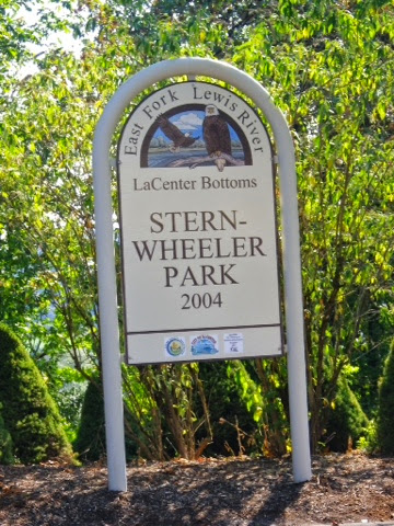
In La Center, we found this great park to have our lunch.
It had some interesting Native American animal...carvings?

Froggy

After lunch we made a quick stop at a grocery as we realized we had forgotten spices for our dinner. We continued on. It was getting pretty warm. The hills were mostly rollers--up, then down. For all Jasmin's fear about climbing the hills, she did great! She stayed right with me on every one.
At the beginning of a rather steep and longish hill, I went to shift into the small ring, and dropped the chain. It did it's nasty thing of wedging between the folding bolt and the small ring. We pulled into a driveway so I could get the chain out. As I was trying to take the chain apart at the master link, the owner of the house came out to see what was going on. When we asked his name, he said it was "Georgie Porgie"--funny guy. I was finally able to get the chain to dislodge without having to take it apart (I must remember how I did that for next time). We said goodbye to Georgie and made our way up the hill. It was the steepest hill so far. At least it was all shady.
We continued following the route directions. We were on nice, fairly quiet backroads.

All smiles!It was getting quite warm, and even though I had plenty of water, my mouth was very dry. We were fantasizing about nice cold lemonade. Unfortunately, we didn't go by anyplace where we could make that fantasy a reality. But, before we shriveled up and turned to dust, we arrived at our destination of Battleground Lake State Park.

We paid our $12 and found a nice campsite. First we found the water, drank a gallon each, then sat down and chatted. It was 4:00 when we arrived, and before we knew it, it was 7:15! We decided we should probably set up our tents and stuff. That done, we cooked dinner. We had a delicious meal of pasta, with zucchini, mushrooms, olives, garlic, and avocado.
We made our way to the restroom/shower building and took turns taking showers. When we got back to the campsite we had our dessert of chocolate and more chatting--until 11:15! After one more foray to the restrooms, we crawled into our respective tents and drifted off to sleep in the peaceful quietness of the virtually empty campground.
Day 2--Continuing the loop--36 miles
Not having brought my watch, I woke up in the morning thinking it was probably about 6:30 or 7:00. I turned on my phone to see it was 8:00! Nice! We would still get an earlier start today, because we didn't have to drive an hour and a half first!

Good morning everybody!
We packed up the insides of our tents, then cooked breakfast. We had a nice leisurely meal with, of course, much talking. We finally decided we should probably pack up and get on the road. By the time we got breakfast cleaned up, and the tents packed up, it was almost noon! So much for the earlier start!
Still, before we left, we went down to the lake itself. Battleground Lake is a spring-fed crater. It's a great lake for swimming as the water is very clear. 

The beginning of today's route was pretty easy. We rode along the East Fork of the Lewis River. We stopped at Lucia Falls and ate lunch (okay, so we'd only been on the road for 6 miles, but it was already past noon, and we were hungry!)
Lucia Falls
A short distance farther down the road, we came to Moulton Falls.
Moulton Falls
After Moulton Falls, we departed from the river. Three miles later we rolled into Yacolt. We stopped at the General Store and got water. Jasmin got a couple of souvenirs for her boys.
In Amboy, we began a long steep climb. It was definately the longest climb of the day. Jasmin's legs were getting tired, but she was still doing great. We just took frequent breaks. At one point the sun came out, and it started to rain. Yes, rain! Fortunately, it didn't last long. After reaching the top, we were promised, and delivered, a nice long downhill. The narrative for the route didn't mention any more long climbs, but it should have, because there were a couple of doozies! 

Jasmin becoming a climbing machine!
We made our way back toward Woodland, now riding along the Lewis River.
The road was a little busy, but the shoulder was wide.
Jasmin asked me what mileage we were at. I looked, and we were at 35.7 miles! Woo Hoo! Less than a mile to go! Sure enough, we came down a hill and found ourselves back to Woodland!
So, compared to my usual touring mileage, we didn't do a whole lot of miles. But, it was one of the most fun two days I've had touring! We both had a great time, hills and all! Can't wait to do it again!