Sunday, June 30, 2013

All the Brown Signs and Seeing "Old Friends"

Today dawned sunny without even any fog! I thought for sure it would be foggy. 

I was on the road by 8:20 even though I wasn't trying to hurry. I was only going about 34 miles to South Beach State Park in Newport. I said goodbye to all the kids. They would be going further than me. 

The first brown sign (viewpoint) was Boiler Bay. It wasn't really boiling due to the tide being out, but it was still pretty. 

I climbed under an opening in the fence (not supposed to, but some fisherman were already there) and took a photo on the rocks. 

After Boiler Bay I rolled into Depoe Bay. I went under the bridge to the other side. I heard a kind of barking noise, looked down and could see these guys.

Then as I was riding across the bridge I looked down just as this guy was pulling himself out of the water. 

Just after Depoe Bay is the turn for Otter Crest Loop (a one-way for cars and a bike lane).

It's a climb up to Cape Foulweather. Of course, it was anything but foul weather!
Coming down from Cape Foulweather, I went to shift up to the big ring and dropped the chain. It kind of got wedged between the crank arm and the big ring. I finally got it loose and back on the ring. I used a Monkey Wipe to clean my hands and continued down. I turned to follow the brown sign to Devil's Punchbowl. On my way down, a guy said, "Good on ya for coming down!". I guess not too many cyclists ride down the hill that they, then, have to come back up. It really wasn't that bad. 

The next brown sign was the Yaquina Head Lighthouse. It is billed as an Outstanding Natural Area and there is a fee to enter. Cool thing is that bikes can go in for free! I rode to the lighthouse and took this photo. 
Just off the coast of the lighthouse, there are some big rocks that were covered with Common Muir (I don't think that is the correct spelling) birds. There was also a big bird (eagle?) out on the rocks eating something. Lots of people were taking photos and waiting for it to fly.

On the way back to 101 I saw Dustin from Devil's Lake.

I came into Newport following the Oregon Coast Bike Route. I wanted to check out the Newport Bike shop. I've heard about this bike shop. They have showers and laundry upstairs AND wifi! When I arrived, 5 of the people that were at Devil's Lake were there. I used the wifi to post my blog. I also charged my iPad. 

The couple, Naomi and David, and I left together. We returned to the route and worked our way to the bridge.
After crossing the Yaquina Bay Bridge, I said goodbye to Naomi and David. I turned into South Beach State Park. 

After checking in, I made my way to the H/B site (this is also a $6/night H/B site). I could see some people already here. Turns out it was Mary and her son, JR, from Ft. Stevens! They have been traveling to the various state parks along the coast by bus. The coastal communities have a transit system that links them all together. They are from, of all places, Ontario, OR (my late aunt and uncle lived in Ontario for years)! Anyway, they are camping a couple of nights at each State Park (the ones with H/B sites). Tomorrow they will go north to Beverly Beach. 

We walked out to the beach. JR knew all the facts about South Beach and the Jetties. 

I spent an enjoyable evening watching them try to build a fire without any kindling. With a little help, they finally got it going. 

For a not very long mileage day, I feel like I did a lot of stuff! Tomorrow I'm on to another new park--Carl Washburn. I'm hoping to see some more cyclists. 


Saturday, June 29, 2013

Devil's Lake--Where All the Cyclists Are!

But first, the day's hike and bike.

I woke up earlier than I wanted to this morning, so I decided I would stop at the top of Cape Lookout and do the hike out to the Cape. It was foggy, but I hoped it would burn off. I said goodbye to Martha and Caroline (I wish they were going further south).

The road up Cape Lookout was very quiet. I think they have repaved parts of it because it was quite nice. As I got higher and higher, the fog did, indeed, burn off. I reached the top and locked Betsy to the only thing available--the trail sign. 

I "safeguarded my valuables" by taking my handlebar bag with me. 

The Cape Trail is 2 1/4 miles out. So, 4 1/2 roundtrip. I changed into my red shoes--not exactly hiking shoes, but good enough. 

The trail was mostly gravel to start with, but then there were areas of lots of mud. I carefully picked my way through the muddy places, trying not to get my shoes too dirty. I was mostly successful. 

The views going out were pretty awesome as the fog was still hovering down below. 

As I continued hiking, the fog was burning off down below and I got glimpses of the beach.

Pretty soon the fog had completely burned off. The views were spectacular!

I made it out to the end, took a couple photos, ate a snack, then headed back.
It had taken me about 1 1/4 hours to get out to the tip of the Cape. I figured I would be faster going back as I would not be taking so many photos. It still took me a little over an hour. It was noon by the time I got back to Betsy. I decided to just get going. I would eat something later. 

I came down the Cape and made my way to the third of the 3 Capes--Kiwanda. I stopped in Pacific City where the Dory Fleet launches off the beach. There was actually a boat going out, but I didn't see any coming in. 


Back on the road in the glorious blazing sun, I continued toward Lincoln City and Devil's Lake State Park. Out of Neskowin I turned onto Slab Creek Rd. It is the "highly recommended" route to Lincoln City. I've done it before and it is a great road. Even better now (in places). I managed to do the entire 5 mile climb without getting into super granny gear!

I arrived in Lincoln City and stopped at Safeway for a few groceries. It was just a short distance through town to the park. I've never stayed at Devil's Lake. It is another $6 H/B. The H/B site is up a steep path to a flat grassy area. There is water and a trash can (along with a few picnic tables). I was the only one here...for a short time. Before I went for my shower, three kids came in. After my shower another guy came, then two more, and two more, and two more. Yes, there are, besides myself, 10 other people here (5 women--counting me and 6 guys)! It's awesome! This is what I love about bike touring! We'll see if I see some of these people tomorrow night. 


Friday, June 28, 2013

Netarts Hwy 2, Cape Meares 1

Again with the rain! This time I started with my rain pants on. I left Nehalem Bay at about 8:45. The ride was uneventful until I got to Rockaway and saw Caroline and Martha's bikes parked in front of a restaurant. They were waving at me from inside the restaurant. I crossed the road and joined them. They were just finishing. Caroline only ate half of her French toast and offered me the other half. I ate it with marionberry syrup, and it was good!

Even though I didn't purchase anything (I tried to pay for half of Caroline's breakfast, but she wouldn't let me), I felt it was okay to use their restroom. I thought this sign on the restroom door was interesting. Apparently, only if you eat customers, are you allowed to use the restroom. And, you must eat the customers IN the restroom!!!

Anyway, when we came out, the wind had picked up so it was a little chilly in the rain. I put my rain pants back on. 

We rode in the rain through the little towns along the way--Garibaldi and Bay City. In Bay City (or maybe it was still Garibald)i, the Oregon Scenic Railway train was on the move. It had just blown it's whistle. 

There was also a "cow" engine on the tracks. 

When we got to the Tillamook Cheese Factory, Martha and Caroline opted to continue as they will have a few days in Tillamook to check it out. I went over so I could get my favorite Tillamook flavor of ice cream, Tillamook Mudslide. 

I also went up to the cheese making viewing gallery.

After my ice cream, I went over to the Chamber of Commerce to ask where the library was. I wanted to post yesterday's blog and I didn't want to have to hunt down a Starbucks (or buy something either). Turns out the library was right on my way!

Blog posted, so I headed out (actually, I never went in-just used the wifi from outside). Since I had just been to the cheese factory, I thought I would take a photo of where the cheese begins. 

The first time I did the Coast with Julie, we did the 3 Capes Scenic Route. It goes up Cape Meares, Cape Lookout, and Cape Kiwanda. The second time, I bypassed Cape Meares, and just took the Netarts Hwy to Cape Lookout State Park. This time I decided to do Cape Meares again (even though it is a nasty climb!).

As I came upon the turn, I saw this sign. 

I toyed, briefly, with the possibility that maybe a bike could get through. But, as you can see, if not, that would be 12.4 miles for nothing. So, once again, I took the Netarts Hwy. Except that there is still no shoulder, it seemed easier this time.

I made it to Cape Lookout at about 2:45. I was the first one here. Martha and Caroline have showed up as well as one other cyclist. The sun was out for a brief time, but everyone says the weather is supposed to get nice...

Thursday, June 27, 2013

Oddly, Outnumbered!

Once again, there was rain throughout the night. However, it quit long enough for me to pack up and eat my breakfast. I tried wearing my rain jacket as insurance that it wouldn't rain, but, alas, I think I need a new insurance policy. As I headed out from Fort Stevens, it had begun to rain again.

Since I hadn't had wifi for the last two days, I decided to go back to Warrenton to the Starbucks. I also needed a few groceries. There is a nice Fred Meyer near the Starbucks.

After posting and shopping, I headed south on Hwy 101. The rain quit and I swapped out my lousy insurance policy for my hi-vis jacket. Even though it has been raining everyday, it has not been cold. 

This section of 101 is not very exciting, so I just pedaled along; feeling the mild soreness in my legs from yesterday's near century ride. I figured once they warmed up they would feel better (mostly true).

I made it to Seaside and, like last time I was here, rode The Prom (a sea wall promenade that pretty much runs the length of the town). At first I had the Prom to myself, but aways further, near the Aquarium, there were a number of people. They moved out of the way as Super Biker Woman on her little-wheeled Betsy came through.

Beyond Seaside, 101 turns a bit inland. There is a good size climb before dropping back down and out  to the ocean at Cannon Beach. There I stopped at my old roommate, Julie's, quilt shop (if you are a quilter visiting Cannon Beach, she is the only shop in town--quite the selection too!). The only time I see her is when I'm riding through Cannon Beach, but that's been three times in the last 4 years! Julie was pretty busy and also hobbling around on crutches from a badly sprained ankle. We didn't visit long.

After leaving the quilt shop, I rode across the street so I could go take a photo of Betsy with Haystack Rock. She also saw a big puffin that she wanted her picture with.
As you can see, I obliged.

As I continued over to the beach access for Haystack Rock, I saw two gals with their touring bikes (Surly LHTs) sitting on the wall out of the wind. Of course I stopped to talk to them. They were Caroline and Martha from the Midwest. They were out here to do a bit of the Oregon Coast. However, they were not enjoying the headwind. Oh yeah, I forgot to mention there was a headwind today--a really strong headwind! This would have been the day any northbound cyclists would love! 

Caroline and Martha were waiting to take the bus further South. They also didn't like all the traffic. Unfortunately, that is the Oregon Coast in the summer. It doesn't just attract cyclists. I told them the traffic doesn't bother me too much. I took a photo of the three of us. That's Martha on the left and Caroline in the middle (notice Haystack Rock in the background--I am so good!). 

Here's the photo of Betsy with Haystack Rock.

We said our goodbyes (I gave them my blog address) and I returned to the road. Just a short way down the road, I pulled off for a bit of lunch at Tolovana Wayside. There was a guy sitting on a bench playing guitar. I listened as I ate a hunk of Dave's Killer Bread Sindog.

Next up was the climb through the Arch Cape Tunnel. It has a button to push to warn drivers there is a cyclist in the tunnel, but I managed to get almost all the way through before a car passed me (several were coming the other direction). I stopped at the other end to turn off my flashing headlight and taillight.


See? No cars!

I continued to the top, then cruised down to Oswald West State Park. Then it was another long climb to where you can see Manzanita and Nehalem Bay down below. They have recently repaved that section so it was very nice riding.

At the lookout, the wind was really whipping. I decided it would probably be a good idea to take the Da Brim off my helmet so I wouldn't be picked up, ala Mary Poppins, and blown over the side! Notice how flipped up it looks in the photo before I took it off.
That's Manzanita and Nehalem Bay below. A little bit more climbing after the lookout, then it was a screaming good downhill!

I made it to Nehalem Bay State Park. This is my favorite Hiker/Biker site. This is also where I met Christian (only, I thought he said his name was Kurt--I found out the next night at Cape Lookout that it was Christian). When I arrived at 4:00, there were just two other tents. I didn't see any bikes. Later I saw their backpacks. Later two backpacking gals came in. Hmm...that makes 4 Hikers and 1 Biker. I am outnumbered! The hikers are hiking the Oregon Coast Trail.

I fixed myself a delicious dinner of sautéed zucchini, mushrooms, carrots, tomato, and broccoli in a garlic balsamic dipping oil. I added some chicken for protein. When the veggies and chicken were done, I added a bit more oil to the pan and toasted a couple slices of sandwich thins. It was gourmet!!! One thing about it not being sunny, the veggies keep longer in the pannier. Anyway, it was great and I am full!

I hear the sun is supposed to come out tomorrow (bet your bottom dollar that tomorrow there'll be sun). I won't hold my breath...

Wednesday, June 26, 2013

The Banks-Vernonia Trail and Hiding in Plain Site

First day on the road, and it's raining. Fortunately, not too badly. I just put my rain jacket and my helmet cover on. Too warm for rain pants (hmmm...makes me think I should have brought the Rainlegs).

As I was leaving the most bike friendly city, Portland, I had no trouble finding my way to the St. John's Bridge. I just had to follow the signs.

I made it over the bridge. The St. John's Bridge is one of the prettiest of Portland's many bridges--very gothic looking. Don't know if you can see the "sharrows" on the far right lane, but they are there and I was able to ride comfortably.

I came down on the other side to Hwy 30. At this point I was basically doing the reverse of the STP route from last year. However, I was only on Hwy 30 for a couple of miles before I took a left on Newberry. See the hills in the background of the bridge photo? Yeah, I had to get over them. Newberry was pretty much a steep 2 mile climb up to the top.
If street names are any indication of how high up I was, the road I turned onto at the top was called Skyline. Coming down I was on Old Cornelius Pass Rd. Since I only came down on Old Cornelius, I figure Newberry must have been the up side of the Pass. Maybe I can add that to my list of Passes I will do on this trip.

I didn't have a map for this route. I was following directions from the "Bike There" app. So far, everything was as the app directions had said. However, at one point the directions had me turning onto a gravel road. Since I have this new-found fondness for riding on gravel roads, I continued to follow the directions. It ended up being just a 1/2 mile section of gravel before I turned onto another paved road. Still looking good!

I rode past some huge blueberry fields! They are not quite ripe yet, but give them a couple of good hot days...

After several more turns and another short gravel section, I reached the Banks-Vernonia Trail--my purpose for going this direction to the Coast.
I picked up the trail at the Banks end. This is a very nice rail trail from Banks to Vernonia (uh, hence the name). It had even stopped raining! I rode for a few miles, to one of the other trailheads where I stopped for a bite of lunch.

Back on the trail I came to this beautiful green mossy section. Had to take a photo!

Then I came to a long trestle. This trail is also for horses, but they only let bikes and pedestrians on the trestle. Horses have to go down and around.
Just after the trestle, there was a road called Bacone. According to my Bike There directions, I was supposed to exit the trail and go onto this road to get to Vernonia State Park. It just didn't seem quite right. I pulled out my phone for a little Google Maps assistance and saw that there was no Vernonia State Park showing up on Bacone Rd. I opted to stay on the trail as there was a Hike-In campsite further up the trail. I also saw a sign for a campground called Dairy Creek. It is part of LL "Stub" Stewart State Park (which you can't get to by going on Bacone Rd).

I decided to go to Dairy Creek because I figured they would have water and showers (right about the water, wrong about the showers). So I rode until I came to the sign pointing to Dairy Creek. Well, it was a 1/4 mile gravel trail that went up quite steeply! I got off and pushed Betsy (not an easy task when fully loaded). I had to keep going, because if I had stopped, I don't think I couldn't have gotten Betsy going again. I finally reached a section where I could ride, but it didn't last long before I was back to pushing. I reached the top, only to realize I could have taken a road! I'll be taking the ROAD down in the morning! 

I rode around the park to check it out (the walk-in tent sites are at the beginning), hoping for showers. I found the pay station. I'm not paying because they want $21 for a walk-in tent site! And, no showers! I think that is a little exorbitant! When I returned to the walk-in sites, I chose one that is not as visible from the road. Although, it's not like I'm hiding. I'm pretty much in plain site, but there is a guy next to me who has set up a veritable Taj Mahal of campsites. He has so much stuff that when you look from the road in the direction of where I am camped, all you see is his stuff. I think it's brilliant! I'm planning to be out of here early in the morning anyway.

It's only 7:45, but I think I'm going to hit the restroom once more and retire to my tent. I didn't get as much sleep last night as SOMEONE kept trying to join me in my bed on the couch!

On to Fort Stevens tomorrow--about 70 miles. I hope not quite as many hills as today...


Bad Directions Lead to Near Century

At home I regularly sleep until 8:00. On the road, even when I set my alarm for 6:00, I'm awake at 5:30. Probably has something to do with going to bed so early.

It was good that I got up at 5:30, because that meant I was on the road by 7:30. THAT was good because I knew I had a long day of riding to get to Fort Stevens. 

I returned to the Banks-Vernonia Trail via the road entrance to the park. Today I had about 13 miles to complete the trail to Vernonia. As I was quite early, the only other trail users were the slugs and snails.
I think I managed to not run over any of them.

The trail continued the gentle grade up for a couple more miles. Then it was a nice downhill. Then it was a really steep downhill (11% grade)! There was even a sign saying to walk bicycles (yeah, not doing that!). 

At the bottom of the steep grade, the trail crossed a road. Guess what happened on the other side? Yep, another 11% grade, only this time I had to go up! It had some tight switchbacks, but it still got the heart thumping and the lungs working hard!

The remainder of the trail was fairly level. It ended at Anderson Park in Vernonia. From there, my "Bike There" app directions said to turn on Adams Ave. I didn't see a sign for that, so I just went to the end of the trail. The end of the trail was not Adams Ave. Still, I turned left like I was supposed to on Adams. I came out to the main drag through Vernonia (Bridge Rd/Hwy 47). My directions said to turn right onto Bridge, so I did. In a short distance I was supposed to turn left onto State St. I didn't see a State St, so I pulled out my phone to see where I was in relation to State. Yep, it was behind me (before the road I had come out of). I looked at the route while I was at it and compared it to just continuing on 47. It looked like 47 was a longer way to go, so I turned around and went back to State. 

Everything was going according to the directions. I rode along State, which became Keasey. I had ridden about 10 miles when the pavement ended, and the road turned to gravel. Since I had ridden two gravel sections yesterday, I thought it would be okay. I looked at the directions and figured, at the most, it would be about 6 miles of gravel. Since I kind of like riding on gravel, I continued on. 

After about two miles, the gravel road became narrower and more dirt than gravel. I thought to myself, "Hmmm...curious...this does not look good."  Sure enough, in about 500 yards the road ended. Well, it didn't really end, but in one direction there was a logging company gate--locked with tall grass growing behind it, and the other direction was an open gate, but the "road" ended in tall grass also. I pondered my options of which there was really only one--turn around and go back the 12 miles to Vernonia. After a few choice expletives, I turned Betsy around, and headed back. 

Along the way, a guy came along in a truck. I stopped, and he asked me if I was lost. I said I wasn't lost per se, but the directions I had had ended in a dead end. Funny thing was he said there were four other cyclists the week before trying to do the same thing! He also said it WAS possible to go that way, but that the likelihood of getting lost was pretty high. They are all logging roads without any signage. I asked if there was another way without going all the way back to Vernonia. He told me of another logging road, but he said that, too, was pretty difficult. He also told me there was a paved road near Vernonia that I could take, but it wouldn't save me much--just a couple of miles. I had seen Stony Point Rd on the way out. I opted to take that. 

So, I ended up on Hwy 47 afterall. Not only was it going to be longer, but I had just done nearly 24 miles for nothing! This day was getting longer!

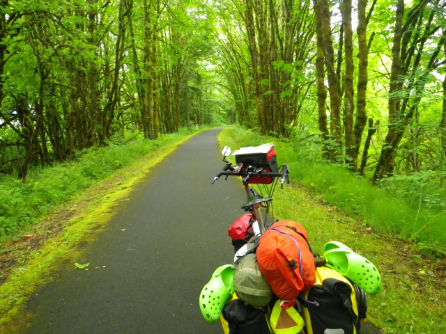
Riding 47 was not bad. There were logging trucks, but most were going the other direction. Other than that, there wasn't much traffic and it was a pretty smooth road. Although it had been raining in the morning, the rain had stopped and the sun even came out...for awhile. 

I rode 47 for, I don't know how many miles, until I came to Hwy 202. 202 was the road I was supposed to come out on from my directions. The sign said 202 was the way to Astoria, so I figured that part of the directions was correct. The road sign said 47 miles to Astoria. I had already gone 46 miles. Yep, I was going to be on the road for a long time! However, I didn't think I would be going all the way to Astoria, because I was going to Fort Stevens which is Warrenton. I was hopeful that I didn't have 47 more miles to go.

The clouds were moving in again when I pulled into a county park to use the restroom. Before I could leave, it started raining--pouring actually. I stood under a tree and pulled all my raingear on. As usual, as soon as I got everything on, it slowed down. Since it was still actually raining, just not as hard, I kept the raingear on. 

About 2 miles down the road the sun came out and I was cooking in my rain pants, so I stopped and took them off. A short time later I took my jacket off too. 

At one point, I pulled off to eat something as it was about 12:30. I didn't feel like making a peanutbutter and Nutella sandwich, so I just ate some almonds and a Clif Bar (my second for the day). 

Back on the road, I noticed that I was gradually climbing. Then I noticed it was starting to rain again. I stopped and put my jacket and helmet cover back on, but not the pants. I was hoping for just a light rain...yeah, not so much. Soon, it was pouring again. Since I was pretty warm because I was going up (and up, and up), I didn't bother to put the rain pants back on. I was pretty well soaked from the waist down. 

The directions I had tried to follow had me coming out to 202 from "Wage" Rd. I didn't see this road for a long time. I was hoping, by then, that I wouldn't see it because, according to the directions, I would have 29.9 miles on 202 from Wage Rd. I, unfortunately, did see the road. I calculated I would be over 90 miles by the time I got to Fort Stevens. I've done 89 before, but that was flat and with a tailwind. I was a little worried. I just kept telling myself I had lots of daylight!

The climbing continued. It dawned on me that I would eventually get to go down to get to the Coast! Boy, was I hanging on to that thought!

Finally, I reached the top and did, indeed, have a nice long downhill. It was still raining and I was a little chilly coming down, but not cold enough to put my rain pants on. 

The road was still on a downhill trend, when I realized I really needed to stop and eat something. The banana I had eaten on the way up was long gone! I pulled off and grabbed my spoon and jars of peanutbutter and Nutella. I ate a couple of spoonfuls of both, then pulled out my bread and spread more on and ate that too. I felt about a 1000 times better, and was even confident that I could make it to Fort Stevens!

Unfortunately, it turned out that I did actually come into Astoria (on the East side of the Nehalem River-which I crossed about 5000 times today!). I was at 91 miles when I crossed the Youngs Bay Bridge (which was VERY DIFFICULT as there was a full-on headwind, and the shoulder is not very wide).

I finally pulled into Fort Stevens at 6:10. I had gone 99.5 miles. Why didn't I just do another half mile so I could say I did a century? Because I was exhausted! I did not want to ride any more than I had to to get to the Hiker/Biker site. 

Needless to say, the shower was awesome! There are no other cyclists here, but there is a mother and son who are...um...interesting. 

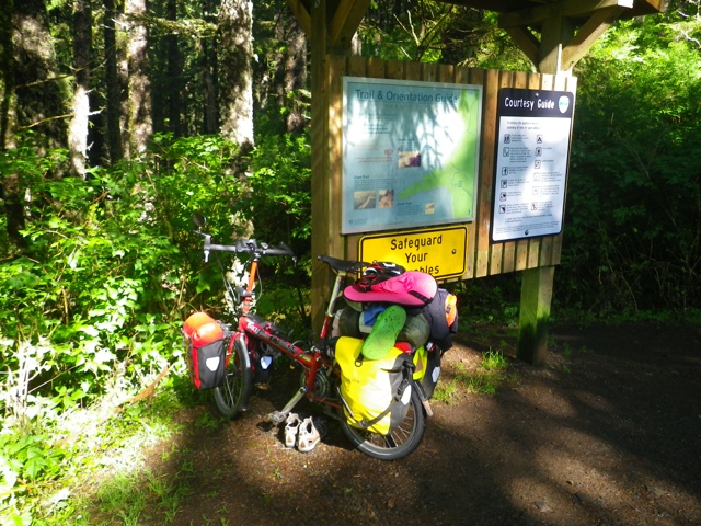
Tomorrow will be a MUCH shorter day. By the way, I blew my previous longest day of 89 miles out of the water! One more photo for the road--literally. If I had this I could have done the logging road route!


Sunday, June 23, 2013

A Great Way to Start a Tour!

Today's total mileage? 1.3 miles. That's how far it is from my house to the train station.

Day 1 of my Long Way to the Cabin Tour (form here on out...LWCT, for short) started with a train ride to Vancouver. The nice train man (not Mark, my usual nice train man) took my heavy duffle bag and tossed onto the train like it weighed nothing. He wouldn't even let me put it into the luggage rack. That was a good thing because I'm not sure I could have lifted it up!

After an uneventful hour and a half-ish, I arrived in Vancouver. Once again the nice train guy hefted the duffle off the train for me. I went back to the baggage car to retrieve Betsy. My dad was there with the van and I loaded everything up. 

The BBQ at my brothers' house wasn't until 3:00, so I had time to make a run to Safeway to get the food I needed for my LWCT. I got everything loaded and we went to Scott and Tim's at the appointed time.
    Brothers, Tim and Scott, and me

Slowly my cousins started arriving as well as Scott's fiancée, and finally her sister and two of her kids. Cousins, Jeannie, Abby, and Claire came from Hood River. I'll see Claire again when I get to Hood River on the LWCT. Erin, John, and James came from Vancouver (I haven't seen James since he last stayed with me at 2 1/2 years old. He is 19 now.). Vince and Sharon, and Lisa and Tag (I think they are all in the Portland area) came too. I don't think I've seen Lisa in 18 years--Vince, too. 
    Cousins, Jeannie, Vince, Erin, and Lisa

    James, Abby, and Claire
    Paparazzi!

Lori, Scott's fiancée, is a sweetheart, and I look forward to her joining the family!

We had lots of great food and even more great laughs. What a wonderful way to start a tour!

Here are a couple of parting shots of the dogs:

     Bubba and Grace--my bed partners for the night