Monday, May 27, 2024

Memorial Day Weekend Bikepacking Trip-Day 3

What a Great Finish to a Great Weekend!

Today would be our longest day, so we wanted an earlier start. I was up pretty early, and woke up Jana and Steph at 6:45ish. We were ready to roll right at 9:00 as planned. My phone was pretending it hadn’t charged off the power bank overnight. I hooked it back up to the power bank, and made sure it was charging before putting it into my handlebar bag. No photos until it charged. 

We started the longest climb of the day after less than a mile of warmup. It was a 5.2 mile climb with double-digit grades for the first half. A blue car went by me as I was slowly chugging up. Then it stopped. The guy asked me if I was okay, and did I want a ride! I thanked him, but told him I was fine, and didn’t need a ride. It was nice of him to offer. 

At one point, I stopped at a viewpoint. I really wanted to take a photo. Turns out my phone was already at 100% (from 8%). There’s no way it would have charged that fast if it was really at 8%. Stupid phone. But, now I could take photos. 

We had been way down there just moments before…okay…maybe a bit more than “moments”. And yesterday we had been way over across to the high prairie. 

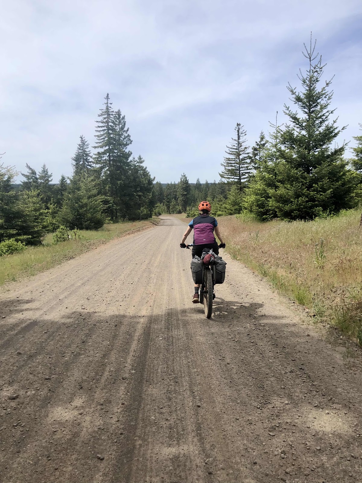
The climb was on pavement for the majority of the steep parts. While we still had more to climb, the road turned to gravel (Long Rd).

Now gravel…

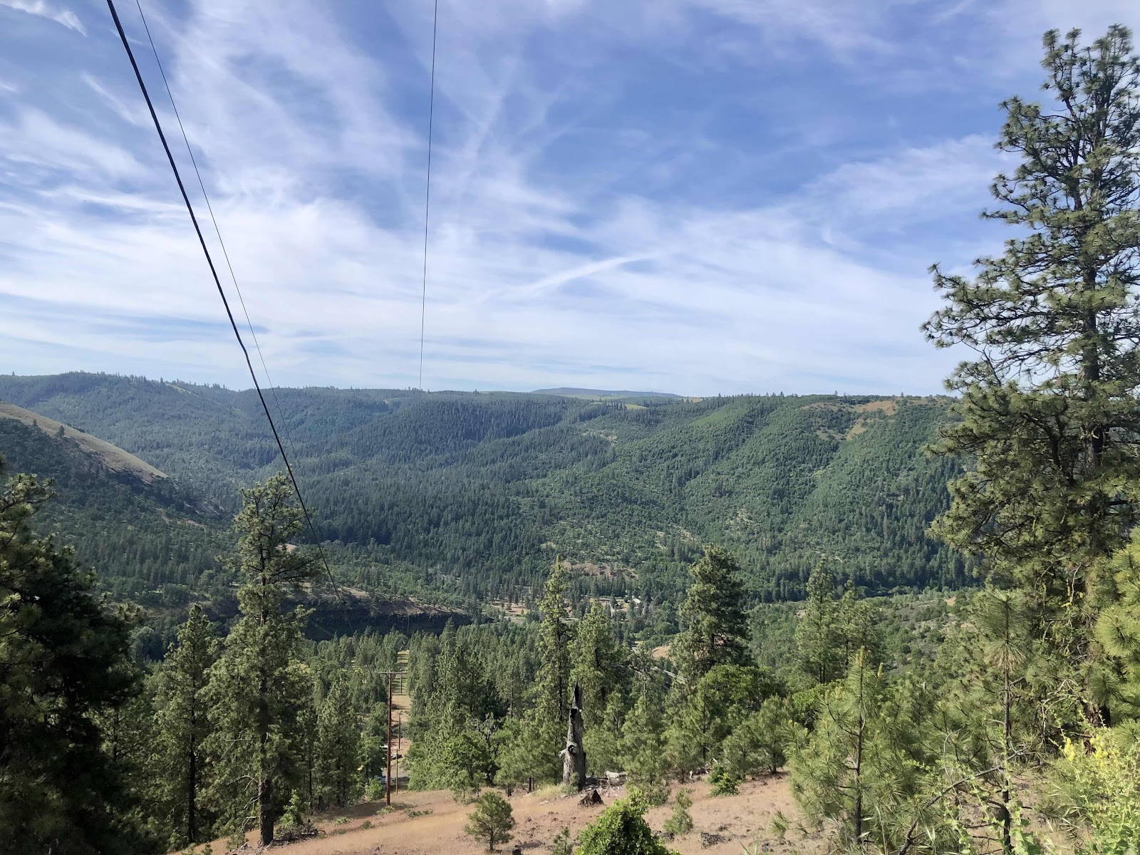
And a view of Mt. Hood!

Jana and Steph were ahead of me when I saw these signs. 

Hmmm…which ones were we? I Guess since we were going in the direction of the Jokers…

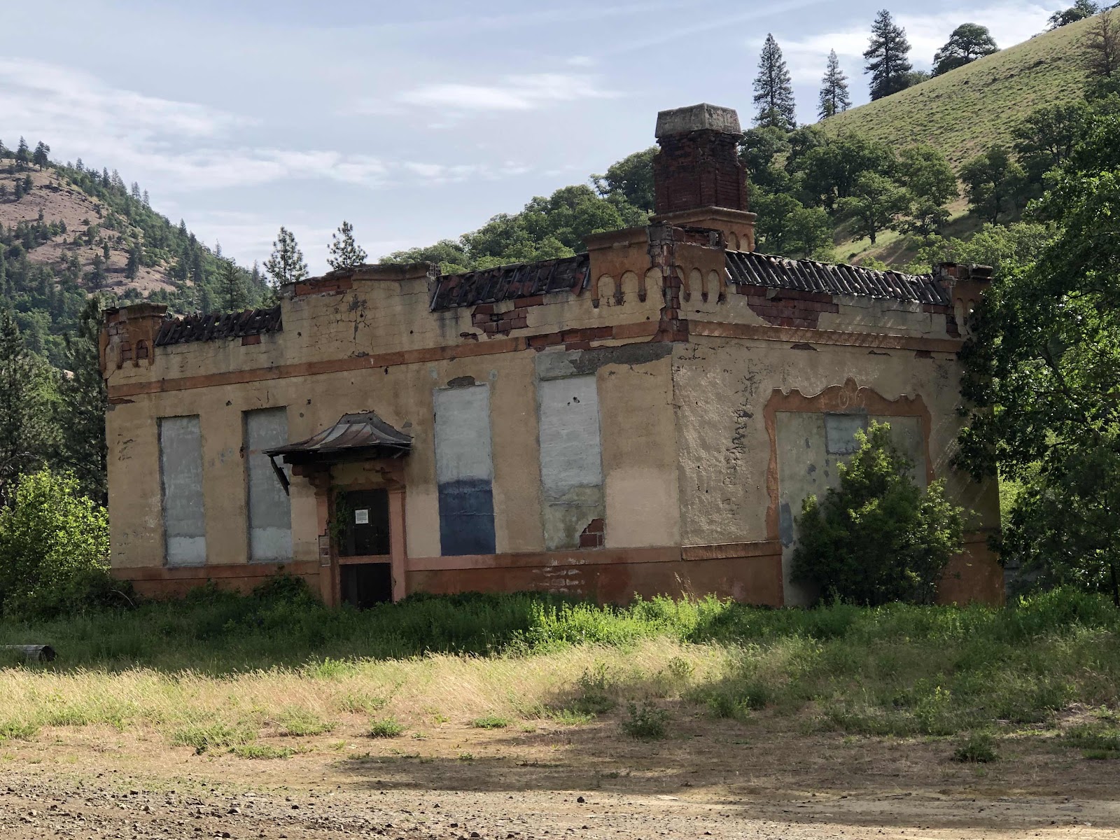
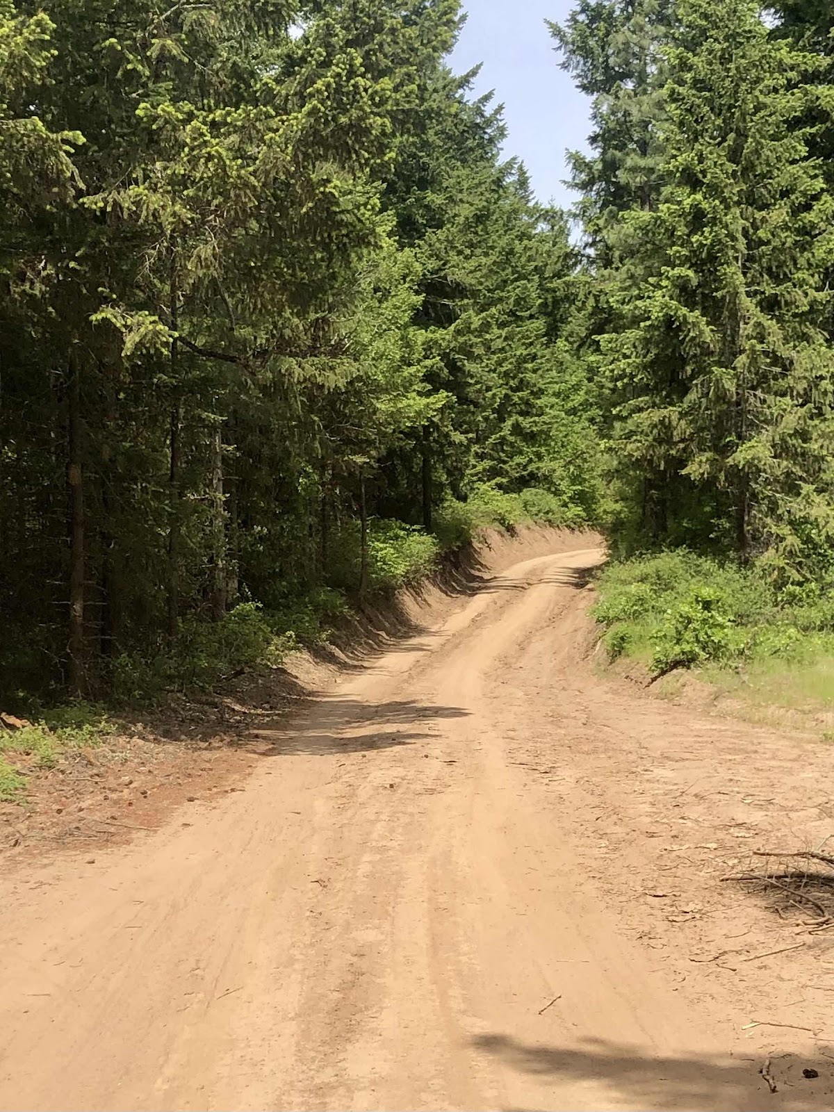
When I was creating the mash-up of the two routes, I had to draw lines (following the roads on satellite view) for the section from the end of Long Rd to Brewer Rd. According to RWGPS, there were no roads between those two points. Of course, there were roads, but not always the best. We had a fairly long section of very rutted out dirt road. We did see a sign that did “Impassable in Wet Weather”. Indeed, it would have been terrible. Fortunately, we had not had any rain, and the road was dry (and also sandy in places).


We finally got out of the dirt and back to regular gravel. We had finished the long climb, but still had three more in the climb profile (there were others, but they weren’t long enough). In between there were some nice descents, or just rolling. 
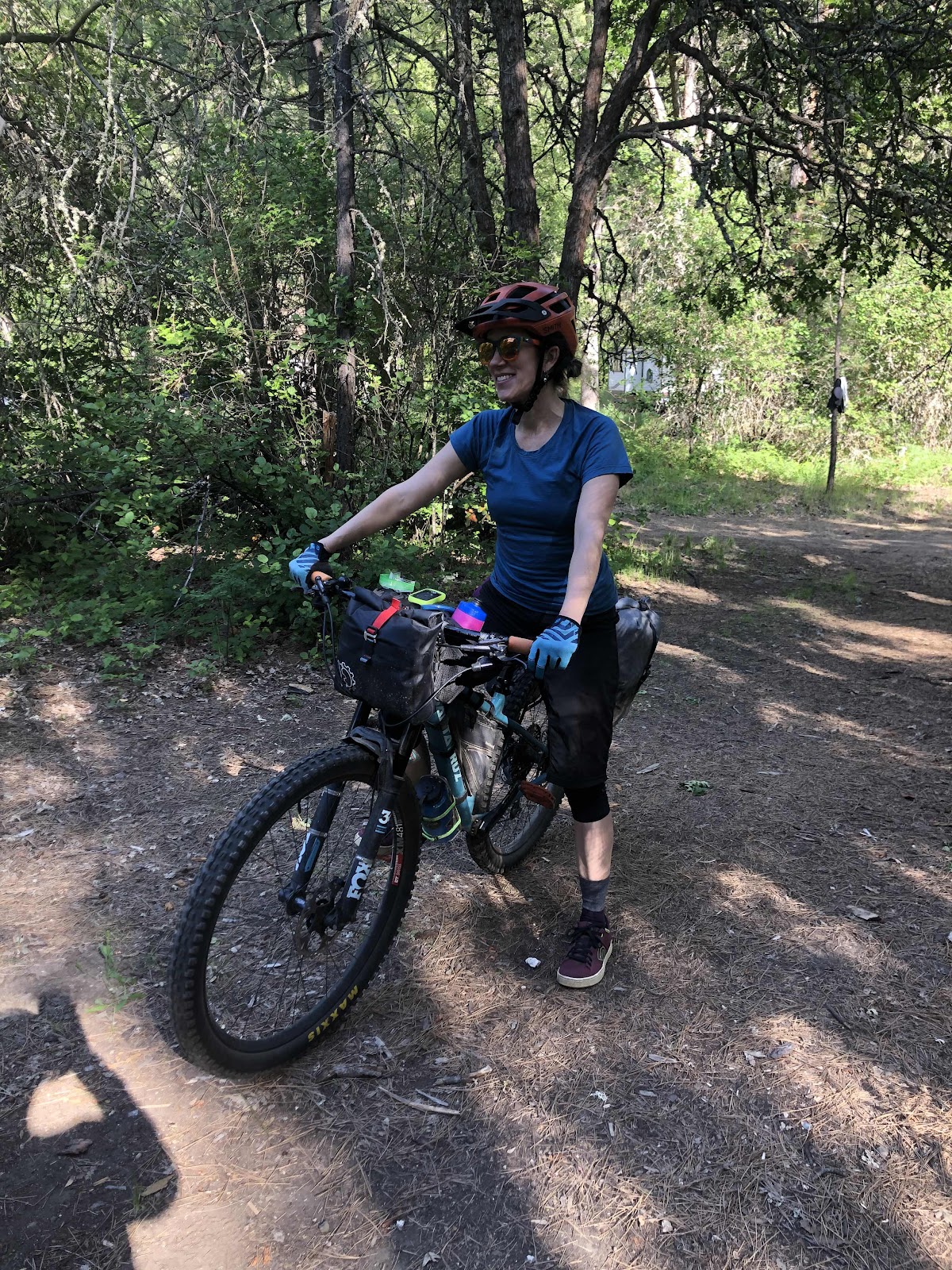
Steph. 

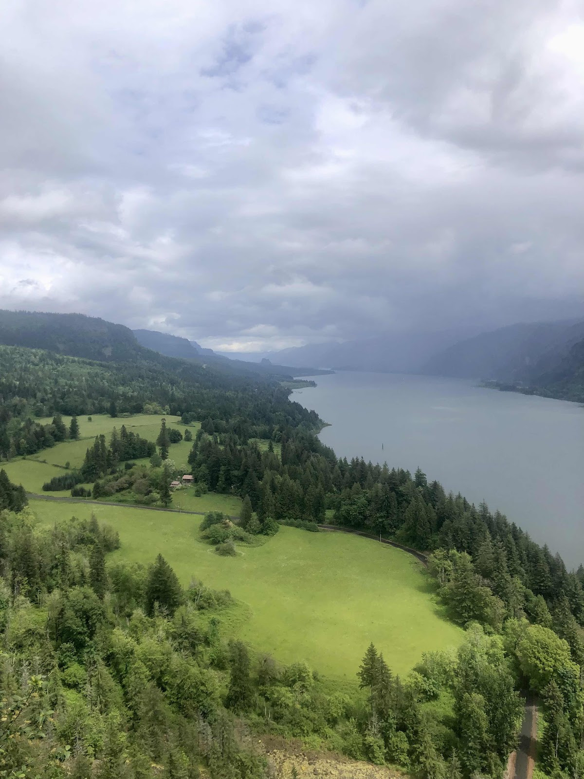
At noon, we stopped along the side of the road with this view of the meadow to eat our lunch. I even broke out my chair. 

Back to riding. 


After lunch we had one more significant climb, then it was mostly downhill. We had a stretch of downhill pavement that was quite fun, then the pavement ended, and we were back to gravel.

Took this selfie at this viewpoint on the pavement part. 

Then came the main descent on Fisher Rd. It was amazing!

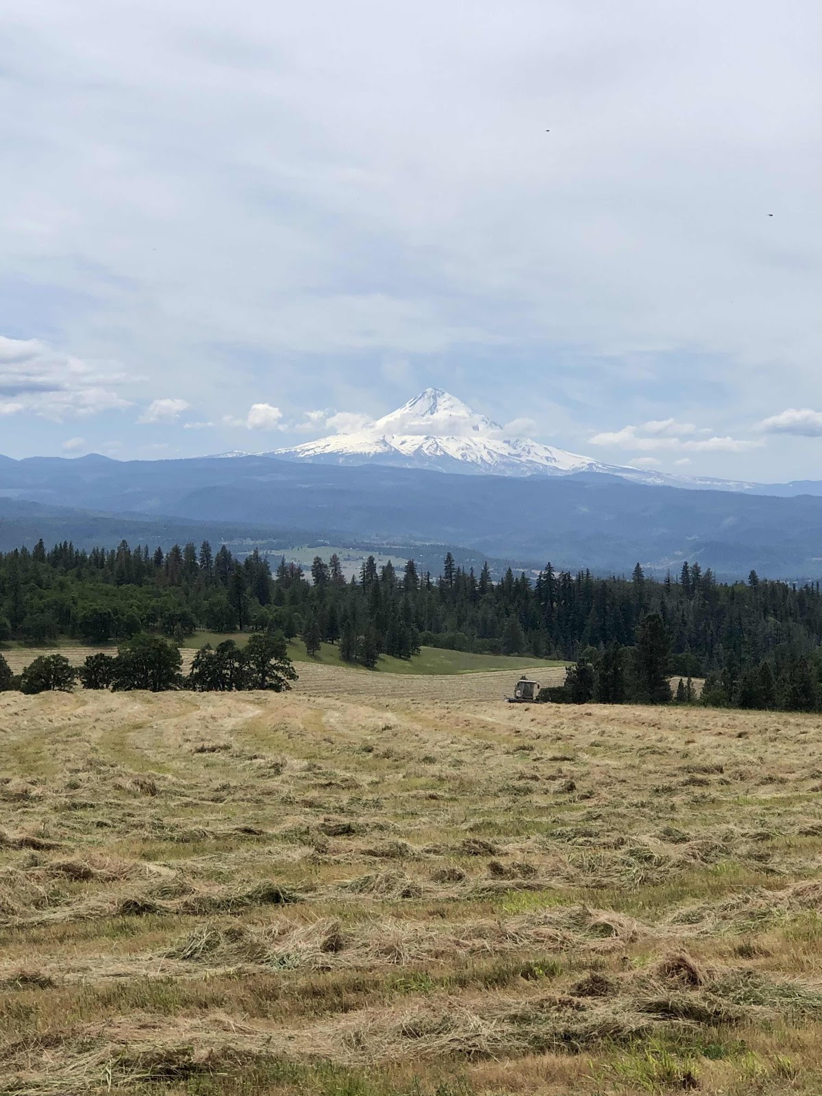
Another view of Mt. Hood with freshly cut hay. 

Going down. 

If you look through the trees, you can see the Klickitat River way down there. We still had to go ll the way down back to the river. 

The views!!!

Multiple switchbacks!!!

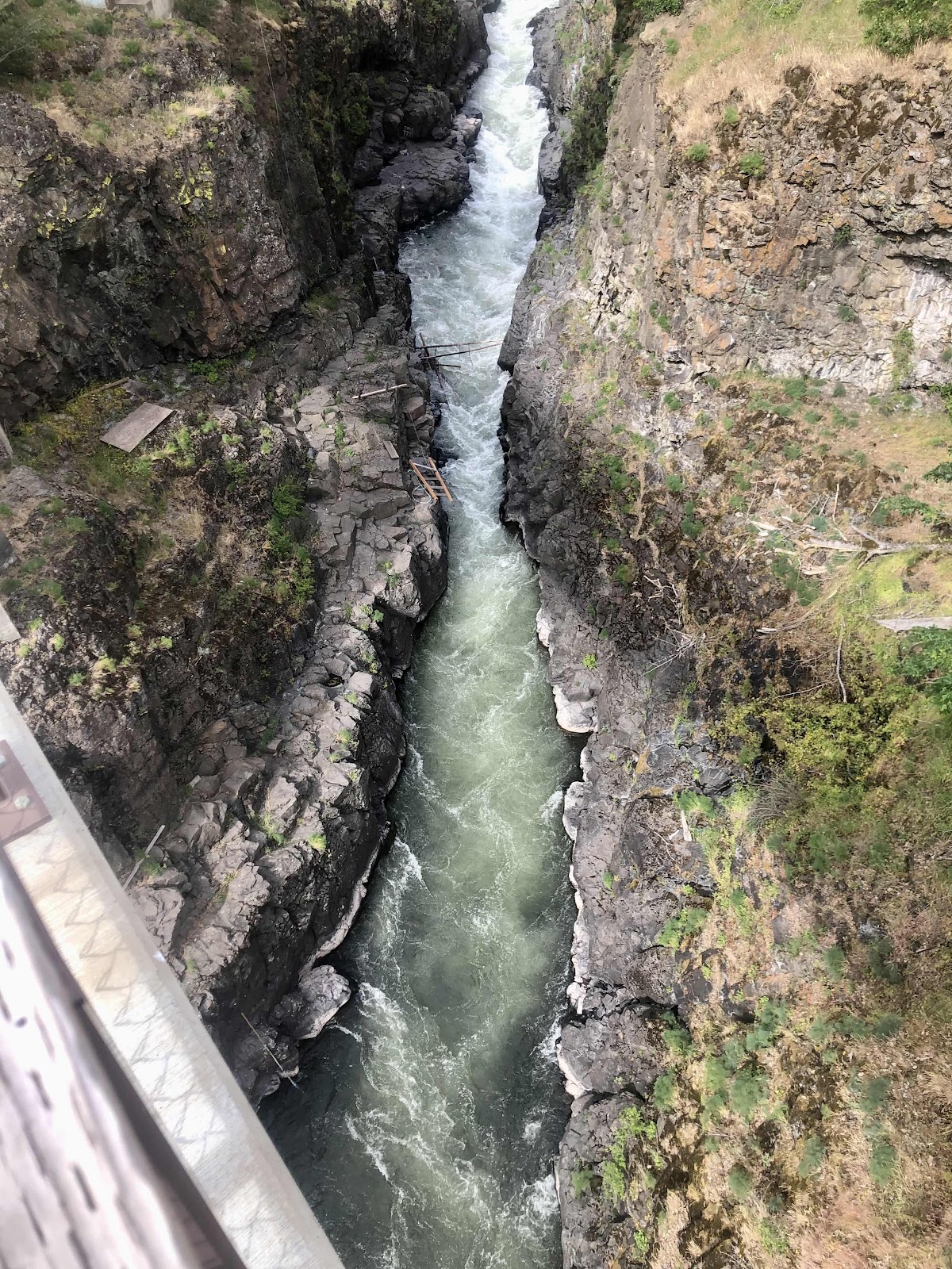
Back to the Fisher Bridge across the Klickitat that we had crossed on the first day. 

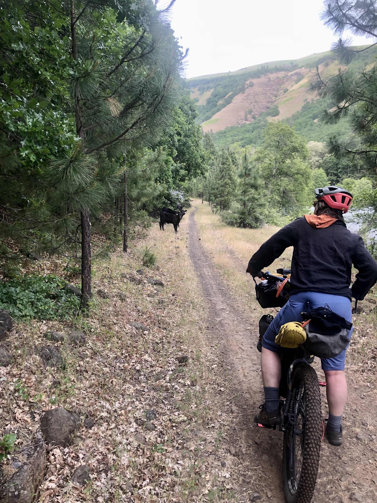
On the Klickitat Trail for another 1 1/2 miles to finish our epic weekend. 

Some Thoughts

This was an amazing route! The weather cooperated (even the wind), and the diversity of environments made for an always changing, never boring, beautiful ride. The direction in which we did the route (particularly reversing the Schilling Rd/Swale Canyon Loop) was perfect. We all said we would do this route again. Memorial Day Weekend might have just been the most optimal time for this route. Too much later, and it would be too hot in the canyon. Too early, and there might be snow or mud. I would wholeheartedly recommend this ride to anyone who has a moderate amount of fitness (there is some significant climbing). Some might not like the idea of camping in the same place twice, but there really isn’t any where else to camp. And riding through Swale Canyon mostly unloaded was really fun. Overall, we gave this weekend 5 out of 5 stars!


Memorial Day Weekend Bikepacking Trip-Day 2

Just Going For a Bike Ride 

Because we were camping at the same campground again tonight, we opted to ride unloaded today. By unloaded, I mean still carrying a lot of stuff! The only thing we weren’t carrying were our tents, sleep systems, clothing, and toiletries. We still had to have repair kits, water (and I carried my filter), and food. Even though we only needed snacks and lunch, we didn’t want to leave food laying around (critters and such). We each carried about 2 1/2 liters of water. 

We didn’t need to get an early start. I got a photo of the Icehouse. 

The remaining structure. 

The reason the building has not been demolished. 

Still some machinery inside. 

We rolled out around 10:15. We had a bit of pavement before turning onto Schilling Road. The road turned to gravel right away, and started what would be about 9 miles of mostly climbing before dropping down to Centerville Hwy. We climbed our way up to High Prairie on a good gravel road. Although this is what I planned when I reversed the Swale Canyon/Shilling Rd loop, I had moments of regret as we were climbing up 14% grades. At least we didn’t have all our gear. 

Jana fixing her squeaky brake. 

Looking down into Swale Canyon. We would be down there later. 

Going up up up…

Still going up, but now getting to the High Prairie. 

I have friends who have a house at High Prairie. Their middle son was at the house this weekend with his wife, and some friends. We stopped by for a glass of water and to say hi. 

Could have taken a better photo…

We had another 3 1/2 miles of Schilling Rd and just a half mile until we were back on pavement. 

Prairie scenes. 

Mt. Adams. 


Arrowleaf balsam root and lupine

Mt. Hood in the distance. 

We would be heading toward that dry grazing land in the distance. 

We had a nice descent down to Centerville Hwy. Just before the descent would end up being the high point of the day. Four miles on Centerville to Harms Rd was a mostly downhill run. Then we made the turn onto Harms to go less than half a mile to the other end of the Klickitat Trail. 

Swale Creek

Even a potty shack at the end of the trail. 


We sat and had our lunch. It was a windy, and a headwind at that, but the remainder of the ride…the Swale Canyon part, would be all downhill. 

Until we got into the actual canyon, I was once again questioning my decision to reverse this loop. But then I thought it would have been a wash. Going uphill with a tailwind vs downhill with a headwind. But once we got into the canyon, the wind died down, and the downhill got steeper. Reversing had still been a good idea. The Canyon part was beautiful. 


There were patches of loose chunky gravel, as well as bumpy bigger rock moments. But, it was a double track the entire time, and like I said, downhill. When we were in amongst more vegetation it was a little buggy. Mostly flies. I used my buff to prevent ingesting extra protein. 

It was 13 miles of Klickitat Trail back to Schilling Rd. Once we reached Schilling, we had completed the loop, and just had slightly over a mile back to the campground. 

Our belongings were as we had left them. It was 2:30. The loop was a little over 28 miles and 2098 feet of elevation. It was a good day for a bike ride. 

The third member of our Adventure Posse arrived about 5:30ish. I actually saw her go by on the road above, but she missed the turn. Soon she was back. 

Woo Hoo! Stephanie made it!

And then we were three tents (Jana’s is behind Steph’s).

We also saw two other women ride in. They too had come from Lyle. They are Rhonda and Shawna. Both are relatively new to bikepacking. They asked about the Swale Canyon part. I think we convinced them it was worth doing. Shawna just ordered a new Priority ADX! We exchanged contact info. Maybe we will do some bikepacking together in the future!

The mosquitoes are out tonight (no wind), so we have retired a bit earlier to our tents. Tomorrow we ride the other loop back to Lyle. 


Memorial Day Weekend Bikepacking Trip Day 1

The Klickitat Trail…aka the Cow-itat Trail

My Adventure Buddy, Jana, and I planned our second annual Memorial Day Bikepacking Trip, this time, up the Columbia River Gorge to Lyle, and the Klickitat Trail. We tried to get others to come with us, and Stephanie will be joining us tomorrow night, but no one else was available for some potentially Type 2 fun. 

I found a route on Bikepacking.com called the Klickitat Overnighter. But, at 46 miles, it wasn’t really long enough. It also didn’t include the Swale Canyon part of the Trail. So, I took part of OMTM’s Swale 80 Route, and the Klickitat Overnighter, and mashed them together to make a 70 mile figure 8 route, with camping in the middle of the figure 8. 

Jana and I drove from Olympia this morning, leaving at 10:30. It was 3:00 by the time we arrived at the Trailhead in Lyle. We did stop to check out the view at Cape Horn. 

Very nice view from Cape Horn. 

It took another hour or so to get the bikes all loaded and ready to go. 

Billy is ready. 

Jana is almost ready. 

The Klickitat River at the trailhead. 

After a couple of issues we were on our way. 

Very briefly paved, then gravel. 


Here we go!

The Klickitat Trail is an old rail bed. It has been improved and maintained as a recreational trail. Some parts are better than others with double track. Other parts are more of a rocky singletrack. But both Jana and I decided it wasn’t too technical for our loaded hardtails. 

Amazing Gorge down below. 

The Fisher Bridge over the gorge. 

Singletrack. 

We were riding through open range, so we saw numerous cows and claves on the trail. We asked nicely for them to moooove. One cow and two calves decided to guide us up the trail. They finally decided we could navigate on our own. 

Can we come through please?

It was 15 miles to Ice House CG (a free campground on the Klickitat River). The old Ice House building is still there. It used to produce dry ice from CO2 extracted from a mineral spring that is not far from here. We had a tailwind the entire way. 

We weren’t sure if there would be space since it is Memorial Day weekend, but there was plenty. 

Our campsite. We will stay here both nights. That means we get to ride unloaded tomorrow through Swale Canyon. Stephanie will meet us here tomorrow night (she will ride from Lyle like we did today).

We filtered water from the river, cooked our dinners, and now I’m listening to the crickets and the river from my tent. Tomorrow the adventure continues. Oh, and there is poison oak everywhere. Must be careful!