Because we were camping at the same campground again tonight, we opted to ride unloaded today. By unloaded, I mean still carrying a lot of stuff! The only thing we weren’t carrying were our tents, sleep systems, clothing, and toiletries. We still had to have repair kits, water (and I carried my filter), and food. Even though we only needed snacks and lunch, we didn’t want to leave food laying around (critters and such). We each carried about 2 1/2 liters of water.
We didn’t need to get an early start. I got a photo of the Icehouse.
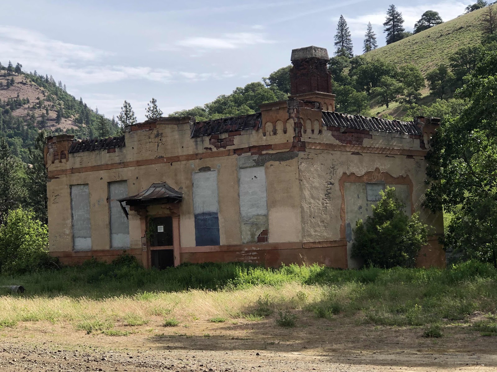
The remaining structure.
The reason the building has not been demolished.

Still some machinery inside.
We rolled out around 10:15. We had a bit of pavement before turning onto Schilling Road. The road turned to gravel right away, and started what would be about 9 miles of mostly climbing before dropping down to Centerville Hwy. We climbed our way up to High Prairie on a good gravel road. Although this is what I planned when I reversed the Swale Canyon/Shilling Rd loop, I had moments of regret as we were climbing up 14% grades. At least we didn’t have all our gear.

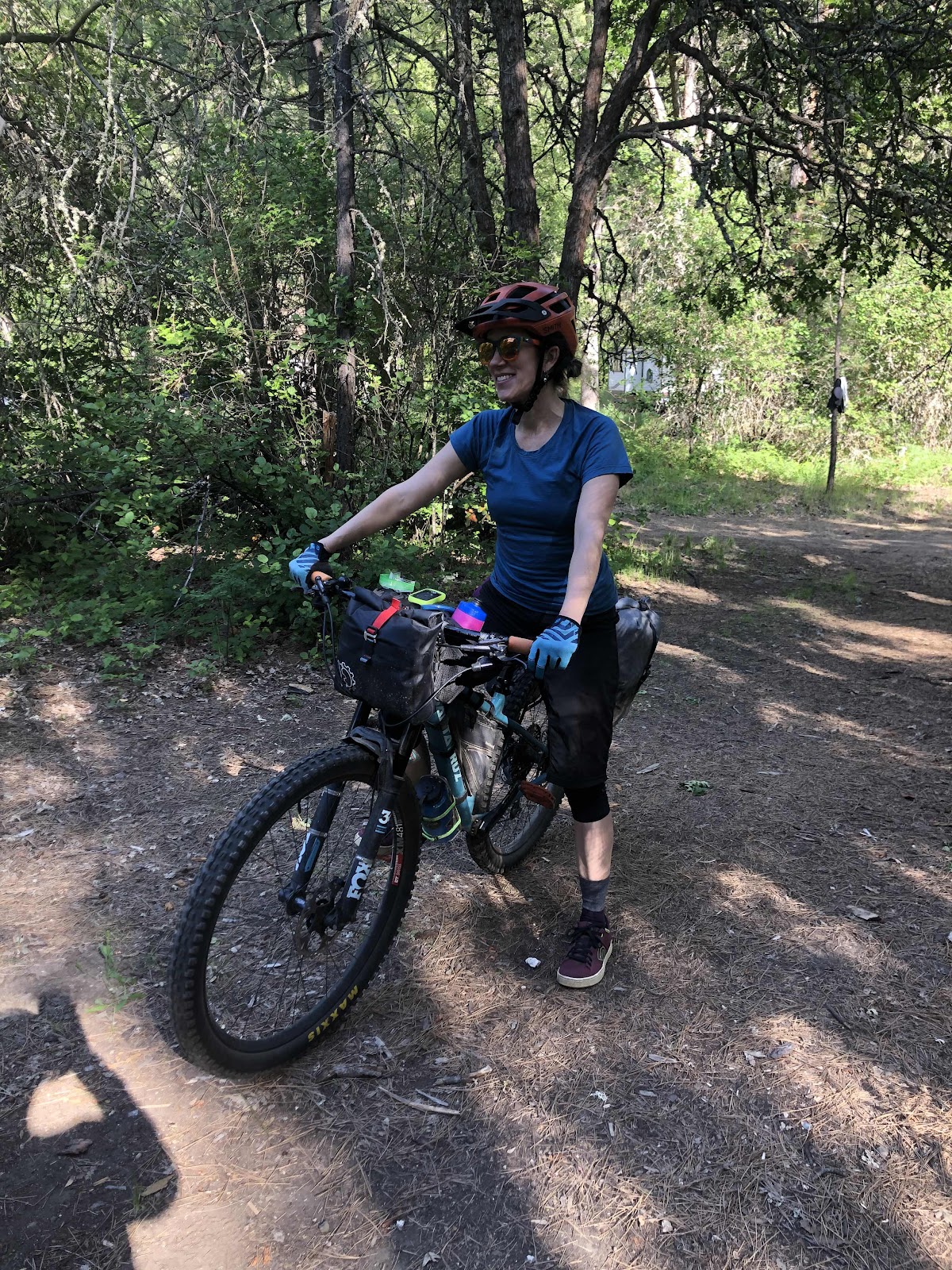
Jana fixing her squeaky brake.

Looking down into Swale Canyon. We would be down there later.

Going up up up…

Still going up, but now getting to the High Prairie.
I have friends who have a house at High Prairie. Their middle son was at the house this weekend with his wife, and some friends. We stopped by for a glass of water and to say hi.

Could have taken a better photo…
We had another 3 1/2 miles of Schilling Rd and just a half mile until we were back on pavement.

Prairie scenes.

Mt. Adams.


Arrowleaf balsam root and lupine

Mt. Hood in the distance.

We would be heading toward that dry grazing land in the distance.
We had a nice descent down to Centerville Hwy. Just before the descent would end up being the high point of the day. Four miles on Centerville to Harms Rd was a mostly downhill run. Then we made the turn onto Harms to go less than half a mile to the other end of the Klickitat Trail.

Swale Creek

Even a potty shack at the end of the trail.

We sat and had our lunch. It was a windy, and a headwind at that, but the remainder of the ride…the Swale Canyon part, would be all downhill.
Until we got into the actual canyon, I was once again questioning my decision to reverse this loop. But then I thought it would have been a wash. Going uphill with a tailwind vs downhill with a headwind. But once we got into the canyon, the wind died down, and the downhill got steeper. Reversing had still been a good idea. The Canyon part was beautiful.


There were patches of loose chunky gravel, as well as bumpy bigger rock moments. But, it was a double track the entire time, and like I said, downhill. When we were in amongst more vegetation it was a little buggy. Mostly flies. I used my buff to prevent ingesting extra protein.
It was 13 miles of Klickitat Trail back to Schilling Rd. Once we reached Schilling, we had completed the loop, and just had slightly over a mile back to the campground.
Our belongings were as we had left them. It was 2:30. The loop was a little over 28 miles and 2098 feet of elevation. It was a good day for a bike ride.
The third member of our Adventure Posse arrived about 5:30ish. I actually saw her go by on the road above, but she missed the turn. Soon she was back.
Woo Hoo! Stephanie made it!

And then we were three tents (Jana’s is behind Steph’s).
We also saw two other women ride in. They too had come from Lyle. They are Rhonda and Shawna. Both are relatively new to bikepacking. They asked about the Swale Canyon part. I think we convinced them it was worth doing. Shawna just ordered a new Priority ADX! We exchanged contact info. Maybe we will do some bikepacking together in the future!
The mosquitoes are out tonight (no wind), so we have retired a bit earlier to our tents. Tomorrow we ride the other loop back to Lyle.
No comments:
Post a Comment