Saturday, December 5, 2020

DIY GP Holiday Edition-A Ride Rating Fairly High on the Epicness Scale

Here we are 5 days into the month of December and the weather has been amazing! Sunshine and blue skies nearly everyday. 

Route-master Tim, of Joy Ride Gravelpalooza fame, put out a DIY Holiday Edition Gravelpalooza route (its what we can do during the COVID crisis). The route gets posted on Joy Ride’s website (and various other Social media sites) as a Ride With GPS file. It’s up to individual riders, or small groups to decide when they want to do the route. The Holiday Edition route was not an easy one. At first glance, the mileage was pretty high at 42.2 miles. Fortunately, the overall elevation was slightly below the “Golden Ratio” (1000 ft/10 miles) at 3924.8ft. There would be some pretty punchy and short climbs as well as one seriously punchy and long climb. And, all of this was on a road none of us has ever ridden before. 

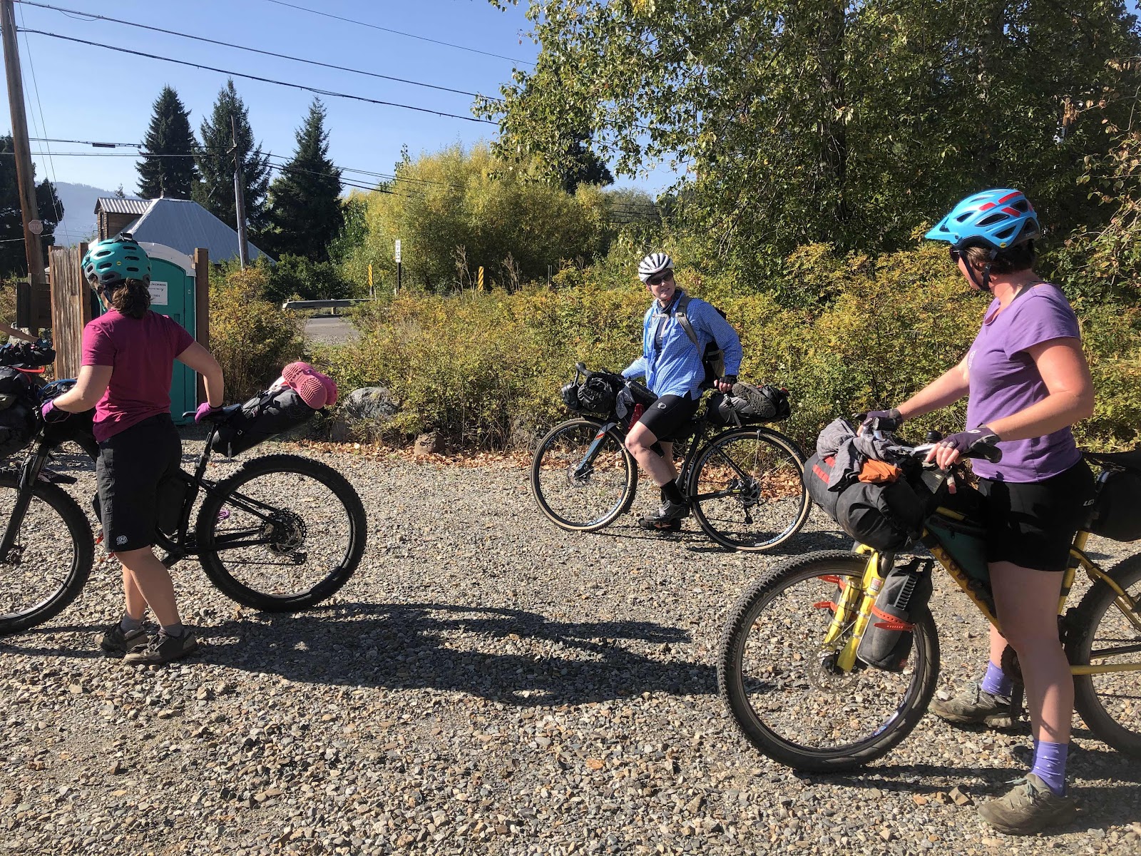
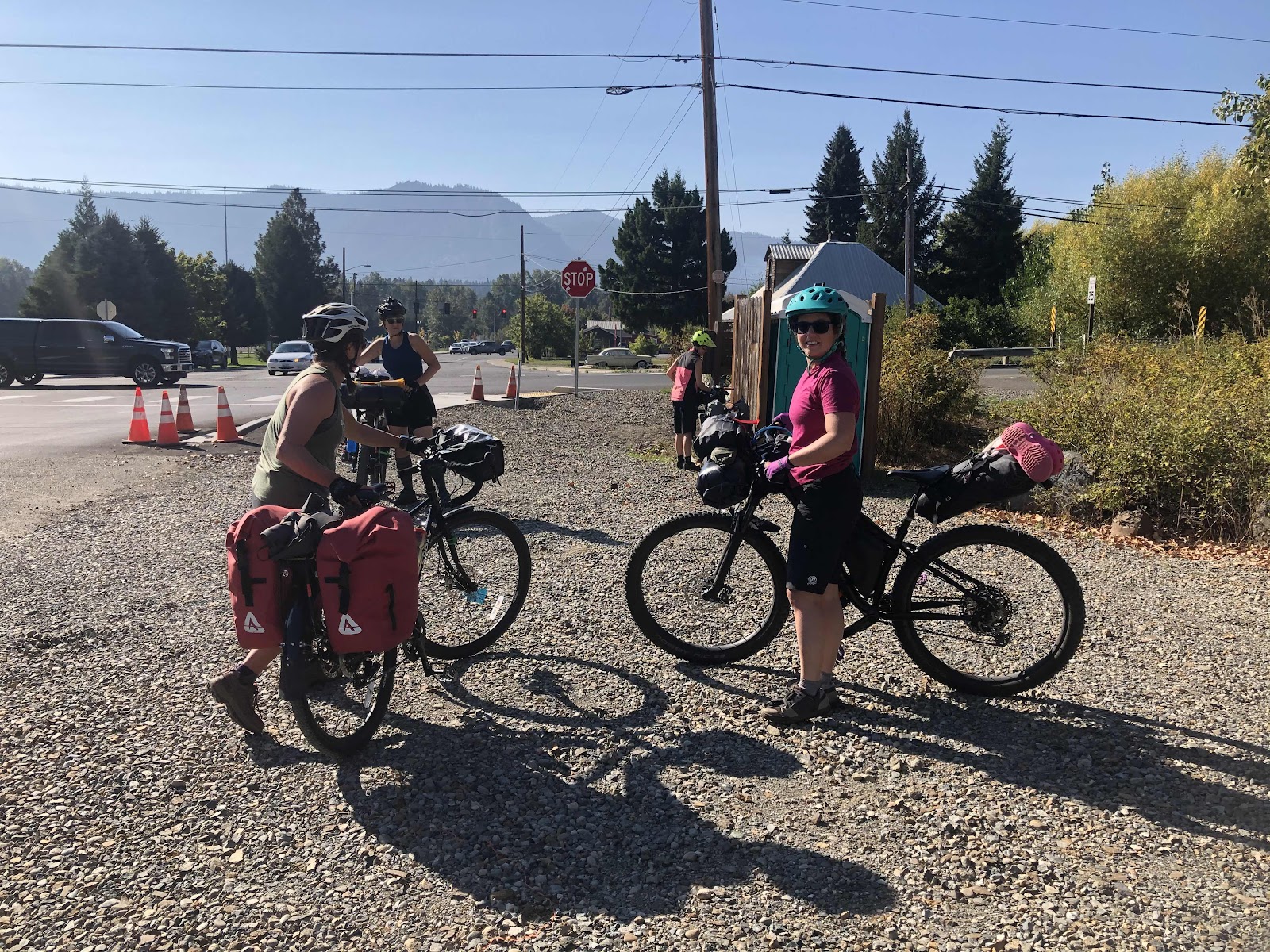
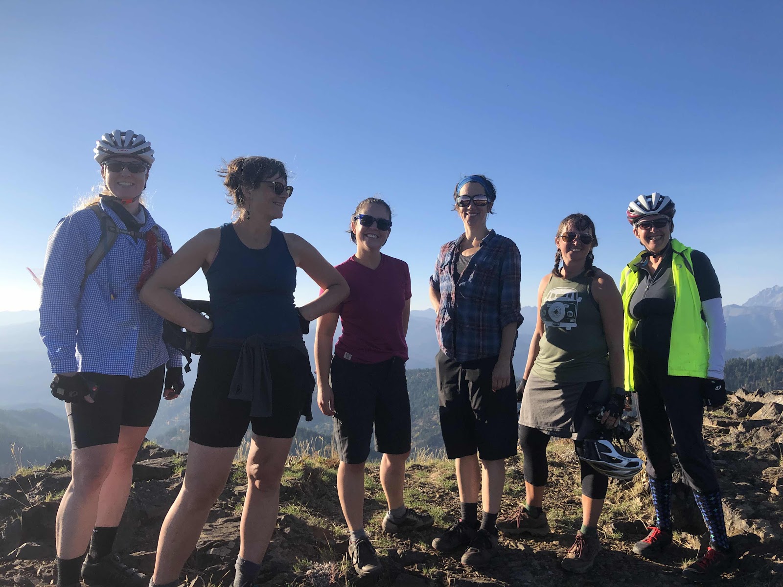
We met at the Mima Falls Trailhead Parking. It’s a good thing the route didn’t start on the Mima Falls Trail because there was a huge group of hikers just starting out. It made our group of 6 look very small. The brave souls that agreed to this epic route were Bethany, Curtis, Linda, Renee, Stephanie, and me. If successful, this would be Renee’s longest ride (and probably most elevation gain). I told her, if she was able to complete the route, she would set new parameters as to what she was capable of doing. 

As we were heading out of the parking, we saw Sarah coming up the hill. She ended up riding with us for the first 6 miles or so. But, as she was not prepared to ride 42 miles, we said goodbye at the top of the D Line. 

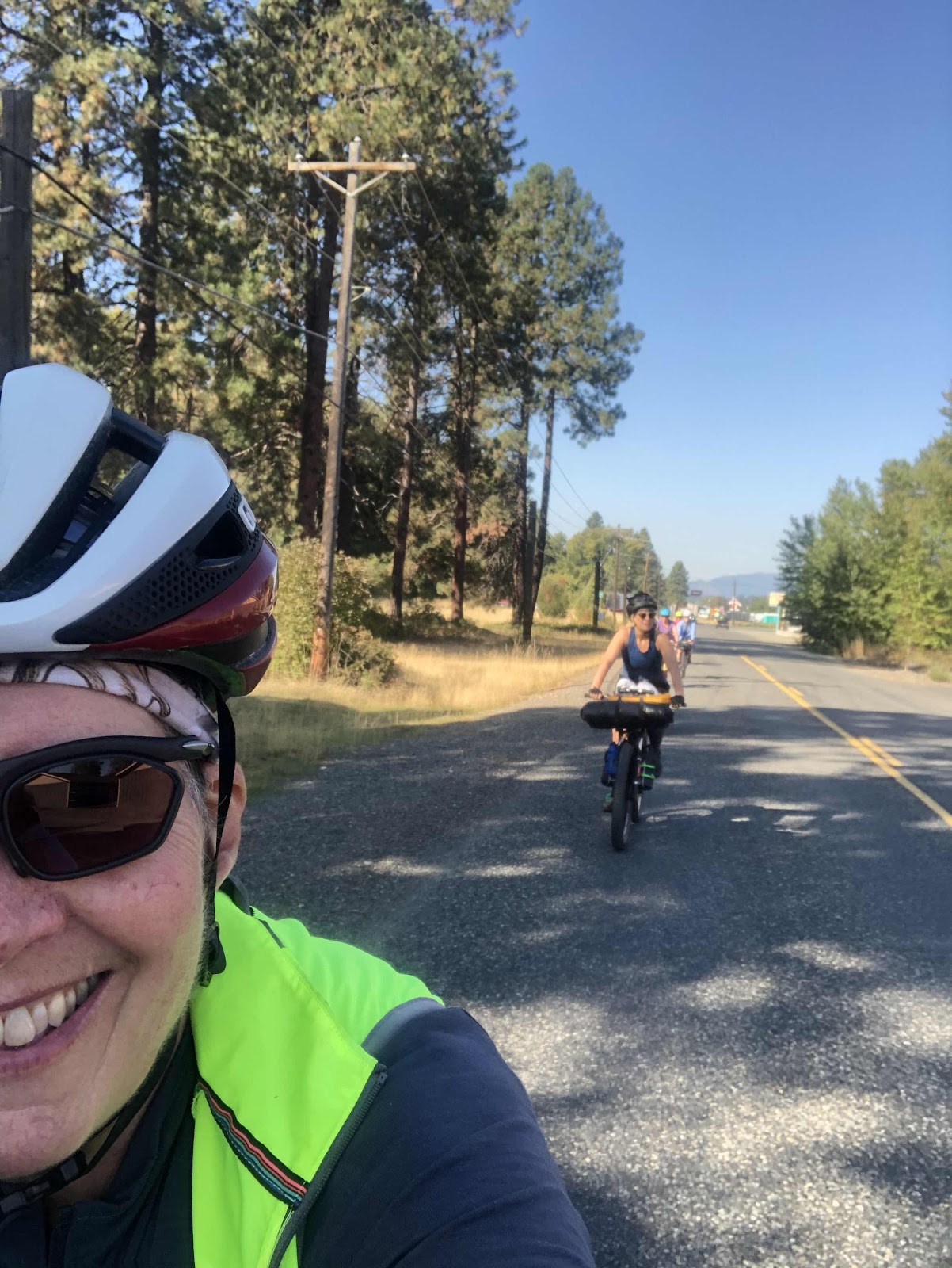
The better part of the first 16 miles were on paved roads, and a good chunk was downhill. This is what made 42 miles seem doable on a sunny December day. 

Once we did a short stint on Hwy 12, the road back into the forest began with a shortish punchy climb. This road was called the DC Line. There was a gate off Hwy 12, and another gate later on that meant no cars (especially on a Saturday when there is no logging). We were to gain over 2000ft of elevation over the next 10+ miles (as you can tell, a bit over the “Golden Ratio”). 

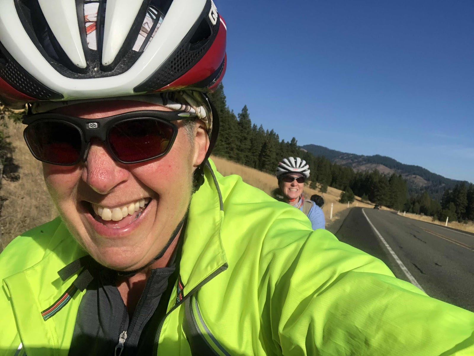
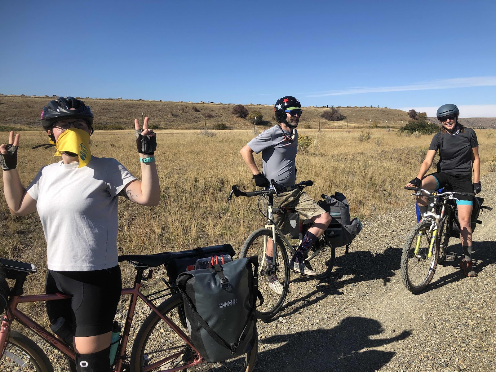
Curtis, Linda, and Stephanie 

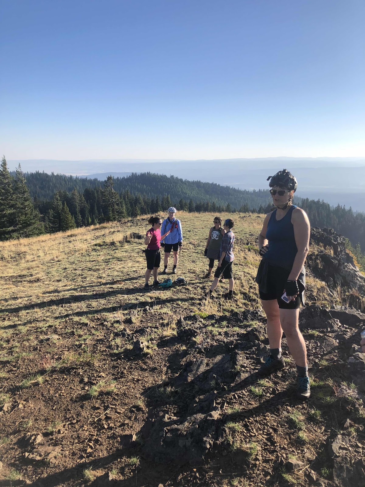
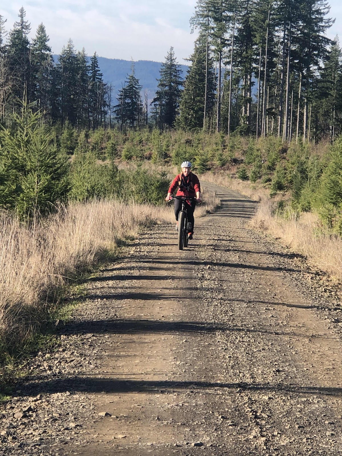
Renee making her way up. 

Bethany on MC. 

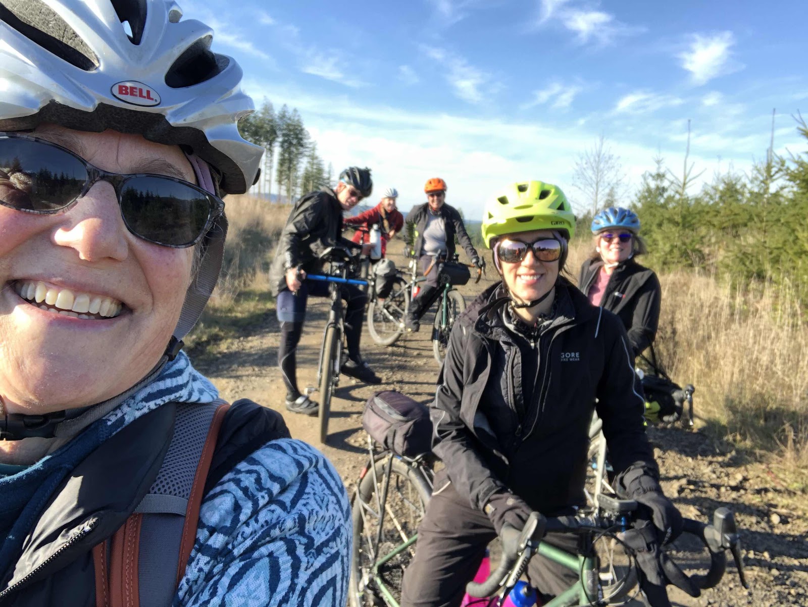
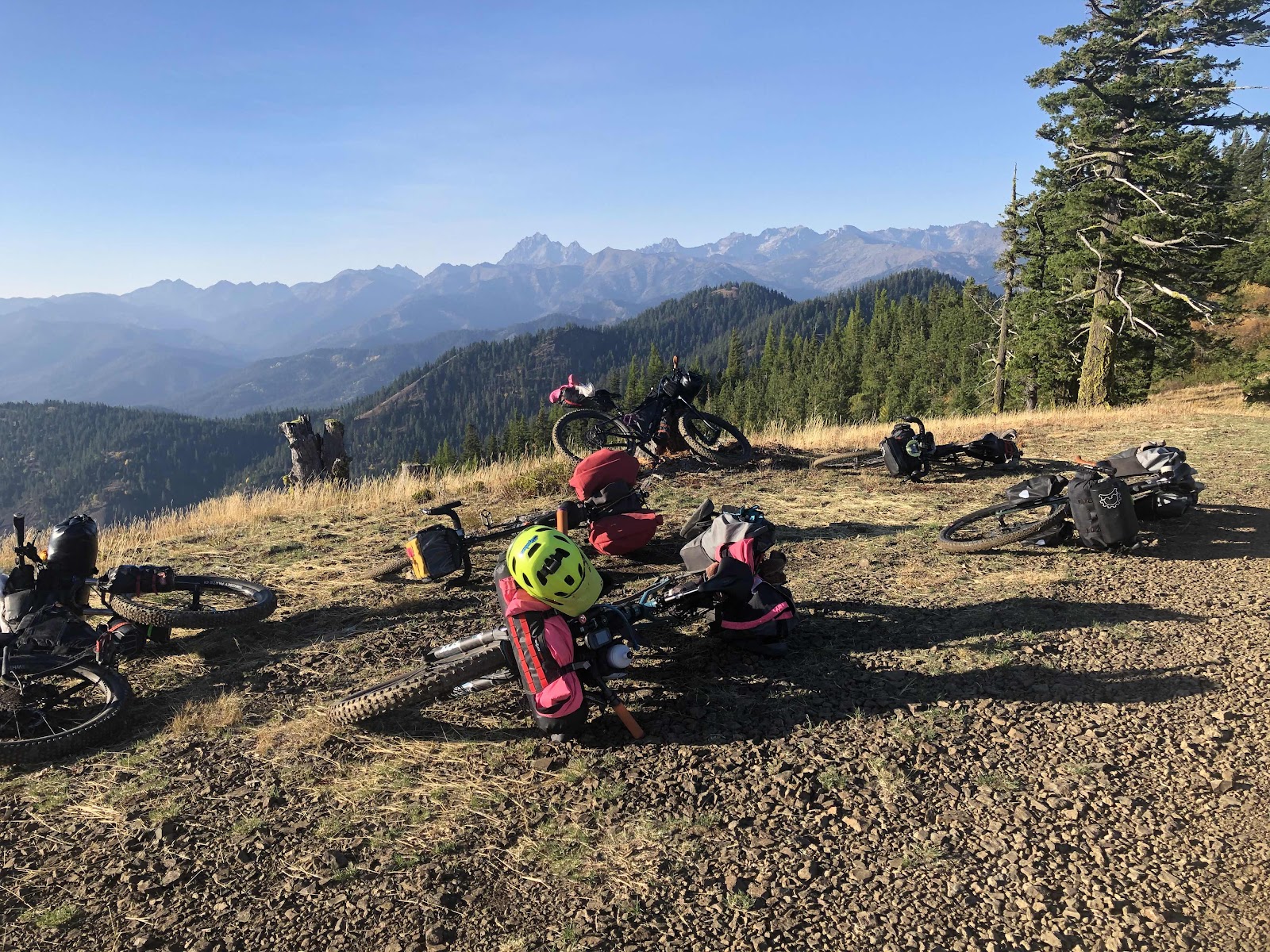
Group shot by Linda! 

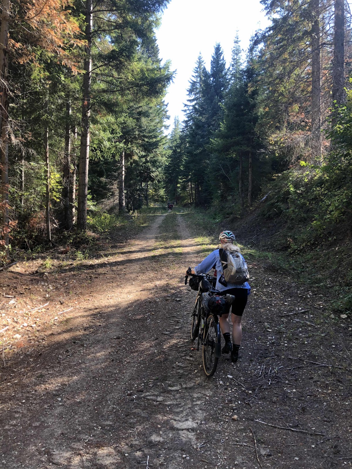
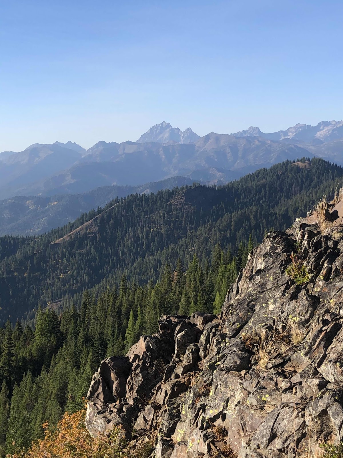
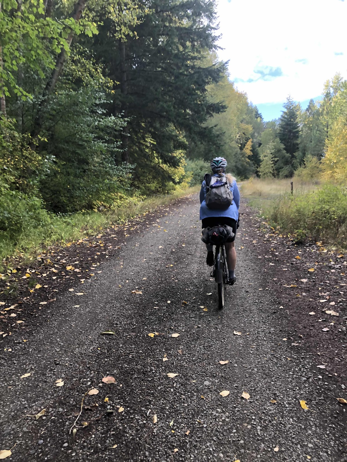
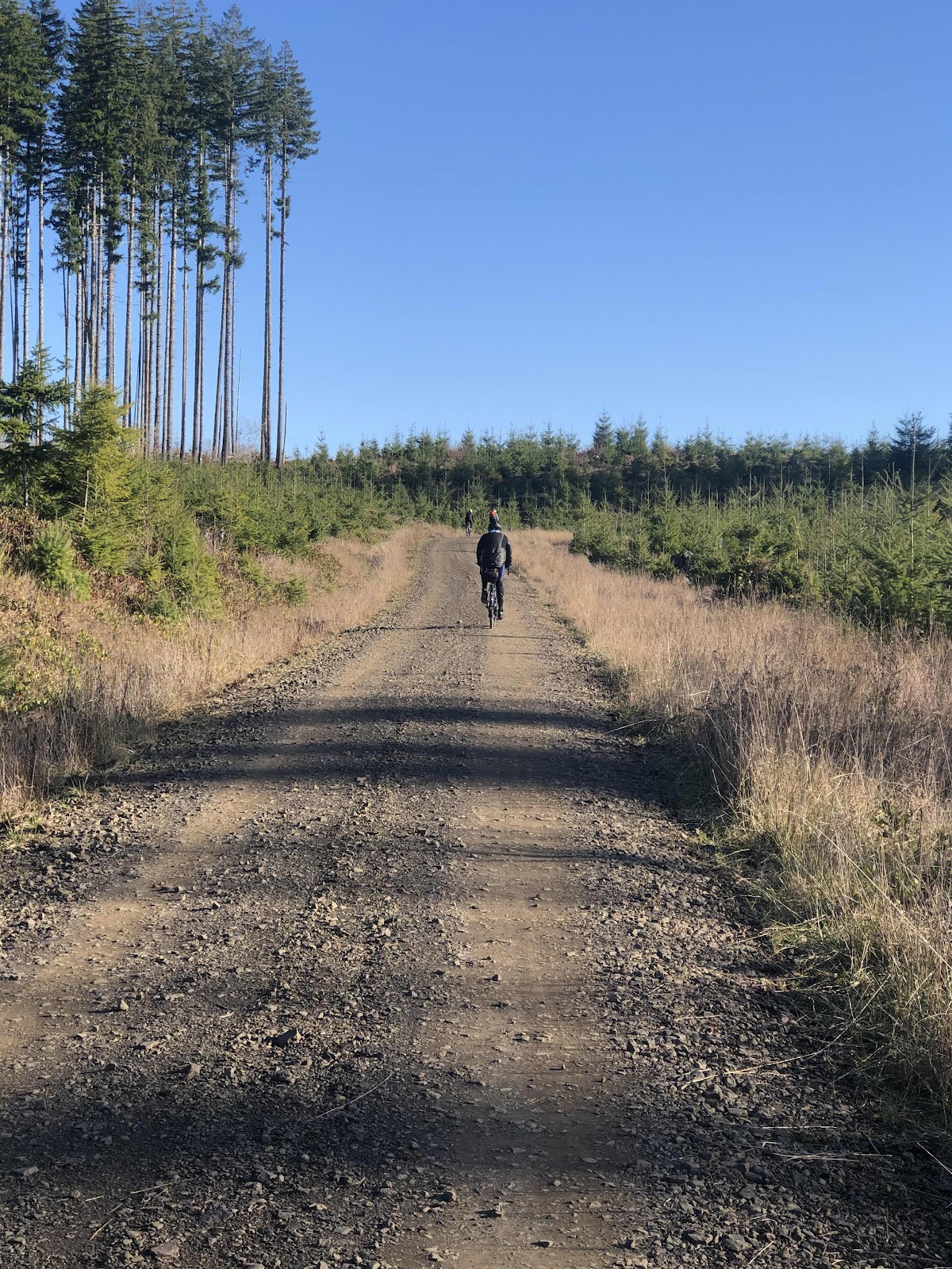
We continued working our way along the DC Line. It leveled out for awhile, but then we came to this point. 

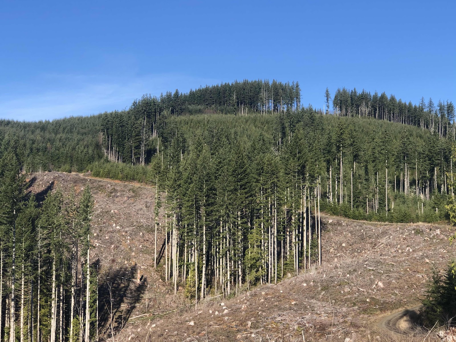
Oh my...that’s the road going up up up!

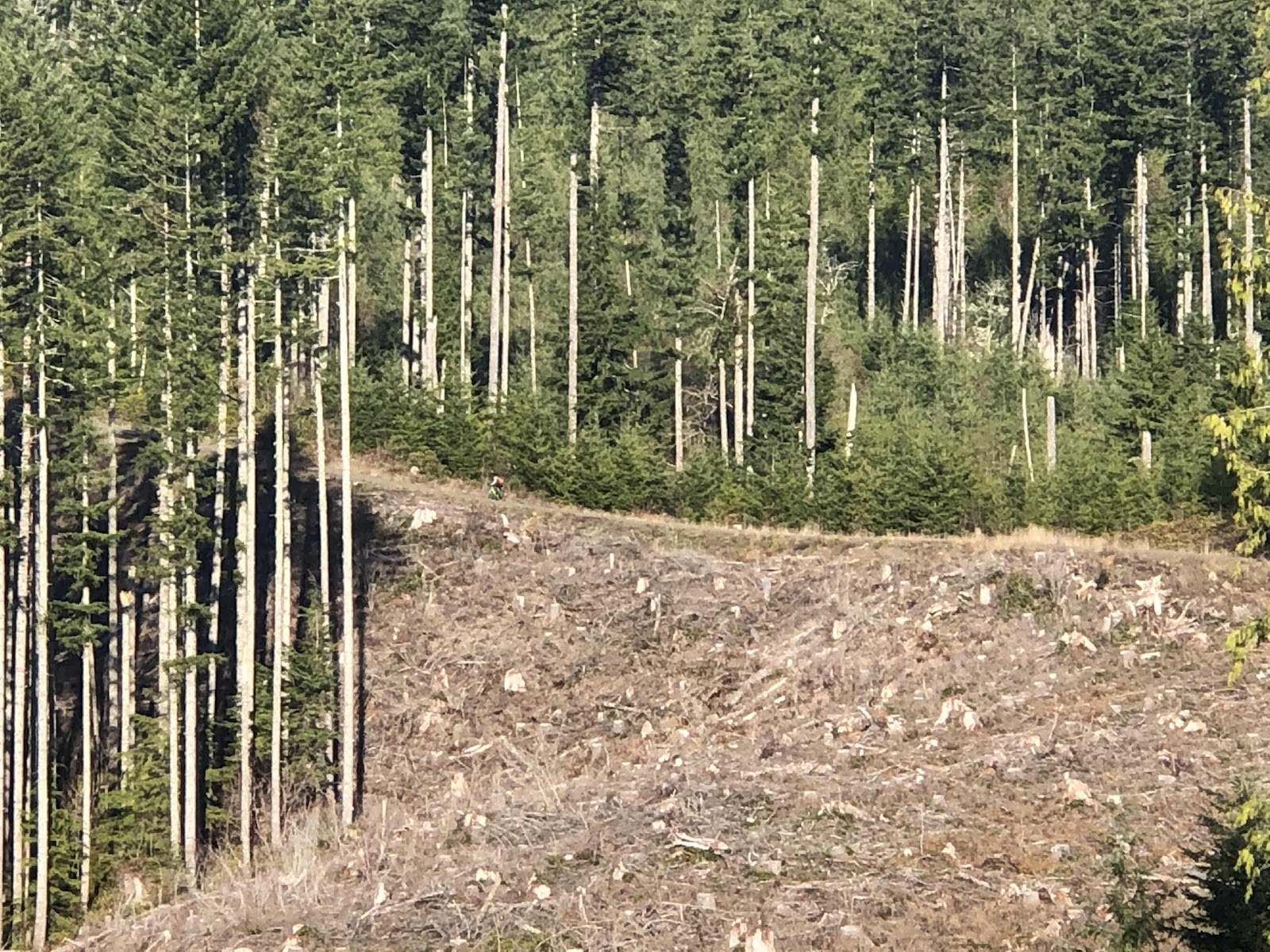
There’s Linda just to the right of the trees that are in the foreground. 

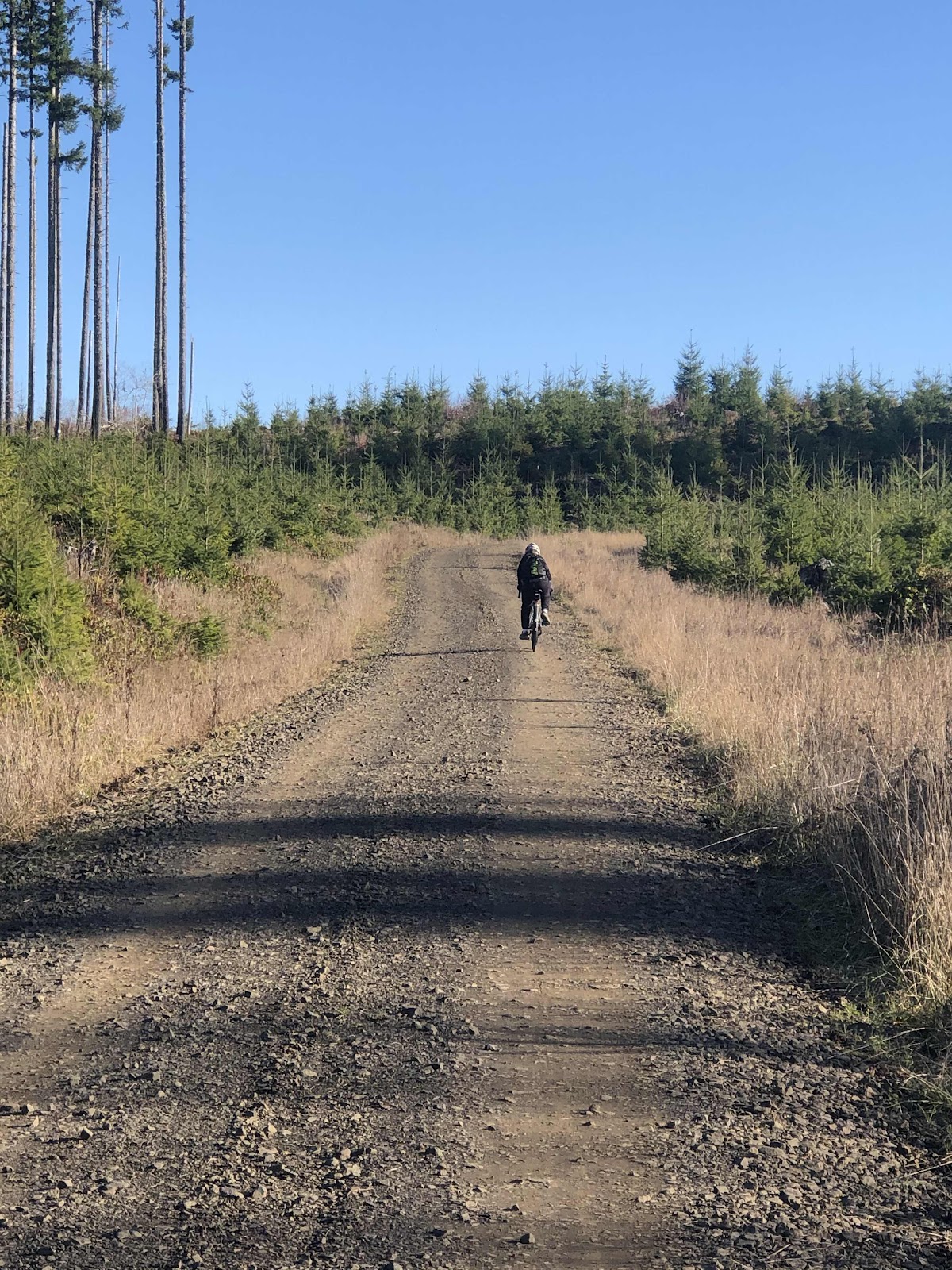
Needless to say, all of us, except Curtis, had to walk at some point. I managed to ride until it got too steep and too much loose rock. When I start popping wheelies, it’s time to walk! We all made it though. 

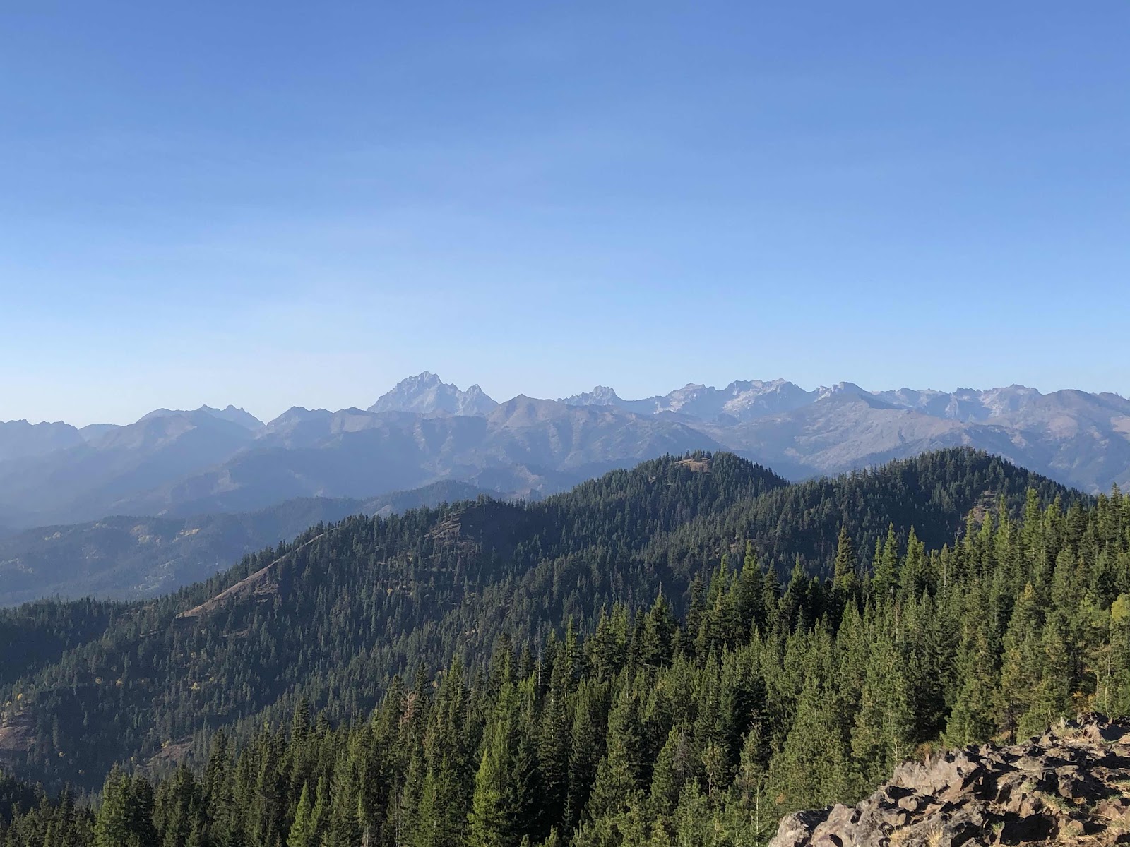
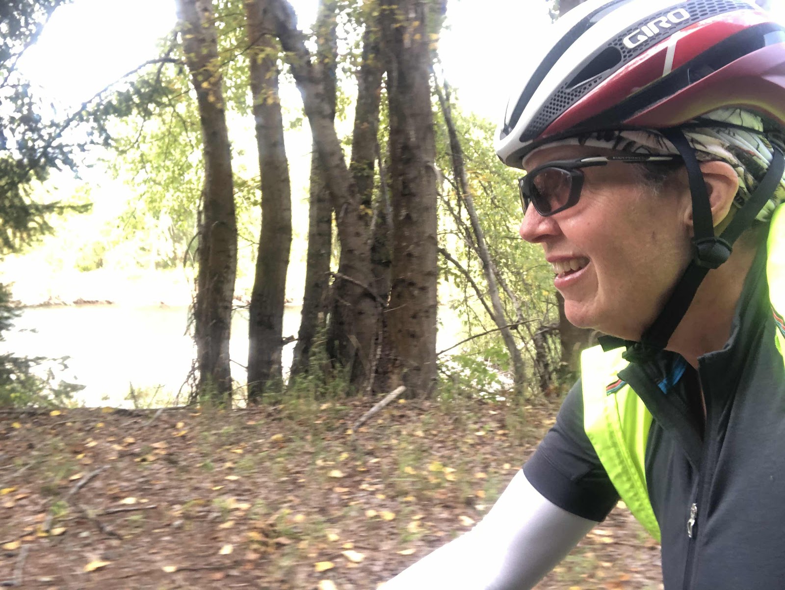
The route took a turn that would lead to some singletrack on the Porter Tie Trail. Or...we could just go up the C Line. The route would be coming back into the C Line anyway, and it cut off some mileage. We opted to take the C Line. It may have been more elevation...we’ll never know (unless we do the route again...). Before getting to the top of the C Line, we got a pretty awesome view of the big three...Rainier, Adams, and St. Helens. 

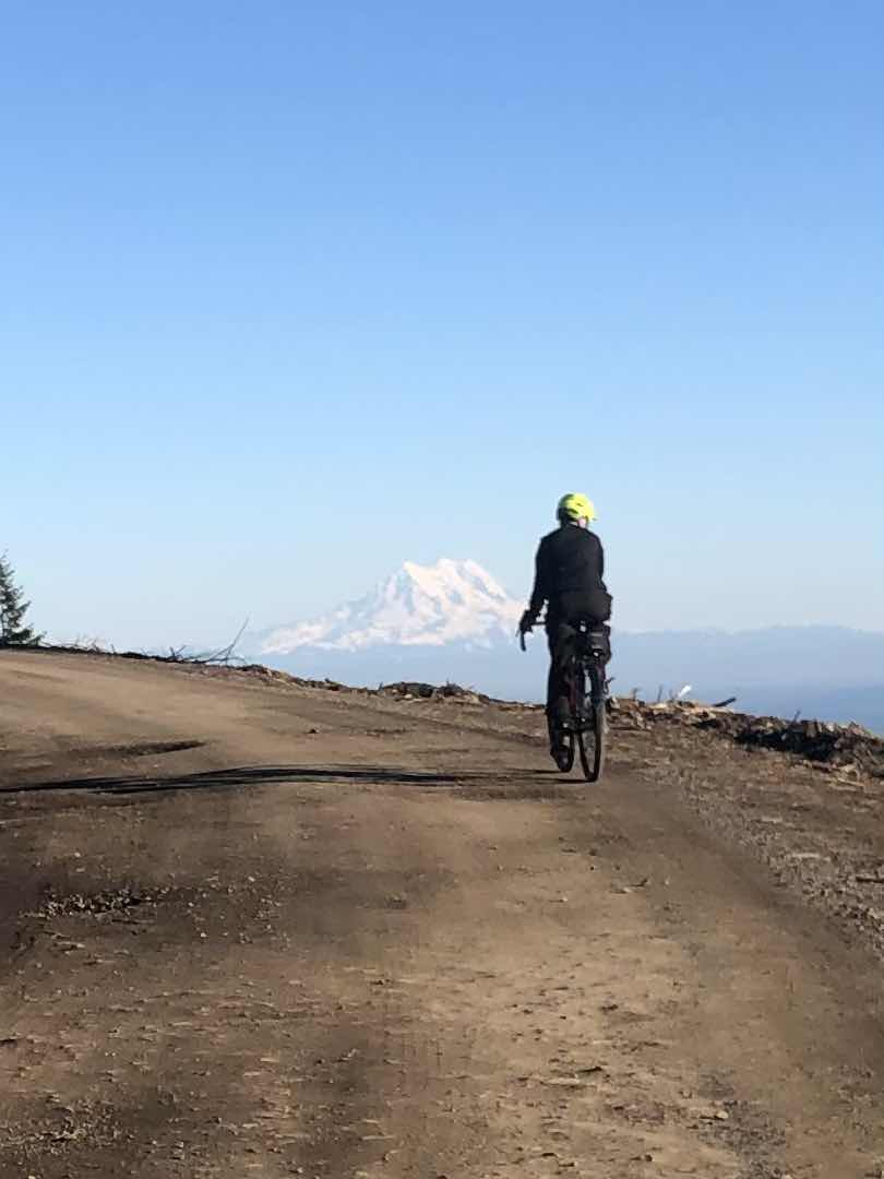
Steph, and Rainier! This is another view recently made possible by logging. 

From the top of the C Line we had a miles long descent to Sherman Valley. It’s more often that I climb UP the C Line. It’s a blast to fly down!

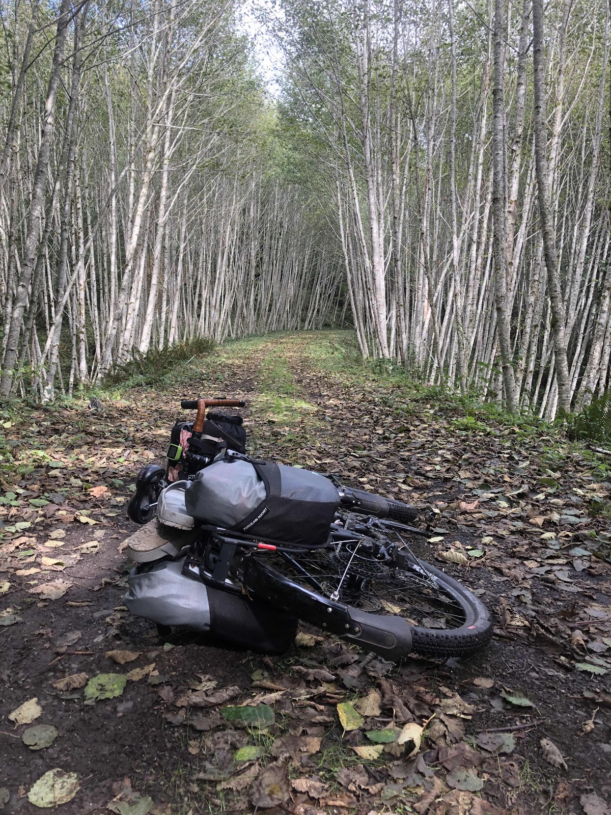
Once on Waddell, we had a little jaunt on the Al Davis Trail which served to remind me that 1) I am not a mountain biker, and 2) I don’t like riding puddle-filled singletrack (even if it is flat and “easy”). But, wait, there was more singletrack to come. The McKenny Trail involved a nice walk up a steep hill. Fortunately, the trail portion was just .5 miles. 

Once back on the “E” roads (9500, 9000), it wasn’t much further back to the cars. The route would have had us following E9000 to Bordeaux Rd, and back via the road, and the way we came, but in my mind, that was just gratuitous road miles, so we took the Mima Falls Trail straight back to the parking lot. 

We ended up doing 37.4 miles (with our little short cuts), and 3622ft of elevation gain. And...we finished before it got dark! Everyone did a magnificent job today. It was an epic ride for a December day, even if it was fantastic weather!


Sunday, October 4, 2020

The Bikepacking Overnight Where Everyone Had Fun Doing Hard Things

Day 1-And So It’s Been Said, We Can Do Hard Things

To back up to the day before...Bethany and I met Stephanie and Katie in Cle Elem Friday night at Eagle Valley Campground. We decided it would be better than having to leave Olympia early Saturday morning to get to Roslyn by 10:00. Steph and Katie slept in Steph’s van, Bethany slept in her car, and I slept in my tent. Since the campground charges by the tent, we only had to pay $14! 

Saturday morning we leisurely packed up and got over to Roslyn before 10:00. Amy, Jana, and Bebeth were already there, and preparing the bikes. As for the bikes, if one were to draw a Venn Diagram of the bikes we were riding, one circle would be made up of hard tail mountain bikes, one would be gravel bikes, and where the circles overlap would be my bike, Sly. Sly, with his drop handlebar and no suspension falls into the gravel circle, but his wider tires and easier gearing put him slightly into the mountain bike circle too. 

Bethany’s and my bikes. 

Katie and Amy ready to go. 

We headed out on the Coal Mines Trail. This trail runs from Roslyn to Cle Elem. We were on it for 3 miles. 

Coal Mines Trail downhill all the way to Cle Elem. 

Step one complete! Welcome to Cle Elem. 


I think there was more to the trail than we did. 

In Cle Elem, we worked our way through town, and out into the Teanaway Valley. We were on pavement for the next 21 miles. 

Nice quiet backroads. 

When we reached the beginning of the gravel, it was time for some lunch. After lunch, Amy decided to continue to a later part of the route (it was a figure 8), and work her way back. 

On the gravel, we began with some general flat to easy climbing. 

Stephanie, Bebeth, Jana, Katie (right in front of Jana), and Bethany (in the right track).

Steph warned us there was some climbing coming up that had some pretty “punchy” bits (short and steep). At one point, we were all working hard when Steph informed us this was not the punchy part!


This was a punchy part. Time to walk! 

As Amy and Jana have said, we can do hard things! And, it was hard, but we all managed to make it, riding when we could, and walking when our legs couldn’t make the pedals go around. 

We finally reached the high point of the route (4900 ft). Katie got the wild idea to ride up a side road to see if there was a view. Eventually, we all rode up. Well...you could say there was a view!

The Stewart Range

Mt. Stewart is the tall one (I think).

Definitely worth the ride up the side road. 

Here’s six women who do hard things for fun!

And...their trusty steeds!

With the day marching on, we headed down the four mile long descent to where we hoped to camp. Unfortunately, there was no place that had both tent spots and water. At the intersection where the route turned and began to climb again, there was neither camping opportunities nor water. As the sun was heading down, we decided to head down toward Hwy 97, and Mineral Springs campground, which was 2.8 more miles, but for sure camping and water (the campground was closed, but we would stay there anyway). On the descent down, we kept an eye out for a possible place to camp. Nothing was panning out. We decided to just get to Mineral Springs before it got dark. 

We lifted our bikes over the gate at Mineral Springs (no easy feat), and found ourselves some campsites. Tents up, dinners cooked and eaten, and we called it a night. We rode 36.7 miles with 3258ft of elevation gain. Yes, indeed, we can do hard things!

Day 2-Where Bethany and I Take an Alternate Route Back

It sure got cold last night! We all started rolling out of our tents around 7:00. Since I have camped at Mineral Springs before (this was the third time), and had ridden from there to Cle Elem via the Palouse to Cascades Trail (formerly known as the Ironhorse or John Wayne Trail), I proposed that, as an alternate to climbing back up to the planned route (which Amy had told us had some sandy parts and singletrack, in addition to the climbing), we could ride down 97, then up and over the ridge to the Palouse to Cascades Trail, and back to Cle Elem, then to Roslyn on the Coal Mines Trail.  Jana, Katie, and Stephanie with their mountain bikes opted to return to the route. Bebeth was not sure, but in the morning decided to also return to the route (brave soul). That left Bethany and I. We decided to do the alternate. It was more miles, but not nearly as much elevation. Also, Bethany had never been on the Palouse to Cascades Trail. 

Bethany and I began our day with a 6.5 mile descent. Since we were still mostly in the shade, and it was still chilly, we rode with our puffy jackets and multiple buffs. As soon as we made the turn to head up and over the ridge toward Ellensburg, we stripped off the puffy jackets and extra buffs. 

Heading up in the warmth of the sun!

Every time I’ve been by this barn, I’ve taken a photo. 

The previous two times I’ve ridden this way, I’ve stayed on Hwy 97 all the way to the top, and down the other side. Today, when we had gone part way up, Ride With GPS had us turning onto Bettas Rd. At first we were just going to continue on 97, but then we decided to follow RWGPS and take Bettas Rd. It turned out to be an awesome choice! The road was quiet, and went through a valley before a short climb back to the other side of the climb on 97.

A nice ride down through the valley. 

Just 8 more miles, all down, on 97, and we came to the trail. 

Palouse to Cascades Trail

Now for the gravel portion of the day’s ride. 

Not only were we riding the majority of the next 28 miles on gravel, but we also got to ride with a rather strong headwind! They don’t have all those wind turbines over there because the wind doesn’t blow! We told ourselves it was still faster than climbing. 

We met a group of three also out for the weekend. They were headed to Ellensburg. 

Emily, Craig (or Greg? It was pretty windy), and Ryan had a wonderful tailwind!

We pushed on through the wind, and took a break at the Thorp Fruitstand. Bethany decided she needed to come back when she could buy stuff that she could carry. As it was, we just bought a few snacks. 

Back on the trail, we arrived at the first of the two Thorp Tunnels. 

Tunnel 46

This tunnel is the shorter of the two. You can see the other end, once inside the tunnel. No headlight required. 

Near the second tunnel, we stopped at a picnic table for some lunch, then headed through Tunnel 47.


This tunnel is longer and darker. Fortunately, Bethany had a headlight, and I followed her. 

We continued riding along the Yakima River. It was very nice, even with the wind. 


That’s not a slip-and-slide!

One of the camping spots on the trail (used to be $6, now it’s  $12!). 

Going through a greener part of the trail. 

Not that you can tell, but the river is there. 

We were both getting pretty tired, and ready to be off the bikes. The wind was relentless until we got off the trail in South Cle Elem. Then it was a short ride back over to the Coal Mines Trail. Of course, what we had ridden down yesterday, we now had to ride back up. Sheesh, that seemed like more than 3 miles going back! We arrived back to the car at 3:00. Steph’s van was still there, so we knew they weren’t back yet. By 3:30, we were packed up and ready to head home. 

We found out when we were almost home that Jana, Katie, and Steph had quite the adventure of their own (involving some bushwhacking to find the singletrack). Bebeth had, wisely, taken the paved road before the singletrack. Bethany and I were very glad we had opted for the alternate route! Today was a hearty 46.8 miles with a less than hearty 1237ft of elevation gain. 

Overall, the weekend was a resounding success! Everyone fulfilled their desired riding experiences, and most of all, had fun doing hard things!


Sunday, September 20, 2020

A Bike Overnight on The Willapa Hills Trail With Jana

Day 1-Green Means Go!

Jana has put out an email asking if anyone wanted to do the Willapa Hills Trail to Bruceport County Park as a bike overnight. Of course, I said yes, even though my longest ride since returning from the Appalachian Trail had been 25 miles (and that was on pavement). From Chehalis to Bruceport, it would be 63 miles, with the final 10 or 11 miles on pavement (trail and road). Understandably, I was a wee bit concerned about the distance. It’s pretty flat, but still...I was back to zero in my bikey fitness level. When I mentioned to Jana about possibly going Friday afternoon, as far as Rainbow Falls State Park, thus shortening the ride on Saturday by 15 miles, Jana said she was unable to go Friday, but we could just park at Rainbow Falls on Saturday. I thought that was a perfect solution.  

There was just one problem. The air quality from all the smoke was really bad. It was considered hazardous to be outside. Since bikepacking should not equate with smoking several packs of cigarettes, we decided we would only go if the AQI was at least in the yellow “moderate” zone. We would make the final decision Friday afternoon for a Saturday morning departure. 

Friday arrived, and the smoke forecast was looking good! The AQI would be in the green zone! Finally! We were a GO!

Jana picked up me and Sly, and we headed for Rainbow Falls State Park. We were on the Willapa Hills Trail by 8:45. 

Jana getting her new Salsa Timberjack ready. 

It was kind of misty raining, so not long into the ride I switched into my rain gear (my Gore Shake Dry jacket and hat and my rain shorts). Of course, as soon as I did that, it stopped raining. 

Jana had the unfortunate luck to ride through some dog shit. Even more unfortunate was that she didn’t realize it until she went to grab her water bottle that was on the underside of the down tube. Yep, dog shit on the bottle, which got dog shit on her gloves. Disgusting!

We stopped at the trailhead in Pe Ell where Jana was able to wash her bottle and her gloves. 

A post water bottle and glove washing photo. 

The rain alternated with bits of sun as we continued our way along the trail. 

Going through these birch trees was pretty awesome. 

After the detour on Robertson Rd, we stopped for some lunch (it wasn’t raining at that moment). I was beginning to notice a bit of fatigue in my quads at about that time (25 miles in). I did some stretching. Surprisingly, neither my butt or my neck were bothering me. 

As we made our way ever closer to Raymond, my quads were beginning to complain a bit more. We stopped and took a break at the Menlo Store where I got a bottle of Gatorade AND a Dr. Pepper (electrolytes and caffeine). The clerk at the store said there were free donuts that a woman had brought in for the customers today. I had a maple bar, and it was delicious!

Rested and refueled, we returned to the trail. The section from Menlo is not the best, although the blackberry vines weren’t too bad, there were still quite a few. We stayed on the trail except for a small section where the trail is being eroded by the river. For that we just diverted out to the highway, then got back on after the barriers. It was still fairly rough trail with creeping berry vines here and there. That, and the fact that my quads were back to burning (but at least no smoke!), had me slowing down a bit. I was looking forward to getting to the paved section into Raymond. 

I caught up to Jana at the city park in Raymond. It was 2:00, and the little Public Market and Carriage Museum were open. We took a break, and had a look around the market. We opted not to go into the museum. 

The Willapa Hills Trail continues south, and ends in South Bend. It is roughly 10 miles from Raymond to Bruceport County Park. The break in Raymond allowed my quads to stop burning for awhile, but I was definitely getting tired. It gave me a greater understanding of what it’s like to do a lot of miles with not enough fitness! But, I would make it. 

We made another quick stop on the other end of South Bend to check out the World’s Largest Oyster. South Bend is “The Oyster Capital of the World”...so they say. 

It’s made of concrete. 

The last three miles to Bruceport included the only real hill of the day. Sadly, I had to employ my easiest gear to climb it (it’s not that steep of a hill). I was more than ready to be done, and really glad we had parked at Rainbow Falls. I’m not sure I could have done the additional 15 miles. 

Since it was still raining, the camp host let us stay in the group area with a large shelter. 

Nice to be under cover!

Day 2-There’s More Climbing Going East

I didn’t sleep great last night, but with all the hours in my tent (we went into our tents at 7:45), I probably slept enough. I fully expected to be stiff and sore this morning, but with the magic of Ibuprofen, I felt pretty good...until I sat on the saddle. No amount of ibuprofen could have made that better. Once things warmed up it was okay (well...not really, but I pretended it was). 

The weather was much nicer today, so we were able to see what we couldn’t see in the rain yesterday along 101. 

We made it to the Menlo Store just before it opened, so we took a break, and waited. The people watching there is awesome. It is definitely the hub of the area (also the post office). One guy pulled up in his van, right in front of the door, and hollered out the window  In between hollering, he asked us where we were going. He finally said he always does this because he only has one leg, and he doesn’t want to get out of his van. Jana went into the store to tell the gal a guy was yelling for her from his van. The gal came out (apologized for forgetting that he does this), and took his order. There weren’t any sandwiches yet, so he only bought cigarettes and beer. Even at the Menlo Store they have curbside pickup (only there isn’t a curb...)!


One advantage to going east is that we did the more rough part of the trail first. A disadvantage is that there is 200 more feet of elevation gain. Normally, it wouldn’t really matter (like, it didn’t really matter for Jana), but in my current state of fitness, it was very noticeable. Sheesh! I was going slow! At least the trail was getting better. 

This stuff is good. 

Jana took some time in Frances to spruce up some graves in the cemetery while I continued my snail’s pace. We met back up at the worst of the two trestles yet to be resurfaced. 

Slow walk across, being careful of the rotten ties. 

As I came through the birch trees again, I just had to take one more photo. 

From henceforth, this shall be called Birch Alley (unless they are not birch trees, in which case it will be called what ever kind of tree it is...I’m not very good at tree identification).

We saw a few people out on the trail. There was one gentleman that Jana had seen two years ago! They spent some time catching up while I was catching up to Jana. 

We took a little break about a mile before Pe Ell for some late lunch. 

The view of the river from atop the trestle where we ate our lunch. Is it the Chehalis? Not sure. 

In Pe Ell, we stopped at the store because I wanted something to drink, and Jana wanted a salty snack for the drive home. A young guy drove up and parked at the store. This was his vehicle. 

I mean, why not take the tractor to the grocery store? I wonder if he brought his own bags???

The final push back to the car at Rainbow Falls had me singing this little ditty in my head (to the tune of the nursery rhyme My Hat it Has Three Corners).
My butt it is a hurtin’
A hurtin’ is my butt. 
And if it weren’t a hurtin’
Then that would be some luck!

At least my quads weren’t burning like yesterday (again, the magic of ibuprofen). 

Even though it was a stretch for my current fitness level, I really enjoyed the weekend. It is a great bikepacking overnight, and Jana was fun to ride with!