Thursday, July 29, 2021

An Awesome S24H With Rebekah (with special guest appearance by Florian)

I spent the last 24 hours doing one of my favorite things…taking a friend on their very first bikepacking trip!

Rebekah had been wanting to give it a go for awhile. The planets mostly aligned (Florian wasn’t able to go) for us to head out to Millersylvania State Park. Sure, it’s not that far from home, but that’s one thing that makes it excellent for a first trip…no crazy logistics. 

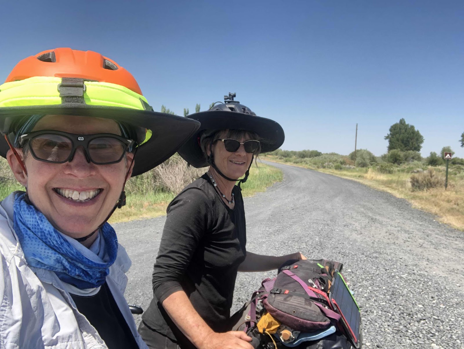
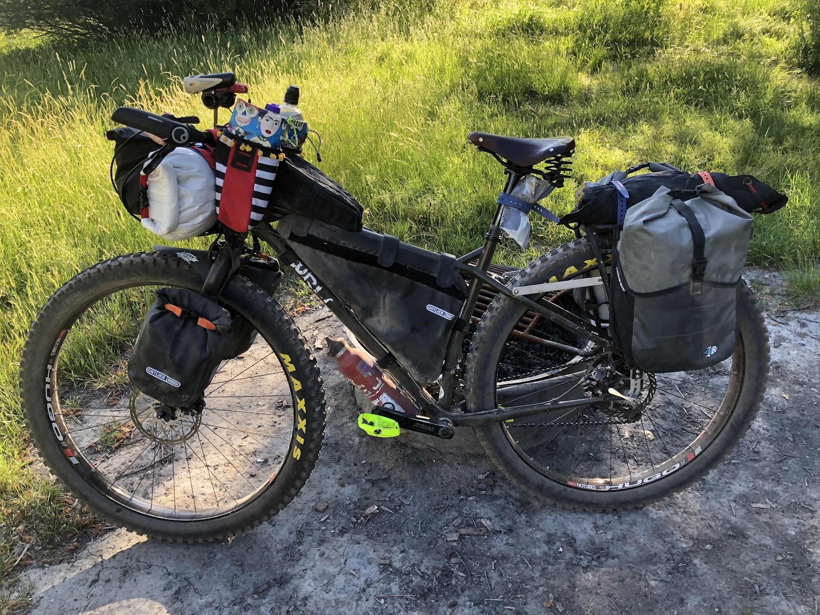
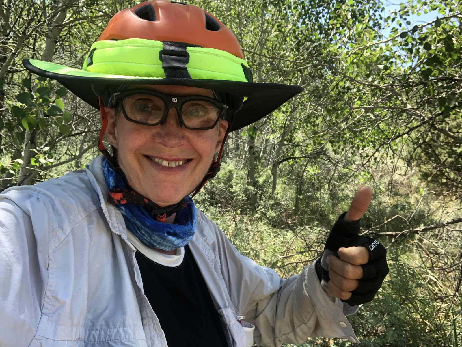
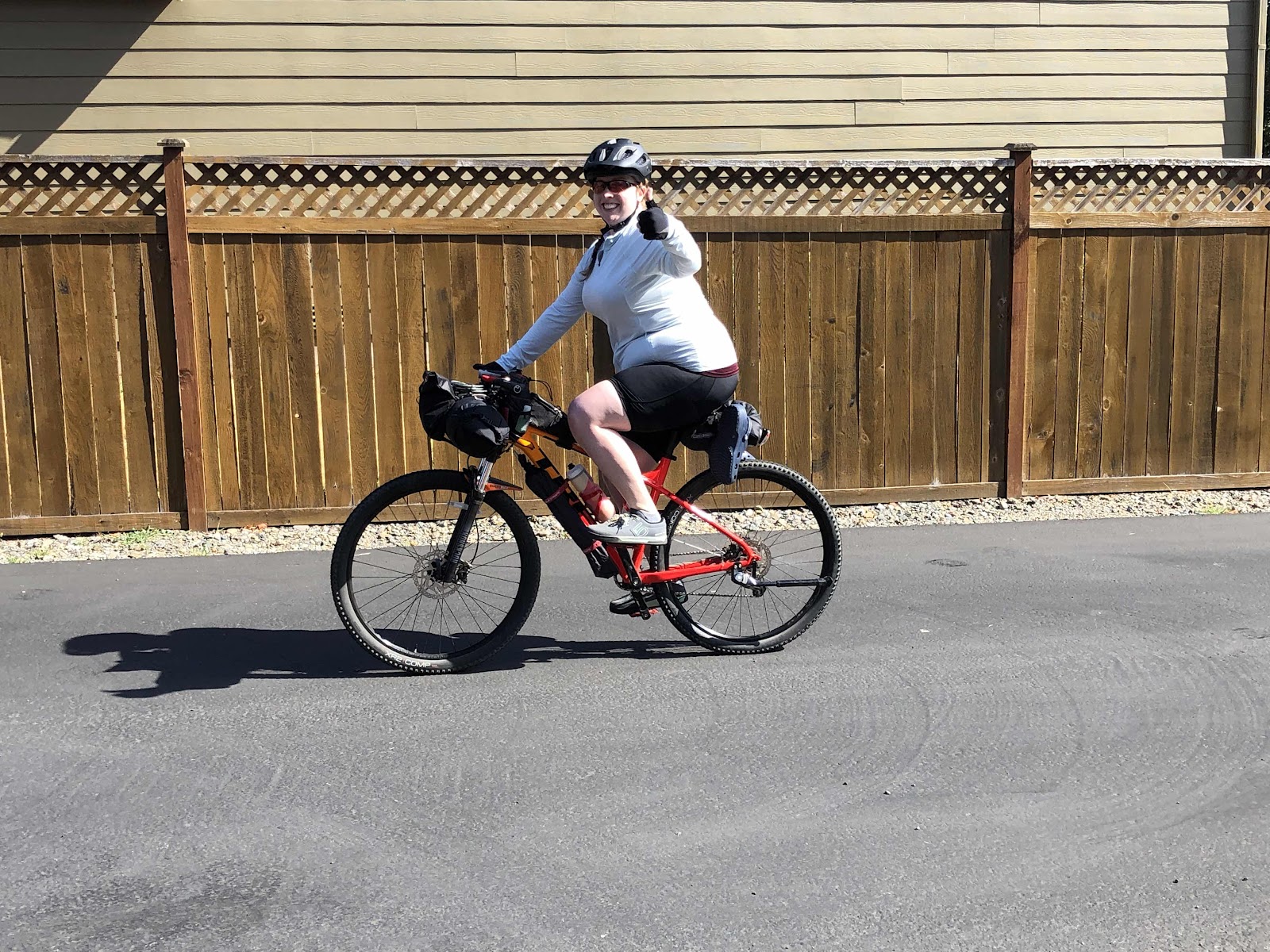
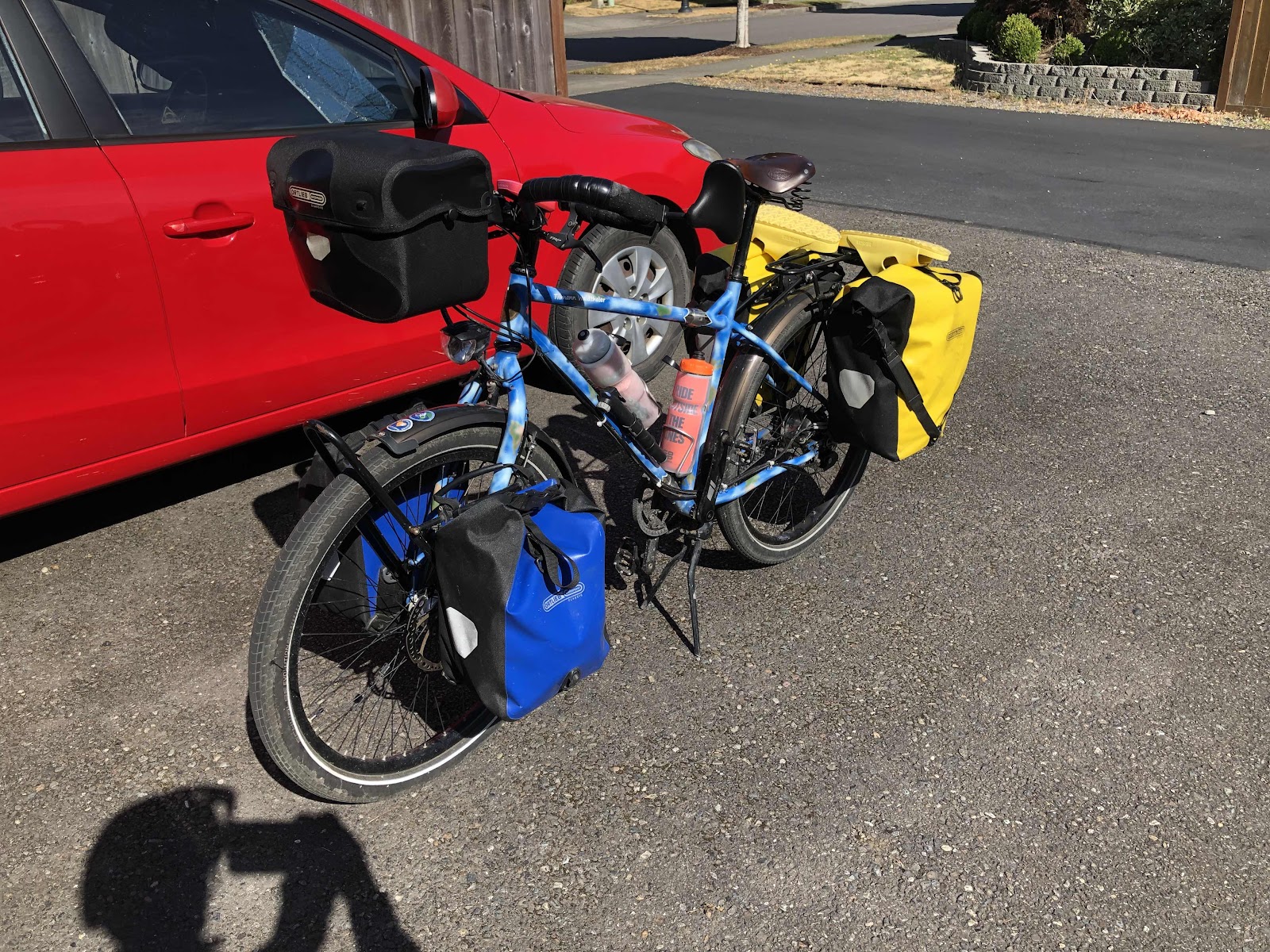
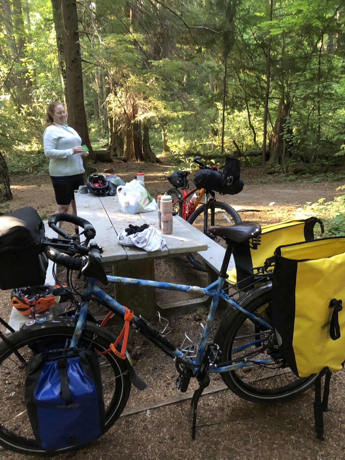
I arrived at Rebekah’s at 9:30 yesterday morning. I opted to ride Tilmann so I could carry anything that Rover (Rebekah’s bike) couldn’t. All I ended up carrying for her was a sleeping pad, toiletries, and her cup. We got everything else firmly attached to Rover. We were heading to the CWT by 10:00.

Woo Hoo! Let’s go!

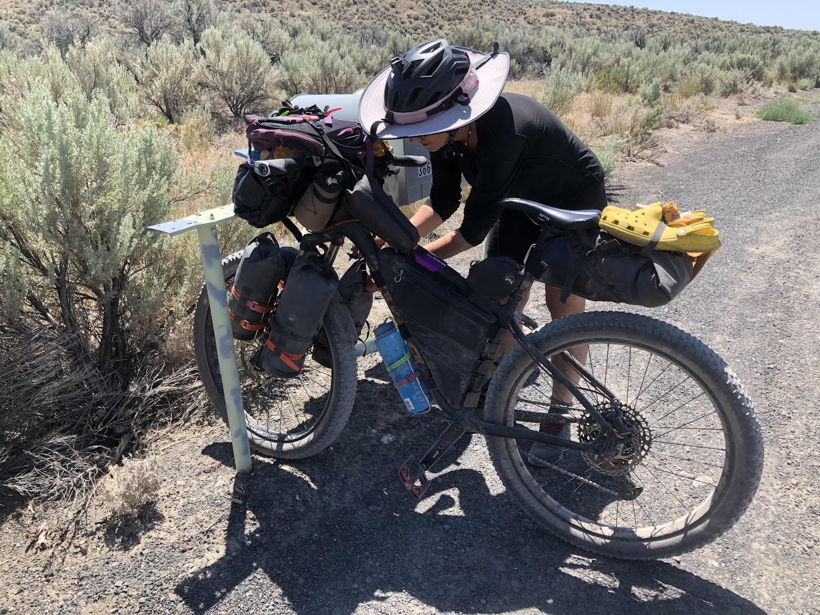
Tilmann looking so excited to be going!

Our plan was not to take the shortest way to the park, but to take the CWT to the Yelm-Tenino Trail, then to Tenino. In Tenino, we would stop for lunch, then go onto Millersylvania by riding through Tenino to Tilley along Hwy 99. There is a more “backroad” way, but it is much hillier (and a bit shorter). 

Lunch in Tenino at Subway was a good break. Along the way to Tenino, I made an awesome discovery about my Garmin. When I am running it on “Tour” mode, it auto-pauses when I stop, then resumes when I begin rolling again! The “Road” and “Gravel” modes do not do this (I’m not sure about “Mountain” because I’ve never run that mode). I think it does this because when you are touring, you take longer breaks. Anyway, it was a happy discovery!

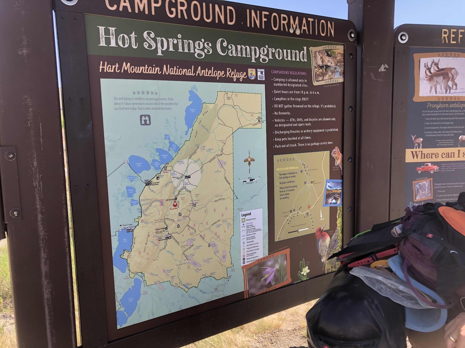
We arrived at Millersylvania around 3:00. 

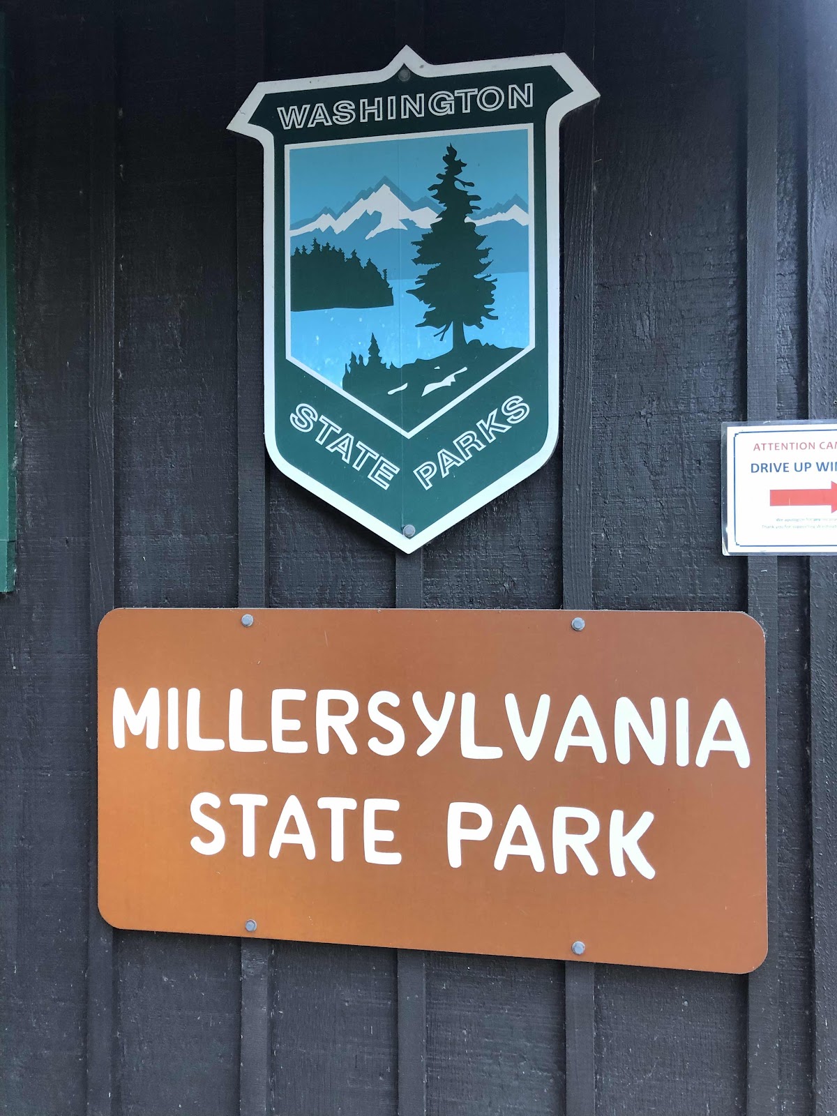
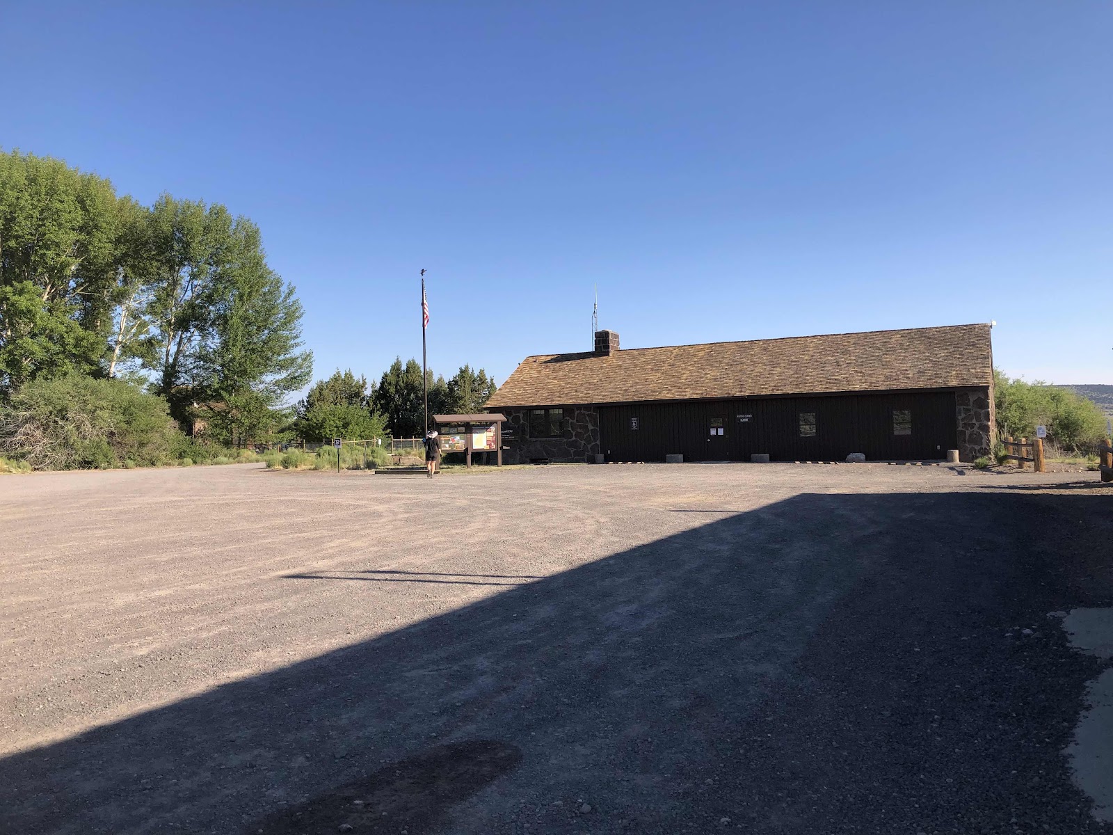
Unfortunately, they are still only checking people in at the drive-up window (the campground was full…good thing they have Hiker/Biker sites). There were a lot of cars waiting to check in. We rode up to the building, and instead of waiting our turn, I just grabbed an envelope, filled it out, put the money in, and gave it to the gal at the window. It helped that I knew where the H/B sites were. 

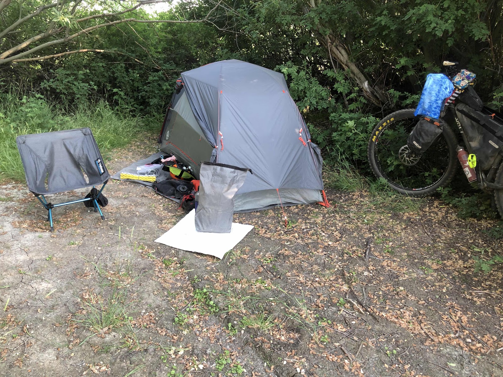
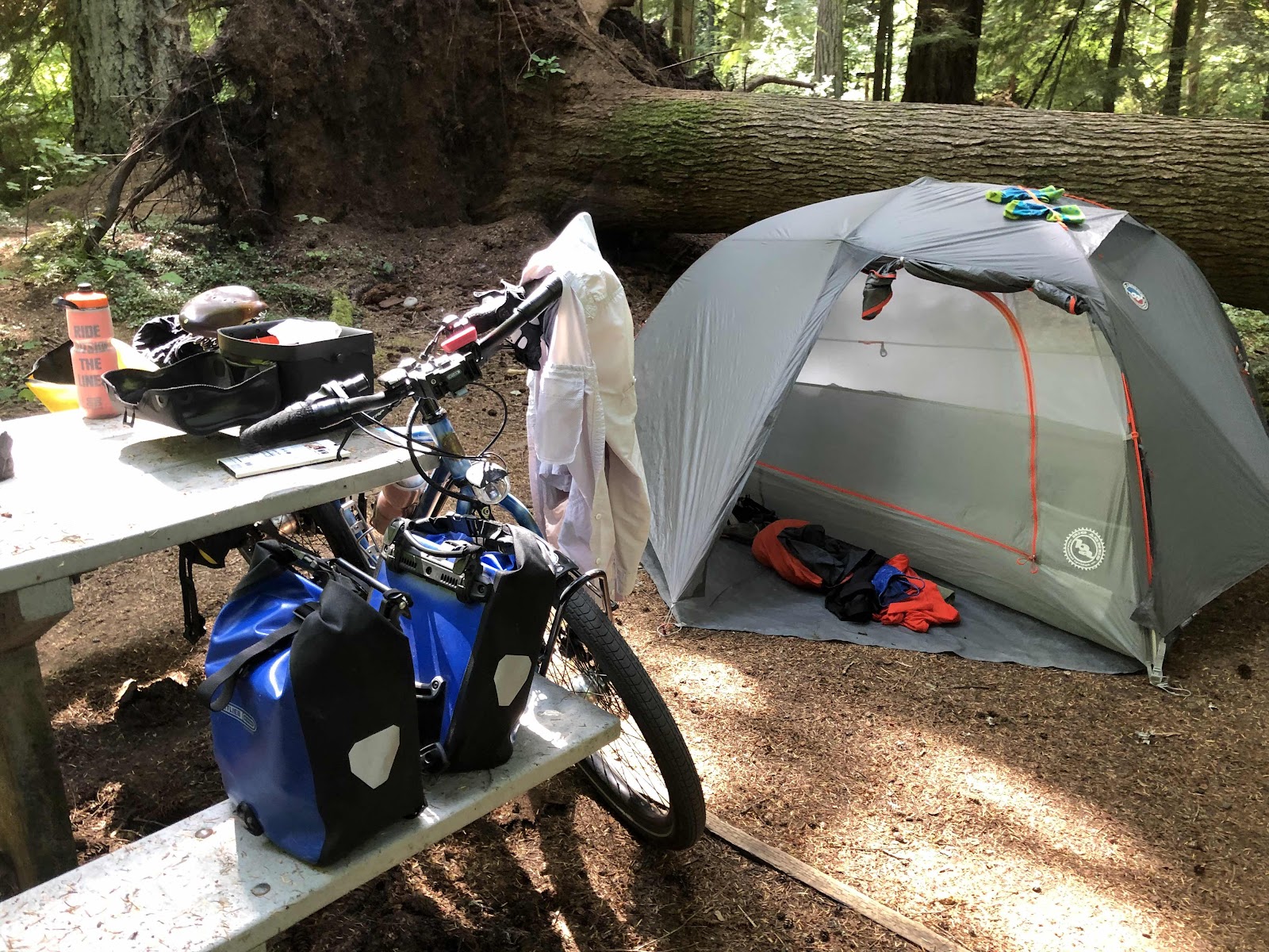
We rolled over to the H/B area, and grabbed a site that had two tent pads (okay, the one tent pad likely belonged to the next site, but there wasn’t anyone else there). 


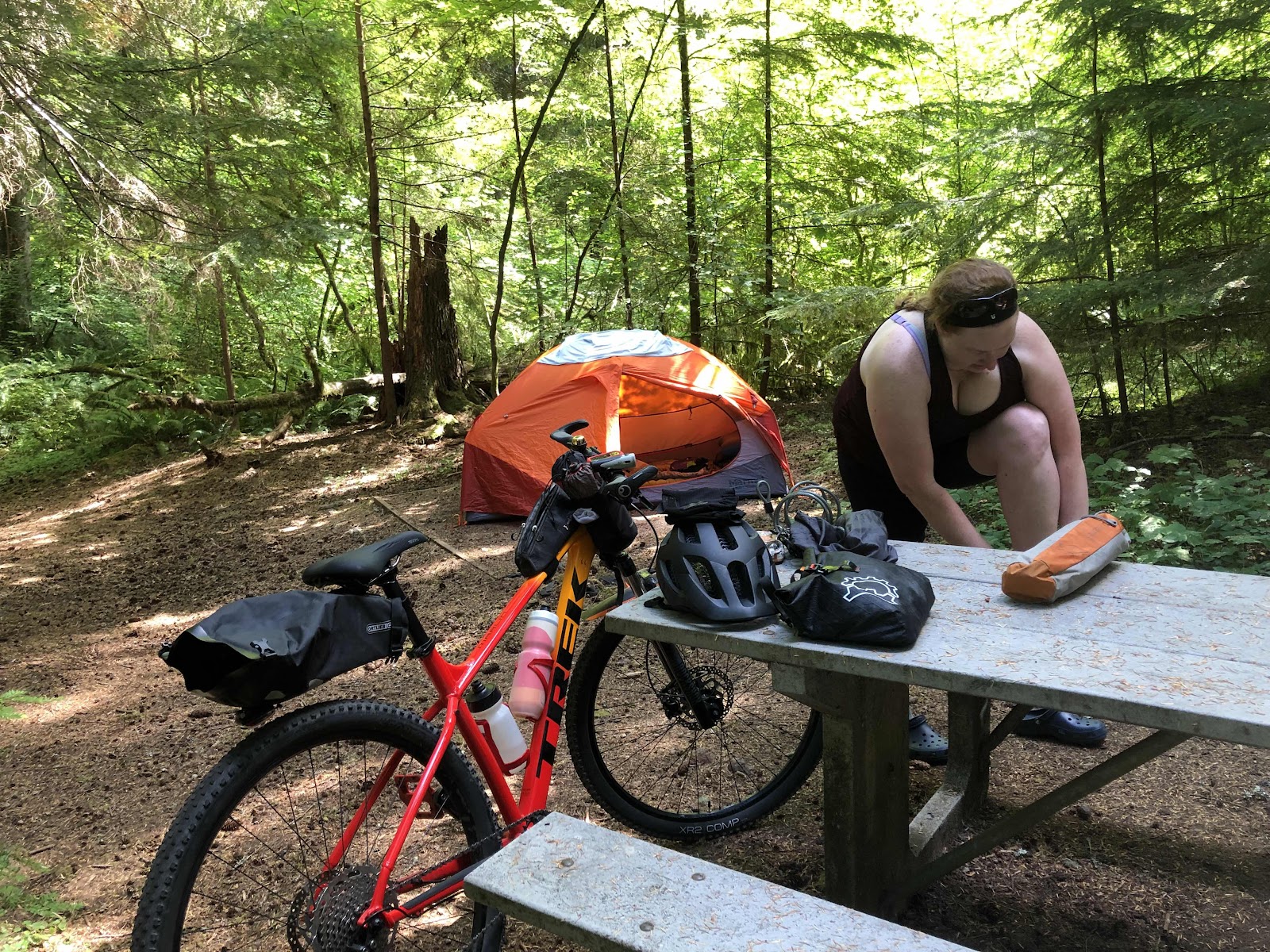
Once our houses were built, we headed down to the lake for a swim. 

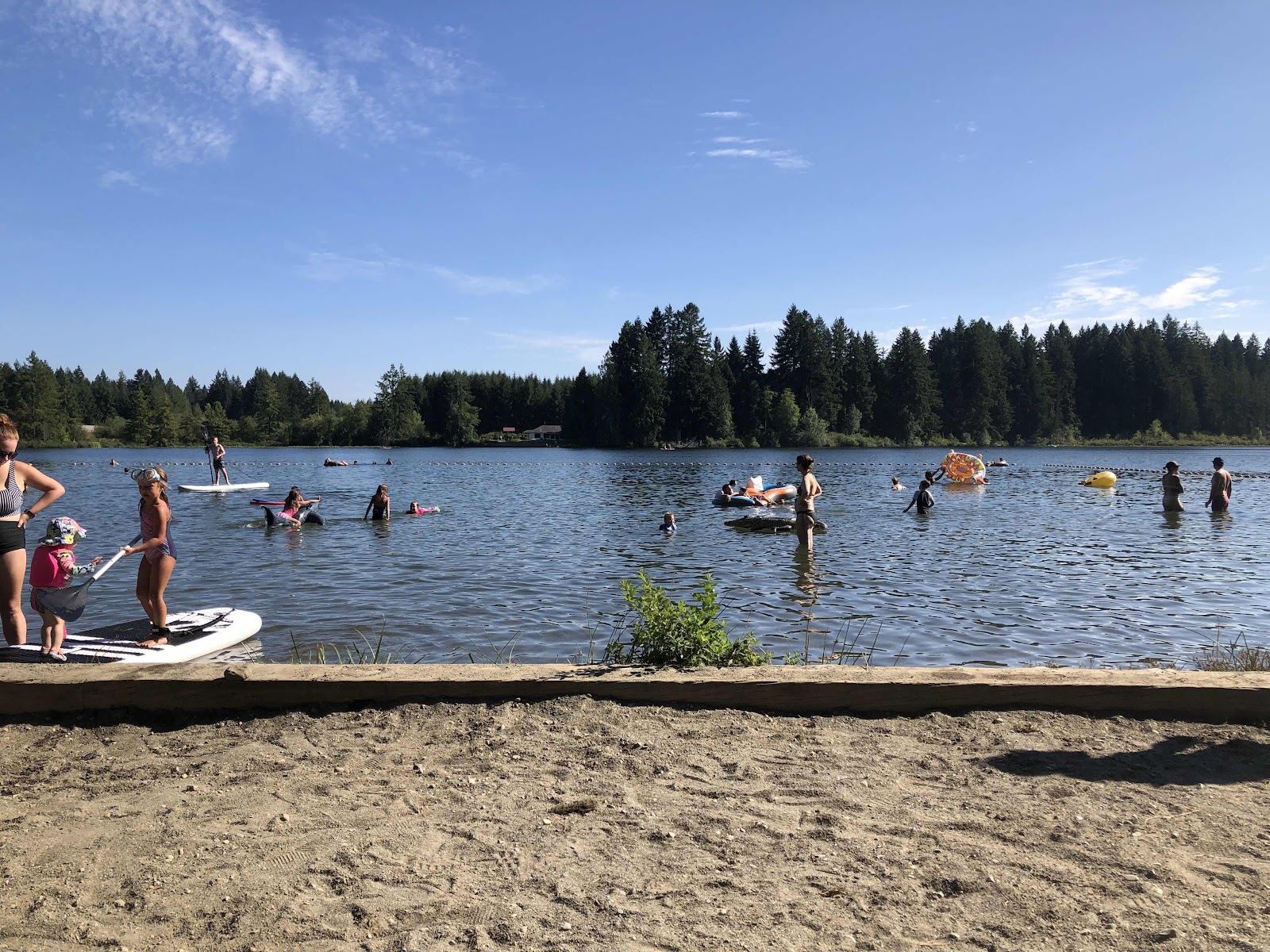
Lots of people enjoying the water!

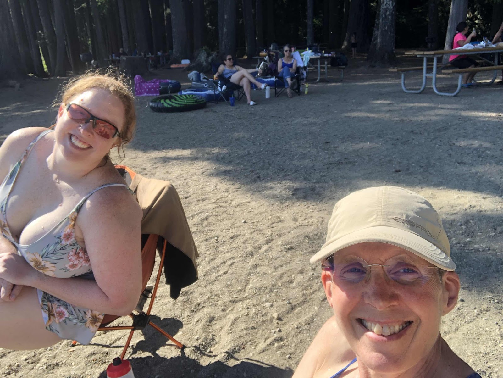
Oh, and I also brought each of us a chair (my Helinox Zero, and my REI Flex-lite) so we could dry off, and enjoy the beach. 

After we both had enough sun, we went back to our campsite. I had brought some hummus, and bought some crackers and carrots in Tenino. We had a nice pre-dinner snack while we waited for our special guest to join us for dinner. 

Florian drove down after getting off work. He brought their Jetboil so Rebekah could try it out (technically, we could have just used my stove and pot as we were just boiling water, but using what they have was a good learning experience). We had our dinner, then went back to the lake. I decided I didn’t want to get all wet again (plus, I was pretty full from the pre-dinner snacks and dinner), but Florian and Rebekah had a good swim. 

Not like we really needed to take showers, but we did anyway for the full state park experience. Meanwhile, Florian fixed a chocolate cheesecake for dessert (okay, maybe fixed is an overstatement…he added water to a freeze-dried  Mountain House Chocolate Cheesecake). We had that, then said goodnight and goodbye to Florian. 

We cleaned stuff up, and retired to our respective tents. Rebekah and Florian had decided Rebekah would be warm enough with just a blanket (like a sleeping bag liner, but a bit more substantial). Overnight, while I was alternating between too hot in my quilt, and too cold without it (so just fluffing it up periodically), Rebekah was a little chilly. At least she had a down jacket. She still managed to sleep, but she’ll be looking into a bike-packable sleeping bag or quilt. 

Since Rebekah had to be back home no later than 10:30, we got up at 7:00. We enjoyed a semi leisurely breakfast (although Rebekah discovered the MH Scrambled Eggs are not to her liking), then loaded up the bikes to hit the road. 

Almost ready to go!

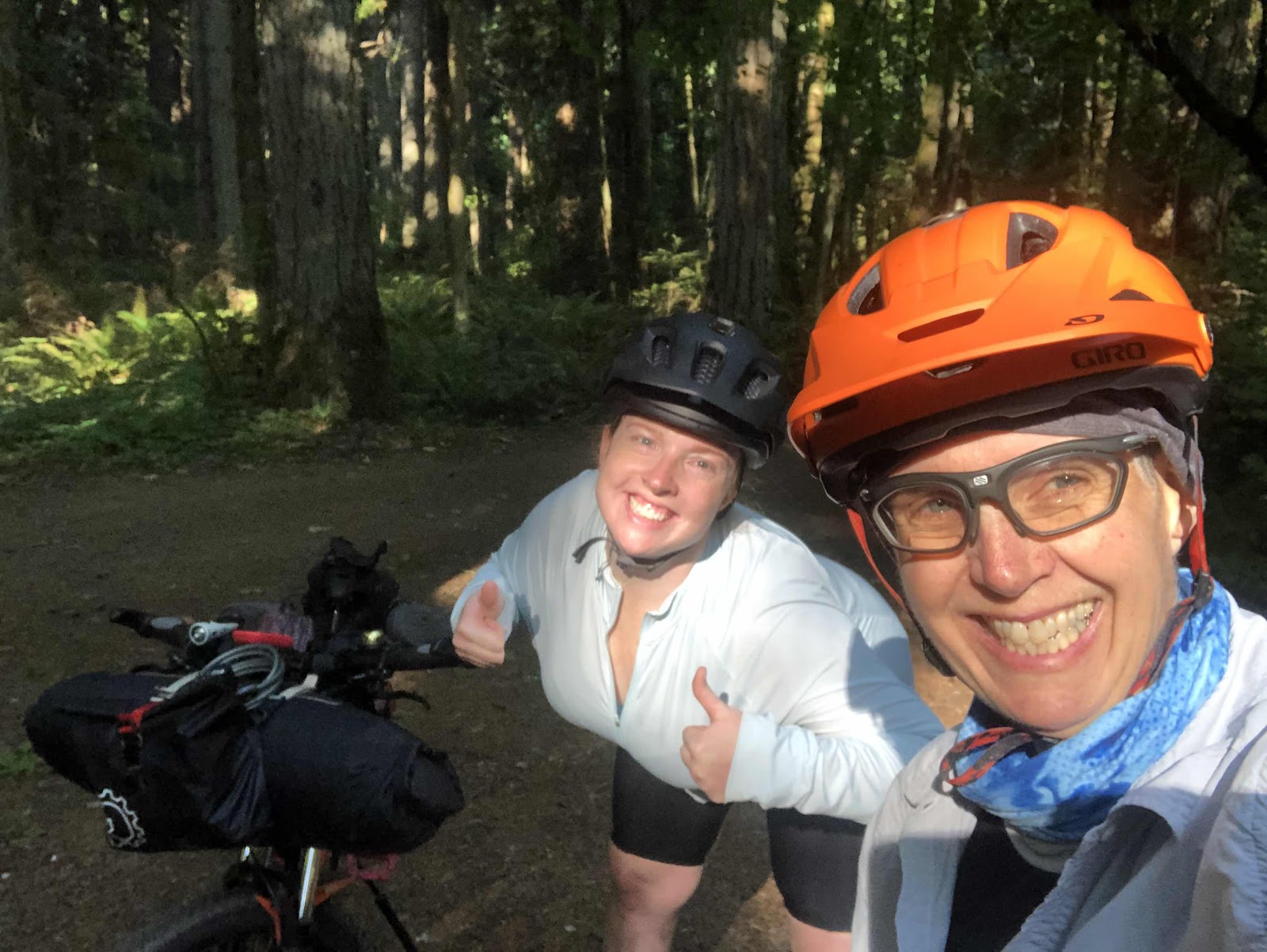
Alright, let’s get this ride started!

Because of the short time frame, we took the shortest way home. Florian had told Rebekah to watch out for Sasquatch. Whaddya know??? Look who we saw!

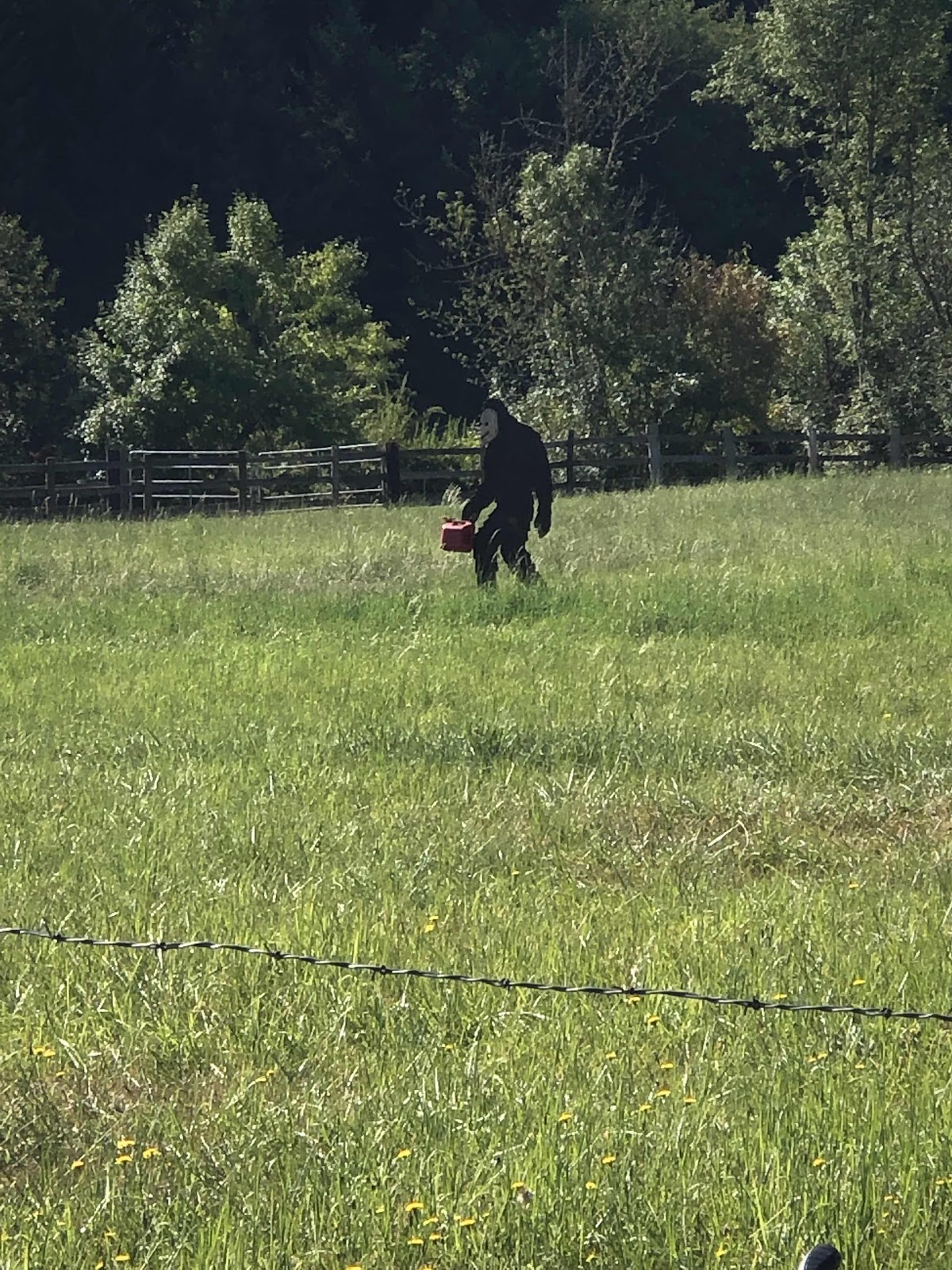
Now, why he’s carrying a gas can is anyone’s guess, but there he is!

We made it home by 10:00. It was a most successful S24H bikepacking trip! Now we must plan another!!!


Friday, July 9, 2021

OBC-A Wrap Up

Jana and I made it back to Olympia around 2:15. Funny thing, this morning my alarm went off, and we both hopped out of our beds and got busy getting ready to hit the road (we had packed and loaded everything we could last night). Then Jana says, “It’s only 4:30!” I had set my watch alarm for 5:30, but had also accidentally turned on the 4:30 alarm (I have 3 alarms on my watch). It was fine, though, because we wanted to get going…the earlier the better. We were on the road by 5:00.

Now for a little review…

Set-ups
Overall, Jana and I were pretty happy with our set-ups. The bikes performed well with Jana’s only needing a little derailleur adjustment, and mine a little brake adjustment. I was very happy with the Maxxis Minion DH tires. I thought they were going to be overkill, but for my skill level, they were perfect. Jana’s tires had less knobs, but she has more skill, and her tires made for faster rolling. Having 3” tires was very helpful. 

I was happy with my “hybrid” bikepacking set-up. I use a rear rack with Porcelain Rocket dry bag panniers instead of a seat bag. The Revelate Pronghorn handlebar harness and Dyneema dry bag worked great. I had no problems with it slipping. I do need to put a longer cable and housing on the rear derailleur shifter, as it was a little too tight of a squeeze with the dry bag. I used the Revelate Egress pocket on the front instead of my usual Yakitaga. The pocket holds more, and I didn’t have to deal with a zipper. The Ortlieb Fork bags were solidly mounted, and I had zero problems with them. The Ortlieb’s Roll top frame bag, even though it’s not a perfect fit, also worked well. I carried two 1-liter bottles in my Oveja Negra “Chuckabuckets” (the ones with the cool Frida Kahlo material), and also had room for my phone in one. I carried the day’s snacks and electrolyte packets in the Gas Tank. 

I took my Garmin InReach Mini (it dangled from the front of the Egress Pocket), and got the “Expedition” plan that allowed unlimited texts. We would have been fine with the cheaper plan that allowed less texts. At the end of each day, I would text Jana’s husband, Bill to let him know we were finished for the day. He could also follow us with the tracking dropping a point every 20 minutes. He said he checked it a few times a day. 

I used my Garmin 830 for the route. We just followed the purple line. Each time I do an unknown route, I learn more how to get the most out of what the Garmin can tell me. I used to think the Climb Pro part was just bonus entertainment, but it was really helpful to see what the climb elevation and distance was. There were 19 climbs that initiated the Climb Pro. We could come pretty close to predicting which parts we would probably be pushing the bikes. But, what the Climb Pro couldn’t tell us was what the surface would be like. Sometimes what would have been rideable from a steepness point of view, was not because the surface was too rough. 

We also used the route on our phones to check how close we were to the various POIs, whether it was a water source, a campsite, or another POI such as an abandoned ranch. The route on the Garmin didn’t show the POIs. 

I charged my three devices (the two Garmins, and my phone) with two Anker battery banks totaling 31,000mAmp. Over the 9 days, I used all the power in the big battery (21,000), and was down 2 lights in the 10,000. I still had enough power to charge my phone fully probably 4 more times. Jana had a solar panel that kept her three batteries fully charged without a problem. . 

Even though the weather was definitely warm (with 2 half-days of pretty hot), I still ended up pulling my quilt over me at some point every night. The last night at Hart Mtn, I slept under my quilt the whole night (and it was downright chilly in the morning). I was happy with my clothing choices. Wearing the white button down UV shirt to ride in was helpful in keeping me cooler (even though it was pretty filthy by the end). Under the white shirt I just wore a very lightweight sleeveless wool shirt. I was mostly comfortable. For bottoms, it was the usual padded bike short with loose baggie shorts over the top. The baggies helped prevent getting mosquito bites on my butt (the mosquitos were out enforce most evenings and mornings)! I also wore a buff around my neck. When it was hot and a dry wind, I would pull the buff up over my nose and mouth (bandit style). That helped keep my mouth from getting so dry, as well as being a dust protector when vehicles would go by on the gravel roads. The only thing I wasn’t happy with was my camp shoes. I brought a pair of those sock-like shoes with the rubber soles. While they packed small, they didn’t really protect my feet when walking on rocks. I should have just stuck with my Birkies. Lesson learned. Most importantly, we both had Da Brims on our helmets (Jana used my old one). They helped keep the sun off our necks and faces, thus keeping us cooler. 

Probably the weirdest piece of gear we both carried, but were really happy we did, was umbrellas. I had my 4 oz Snow Peak hiking umbrella, and Jana had borrowed Bethany’s Solumbra sun umbrella. We used them almost everyday to provide shade during our lunch stops. I even used mine for rain one day! We got pretty creative in setting them on bushes or the bikes, then sitting under them. I was also happy I brought my Helinox Zero chair. I used it more on this trip then I have on any other. It’s also a great place to set stuff to try and keep things a tiny bit cleaner. I’m still really happy with my Big Agnes UL 2HV Bikepacking tent. 

Water
Both Jana and I had the capacity to carry a little over 11 liters of water each. We called it “Carrying Max Water”. We only misjudged our water needs once. It was the first day when we thought we could make it to a campsite that turned out to be too far for the terrain. We managed okay, but cut it closer than we liked (had to walk off-route to a creek to get water the next day some miles into the day). Two or three times we both carried max water. It was heavy, but comforting to know we could pretty much drink as much as we wanted. We were also able to camp without having a water source nearby. 
I carried the bulk of my water in a dromedary bag on top of my rear rack. I could easily lay Mama Cass down, and open up the “spigot” on the bag, and fill my bottles. Jana carried water in all sorts of places on her bike. 

Food
We had planned on being able to get lunch at the Diamond Hotel in Diamond, and at the cafe in Denio Junction. We had also planned to get any necessary resupply in Denio Junction. The hotel in Diamond stopped serving lunch three years ago. Whoops! Before we started, we knew Denio Junction was going to be closed because we would be getting there on the 4th of July. So, we basically had to carry most all of our food. We were able to get lunch in Denio at the Diamond Bar. Even without that, we would have been fine, but it was nice to have one meal not cooked in a freezer bag. 

For cooking gear, I took my new Toaks Titanium alcohol stove. It was good, but I learned that one should carry the alcohol fuel in a metal container (duh…it is a solvent). I had put it in a Platypus 24oz bag. The alcohol seemed to be eating away at the plastic (or at least it smelled like that. In Denio, I got a heavier duty plastic juice bottle, and after drinking the juice, and washing the bottle, I transferred the fuel to the juice bottle. It was fine for the rest of the trip.

Final thoughts
I think we made good decisions for most of the trip. Getting going early in the morning was definitely the way to go. Paying close attention to water was important. Making it a 9 day, instead of the recommended 8 day itinerary, was perfect for our fitness levels and abilities. We were initially concerned about the heat, but it turned out to be far less of an issue, but we were prepared for it anyway. We found that, not only can we do hard things, but we can do really hard things! 

Finally, Jana was one of the best bikepacking partners I’ve ridden with. We thought along the same lines, and it was fun working our way through some of the most remote parts of Oregon with her. Every morning we would start riding by me saying, “No Crashies, no flatties, no whammies!”, and Jana would say, “Bubble of safety!” It seemed to work! 


OBC Day 9-Barn Sour Bikers

The last day of this epic bikepacking trip started at the usual 5:30, but it was unusually cold! I even pulled out my long finger gloves (in camp, not riding). By the time we were ready to go, the sun had come up over the hillside, and things were warming up. I was down to my usual riding attire before we left camp. 

MC ready to go for one last ride (in this neck of the desert). 

Our first stop was the Hart Mtn Refuge HQ to get water from a spigot. No more filtering for us!


Sadly, the Visitor Center wasn’t open yet. 


45 miles of a gravel road plus 7 miles on the highway to get us back to Frenchglen. As we left the HQ, I saw a coyote run across the road, but I could get a photo. 

The washboard was less than pleasant. 

Goodbye Hart Mtn. 

Water to the left, but only cows were near it. 

It was about 12:30 when we reached the Hwy. We had a snack before heading onto Frenchglen. I also inflated my tires for the pavement. 

Mailbox holders sometimes make good bike racks. 

The best part of the pavement was this sign. 

That was an awesome downhill. MC got up to 41mph (a lot for a plus bike with knobby tires)!

I pulled into Frenchglen at 1:15. Jana was a bit later. We had made very good time for how many miles we did. I guess we were like barn sour horses. 

The actual beginning of the route. 

MC hanging in the shade. 

Woo Hoo! Done!

Jana rolling in!

We went to the hotel for some lunch. Fortunately, Jana only wanted something to drink because they had nothing (but potato chips) that she could eat. I had a Turkey sandwich. We checked the hours at the mercantile, then headed the remaining 3 miles to the Steens Mountain Resort. 

Still have to go that way. 

This is where we started the route 9 days ago. We are definitely a bit dirtier!

Our luxurious accommodations for the night (woo hoo, no camping, also, the best shower ever!!!)

We showered, then drove back into town to get dinner and breakfast stuff for tonight and tomorrow morning. Here’s a funny sign at the mercantile. 


Here’s what much of the gravel was today. I told Jana, for all the scrubbing on the washboard roads, we should be squeaky clean!

On the final few miles back to the resort, the washboard was so bad, I had to let air out of my tires!

We’ll be heading out very early tomorrow. I’ll do a wrap up post when I get home. Oh, and the air is very smoke filled here. It’s a fire in Medford. Glad we’re not sleeping in our tents tonight!


OBC Day 8-The Best of Bests


Good morning Day 8!

Shirk Ranch main house. 

We discovered (not really surprising) that there were critters living around the abandoned ranch. Jana left a bar out, and woke up to some biggish critter going for it. I heard some messing around on my bike, and scared of a smaller bugger. Nothing was eaten or destroyed. 

Right out of the gate (no pun intended), we started climbing out of the valley. It was a couple miles long climb. If it hadn’t been so rutted and rocky, more of it would have been rideable. 

Looking back toward the valley we just left. 

Note the haze of smoke in the air. 

As we came upon Jacob’s Reservoir, I saw a coyote running away. But, mostly there were tons of antelope. 

Jacob’s Reservoir

This is just a small amount of the antelope that we’re grazing near the reservoir. 

We continued to see lots of Antelope as we made our way toward Hart Mtn. 


Hart Mtn in the distance. 

We had planned to get water a a source that RWGPS said was likely year round. Well, either the POI was in the wrong spot, or we just read the map wrong (likely). We were a little concerned, but to no avail. We came down toward some trees and there was Guano Creek. 


Our lunch spot. 

We ate lunch and filtered water from the creek, getting rid of the disgusting Catnip Reservoir water. It was so great to have nice, cold, good tasting water again. This was the best lunch spot of the whole trip!

We had the final two climbs of the whole route to do in 7 miles before getting to Hart Mtn campground and hot springs. The first one was the longest at over two miles. But, it was really a nice climb. It was really the best of all the long climbs. There was only one short bit that I walked. There was periodic shade, and lots of vegetation. There was also a creek crossing that soaked my feet. 

Nice climb, even when it was 9%.

Happy for a break in the shade!

The foot soaking through Guano Creek. 

Moths and butterflies at the edge of the creek. 

We came down a substantial amount, then did the last climb of .92 miles. It was pretty easy. 

Next thing we knew, we were at Hart Mtn CG and HS. 

Campsites are free (like Virgin Valley)

We have a site not far from the hot springs. There is a fairly developed one that is a bit warmer than Virgin Valley. 

Stone wall enclosing the pool. 

Nice pool. 

All done soaking!

The unimproved hot spring. 

Tonight is our last night of camping. Jana and I have said repeatedly to each other what a great trip this has been. We are so glad we decided to take a chance on the heat being tolerable. 52 miles of mostly downhill back to Frenchglen tomorrow, then we’ll have a luxurious night in a cabin (we’ll, better than a tent).