I’ve been wanting to try bikepacking with Sly, my gravel adventure bike. I wanted to do the Willapa Hills Trail (the whole thing, not just the parts I’ve done on my road bike, and my Bike Friday touring bike...aka, the easy parts). My friend, Bethany, did the WHT last April (a day ride, unloaded). She has also wanted to do a bikepacking trip with her gravel bike. The planets aligned, and we were able to schedule a short trip this weekend.
Bethany and our driver (aka her husband) picked me up Saturday morning at 7:00. We arrived at the WHT Trailhead in Chehalis (take the Hwy 6 exit from I-5 South, turn right, then turn left, following the signs to the Willapa Hills Trailhead), and loaded the bags onto the bikes. Here’s Sly, ready to go.


Here we are, two bikepackers ready to go!
We had to stop a few times to make some adjustments (mostly just tightening straps), but then we were on the trail!

The first part of the trail is paved. It gave us time to get used to the weighted bikes, and warm up a bit. I continued to have problems with my handlebar pack straps loosening to where the bag would start to rub on the front wheel. I would have to stop and tighten them. It was frustrating until I tied the straps from the pocket to the straps of the Sweetroll. That seemed to do the trick.
Back in 2007, there was a major flood of the Chehalis River. This flood washed out several of the old railroad (now Willapa Hills Trail) bridges. Up until a year or so ago, those bridges had not been replaced. Now, there are new bridges for all of the river crossings between Adna and Rainbow Falls State Park.

Such a nice bridge!
Upon crossing the bridge just after the Adna Trailhead Parking, the trail turns to gravel. It’s pretty well hard packed, and easy to ride. Before we knew it, we were passing the turn to Rainbow Falls State Park (15 miles). From here, the trail continued to be easy, and well maintained.
We arrived in Pe El, where there is another Trailhead Parking lot with restrooms, and the Pe El Country Store just across the street.

The Country Store is the beige building behind the blue building (which is for sale...if you are interested).
I took the opportunity to get a bottle of root beer to go with the peanut butter and jelly sandwich I had packed. Although it was only about 10: 30, we were ready for a break and some food. I can’t decide if it was late breakfast, or early lunch (it was kind of lunch food...). A guy rolled up on a Dahon folding bike. He had come from the road. His son was coming on the trail. I’m not sure where they started (it wasn’t Raymond, because the son didn’t know where Raymond was). The dad had diverted out to the road. The son was riding an All-City drop bar bike with maybe 32mm tires. He was also wearing long black pants and put on a velour long sleeve black shirt when he reached Pe El. Interesting clothing choice, but the dude was doing it. Father and son continued on the path together toward Chehalis.

Bye guys!
Rested and fed, Bethany and I continued toward Raymond. The next section of the trail had a few trestles that were in various stages of decay. There was also a nice new bridge.

Nice view of the river.
We were able to get across the decaying/yet to be replaced trestles, even though we probably weren’t supposed to go across them.

This was the most decayed trestle of the bunch. It was prudent to watch where one stepped.
I almost rode one, but thought better of it.

Okay, I’ll walk...

Watch your step there, Bethany!
Many parts of the trail were tunnels of green. It was really pleasant.

This was fairly comfy to ride on.
At one point we spotted some wild bison! Okay...they weren’t wild, but they were bison!


Mama and calf
We knew there was a section where there is no bridge or trestle, so we would have to divert out to the road running parallel (not Hwy 6). Bethany had done this back in April, so she knew where to go. As we were riding to where she had turned to return to the trail (down a gravel road), we saw a pickup pull out. When we got up to the turn, and there was a closed gate. Bethany said there hadn’t been a gate before. Strangely, the pickup had turned around and was coming toward us (we had ridden further beyond the gated road). I said, “ Oh, there coming back.” Except, they weren’t coming back to talk to us. They started to drive by, but we had stopped, and they then stopped and asked us if we needed something. We asked about the road back to the trail. The woman said it did go to the trail, but it was private property (she was kind of snotty about it). She told us where we could get back on the trail, then they drove off. Bethany thought it was weird, since she had previously gone that way. The pickup had Oregon plates, so we thought maybe they were new owners, or something like that. Anyway, we didn’t try to see if the gate was unlocked. We came out to Hwy 6, rode for about a mile to Doyle Rd, turned there, and immediately turned back onto the trail.
As we continued on, we were hot, and parched (for me, anyway, water wasn’t cutting it). The trail was paralleling Hwy 6. We came to the burg of Menlo. There, sitting along the Hwy, was a beautiful sight...the Menlo Market. We exited the trail immediately! I had a delicious bottle of Gatorade, and a Snickers. Bethany even broke down and had a Henry Weinhard’s Orange Cream Soda (and thought it was quite good)!

So refreshing!

Chillaxin for a moment!
An older gentleman came and bought a large supply of Busch NA (near beer). He asked where we were headed. When we told him Raymond, he said we only had about 6 miles to go.
Back on the trail, things started to get a bit...well...less maintained. We had been navigating around the pokie Blackberry vines pretty successfully. However, the trail was getting narrower and narrower. When we came to a cross street, and saw the condition of the trail on the other side, we opted to divert to the road.

Looks awfully pokie to me!
As soon as the trail widened again, we got back on. Then it was overgrown again. Back out to the road we went, only it wasn’t Hwy 6. Bethany looked on her phone, and we could see that this road paralleled the trail. We had ridden for just a short bit when I saw an access back to the trail. I said I would just go have a look. The trail was fine again, so we got back on.
Before too long, we hit the bit of paved section into Raymond. We arrived at the end of the trail at about 3:30. Since we were just going to be setting up our tents at the Riverfront Park, and wouldn’t be doing so until the sun went down, we decided to go have second lunch/early dinner at Dairy Queen. Besides, we were both really hungry. After both of us consumed too much food, we made our way over to the park. Bethany opted for a bit of a lay down.
Because it was after 4:00, and the Carriage Museum and Visitor Center we’re closed, we didn’t have access to the restrooms to was the dirt off our legs.

Dirt tan.
Bethany utilized some wipes. I went down to the river and washed off my legs. It also felt good to dip my legs into the cool water.

One of the numerous metal sculptures that Raymond is known for. This one is on the dock for the river.
We finally decided the sun had set enough that we could put up our tents. Bethany noted that the grass was pretty green, and therefore wondered if there might be sprinklers. I said I hadn’t seen any sprinkler heads...

Sunset on the Willapa (photo by Bethany)
Day 2: A Lot Harder Than Day 1!
Where was I...oh yes...sprinkler heads. We had a night of semi-sleeplessness, but no issues with anyone telling us we could camp at the park. However, at about 5:00, I was rudely awakened by an attack from...the sprinklers! Ah CRAP!!! Turns out there WERE sprinklers, and there was a sprinkler head about two feet from my tent!

See the little black round devil?
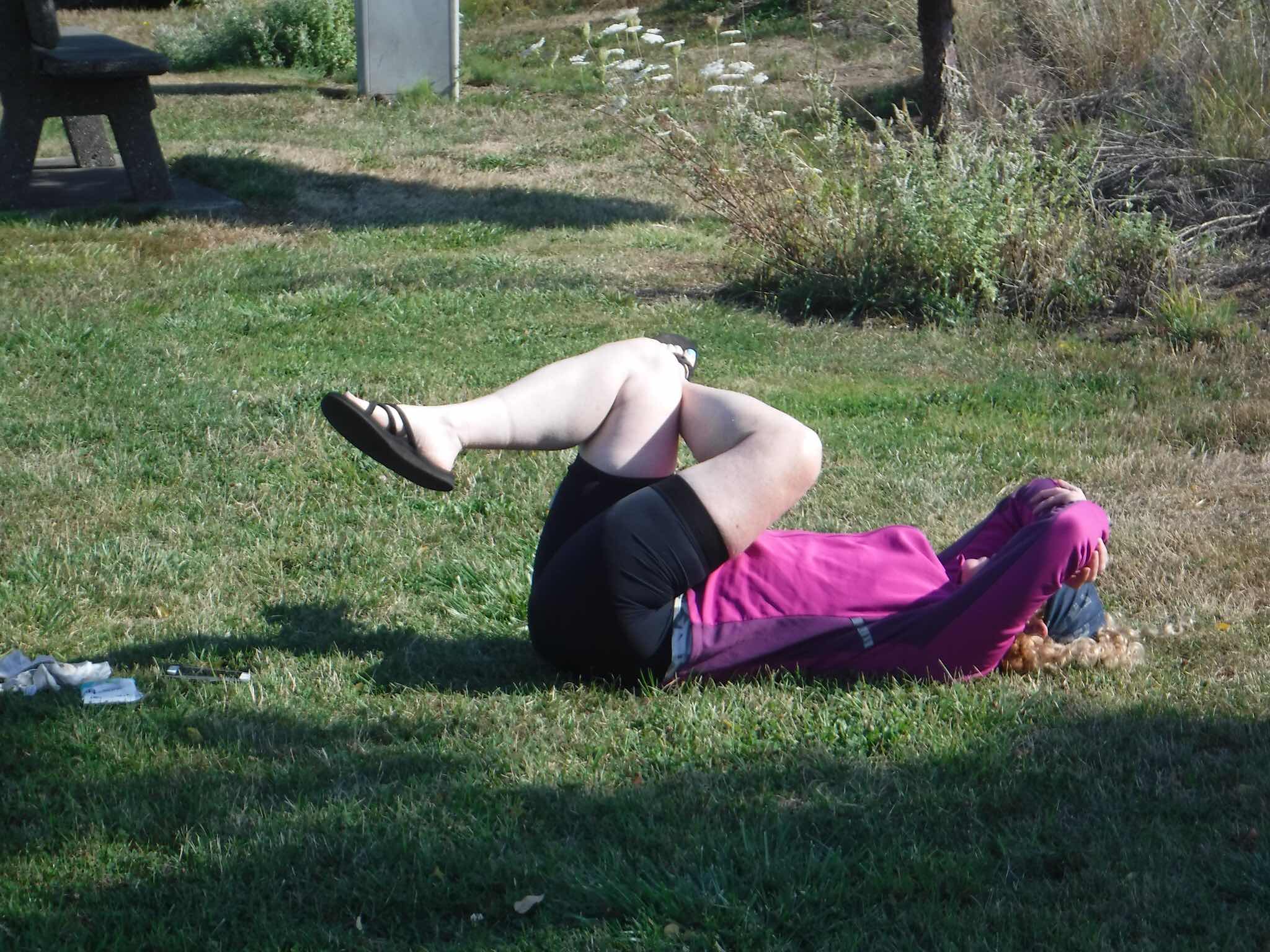
OH MY GOD! The water absolutely pummeled my tent, spraying directly up under the vent, and onto my head! As I was howling, I somehow managed to get the vent closed from inside my tent (it’s part of the rainfly). While it seemed an eternity of regular jets of water continuing to pressure wash my tent (it’s a brand new tent...it didn’t need washing!), I think it really only lasted about 5 minutes before it mercifully shut off. Both Bethany and I were wondering if the bikes had also got a washing. Fortunately, Bethany had suggested, the night before, that we park the bikes up against a small tree near our tents (instead of leaning them against the picnic table). The tree was just behind the sprinkler, so the bikes stayed dry. I retrieved my towel, and dried everything as best as I could. At least I wouldn’t have to sleep in my, now wet, sleeping bag tonight.
We packed up, and ate some breakfast. Bethany popped over to the Chevron to get a couple bottles of water to refill our bottles and Bethany’s Camelback.

Gotta get all this back into the bags!
Shortly after 8:00, we were ready to hit the road. Instead of just going back on the WHT, I had mapped a route to Rochester via Brooklyn. Before rolling out of town, we went over to this cool bike sculpture.

Me and Larry.
We had to climb for a short section on 101 before we could turn off onto Butte Creek Rd. Unable to tell from the map, I didn’t know if Butte Creek would be paved. It was. After about 6 miles, we veered right onto Smith Creek Rd. It was also paved...for awhile.

Yay, back to gravel!
This was a pleasant surprise! The road was pretty good, perhaps a little bumpy. I figured we would be doing some climbing. Oh yeah, there was climbing! A lot of climbing! I think in one climb, we had more elevation gain than all of yesterday (although, that’s not saying much as the WHT is pretty darn flat).

And this was the easy part!
We made it to the top at last.

Whew!
The descent was long, and seemed steeper than the climb...at least sometimes. At the bottom, we popped out onto North River Rd, which took us to Brooklyn. The section to (and a bit further) the Brooklyn Tavern was paved. We enjoyed the smoothness.
Sadly, we arrived 1 1/2 hours before the Brooklyn Tavern would be open.

Why don’t people like to start drinking before noon on a Sunday???
Still, we took a break, and had a snack.

Who needs the Weather Channel?

The parking lot is covered in bottle caps.
After our break, we headed on along Brooklyn Rd to where it becomes gravel.

End of the pavement, back to the gravel!
Coming from Brooklyn, it’s a long climb, but fairly gradual. Neither of us required our easiest gears...yet. Soon enough the road got steeper. There were some nice views though.

This was a nice view looking back.

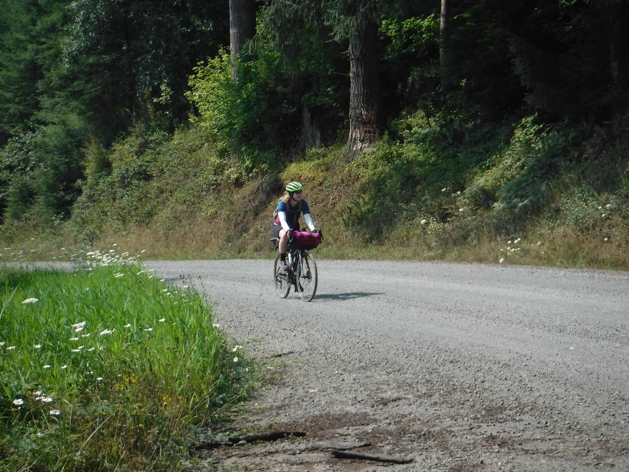
Sly, looking good!

I think we had been over in those hills back there somewhere.
We finally reached the top.
You’ve got this Bethany!
The ride down back to pavement was definitely steeper than most of the up. Back on the pavement, we were both getting pretty tired, but we still had one big-ass hill to go up on Gerrard Creek Rd. We took a little break just before. I was down to my downtube bottle of water. We had about 10 miles to go. The ride down Gerrard Creek after the climb was great, of course. Onto Independence Valley, there were still a few rollers, but no more big climbs. We slogged our way the last few miles, pulling into Swede Hall (where our chauffeur was waiting) exhausted, hungry, and thirsty around 2:15.
Today was shorter in miles (47 vs 53.6), but the elevation gain was far more (3228ft vs 669). Plus, there was no place to get something to drink or eat (we had enough food and water, but a Gatorade or something would have been nice). However, the trip, though short, was a resounding success! We both had a great time, and I really enjoyed doing this tour with Bethany. Now I should go dry my tent...blasted sprinklers!!!
No comments:
Post a Comment