Makaela, Jana (with Radar), and I met at the Mima Falls Trailhead Parking this morning with the intent to do a pre-ride of next weekend’s Super G 50 mile route. Jana didn’t plan to do the whole route with us as she was hauling the trailer that Radar was in and out of (he prefers out). She would go out for whatever worked, then go back.
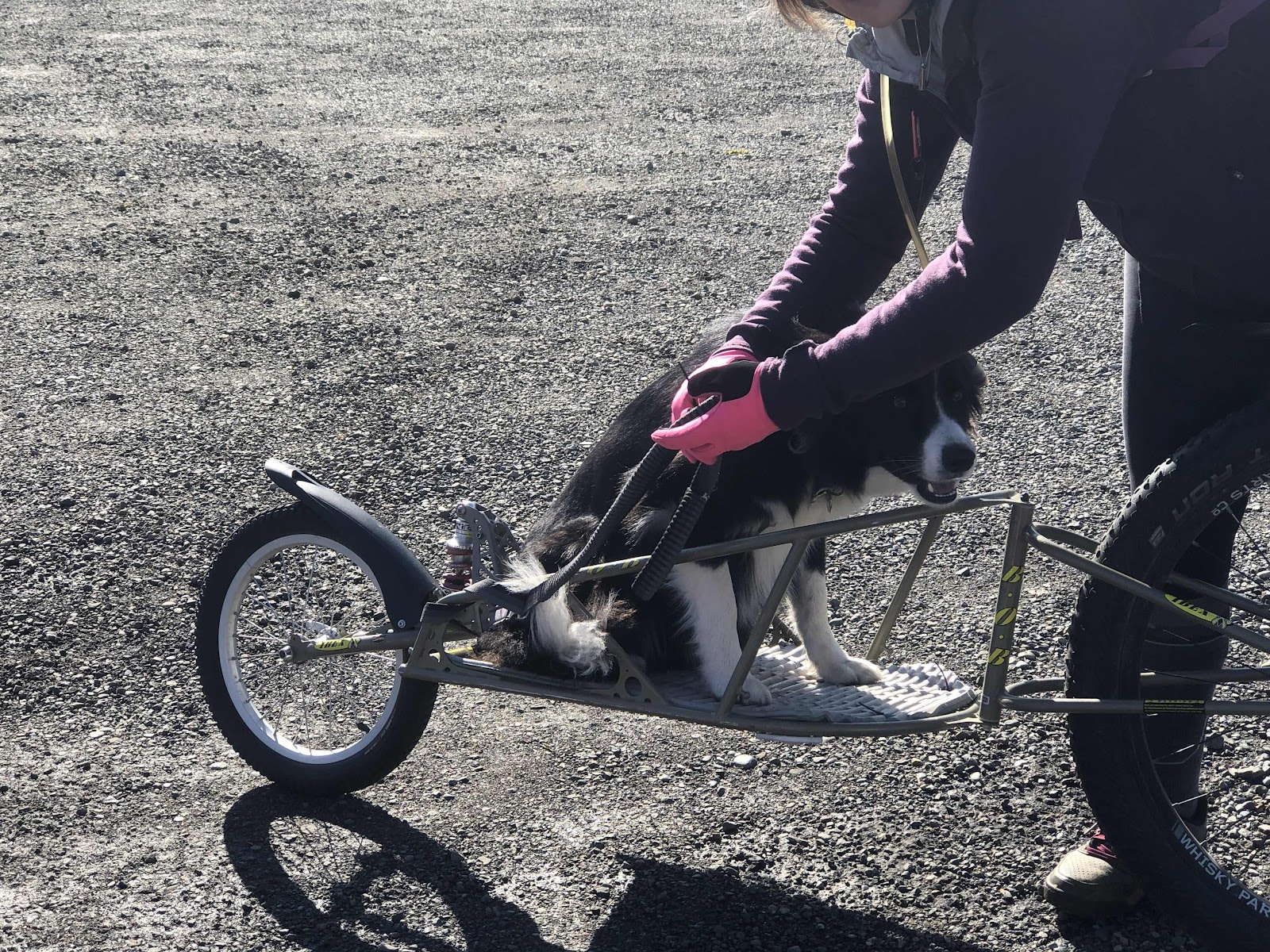
Radar ready to go!
Radar likes to sing when he’s in the trailer, when there is an audience (other riders). While his singing doesn’t bother me, he doesn’t seem to sing Jana’s kind of music (I think she would prefer he sing “Sounds of Silence”). They turned around part way up the E-Line. Jana reported he didn’t sing the whole way back (of course, he didn’t have an audience).
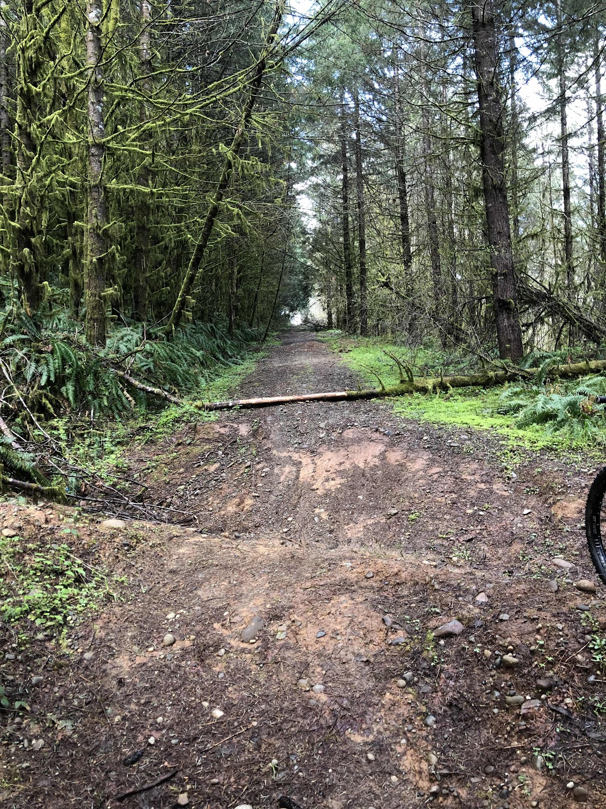
The route continued up the E-Line, then down and onto E5000. I’ve done this portion many times. What was going to be new, was some routing off E5000 (which actually does change names, but it is the main bypass around where they took the bridge out on the E-Line.
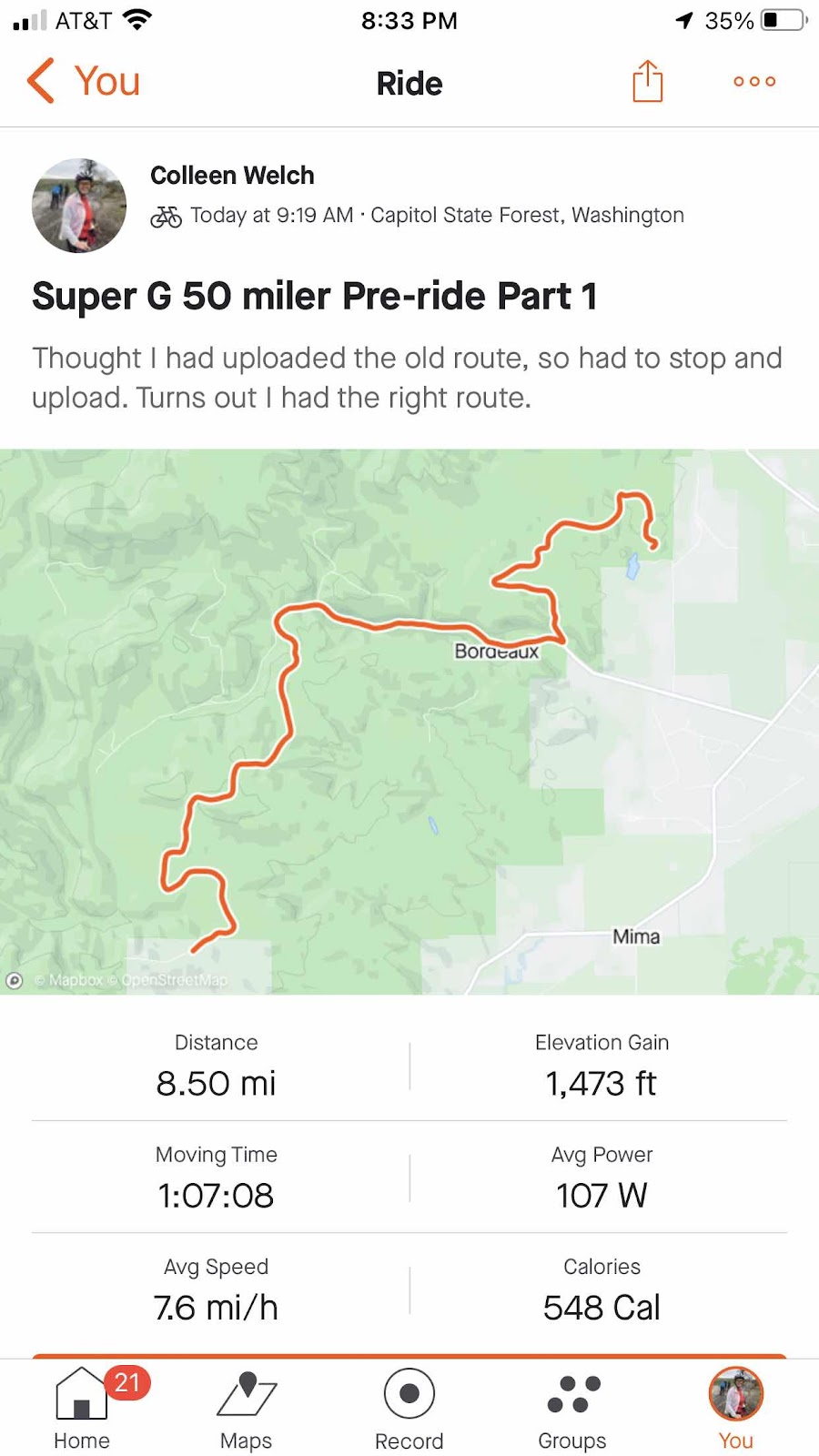
Start is in the upper right.
We got to an intersection, and we weren’t sure which way to go. The reason for this was that Cam, the race organizer, had made a reroute after a report from Makaela and Stephanie’s pre-ride of the 30 mile course a week ago. I wasn’t sure if I had loaded to new route or the old route onto my Garmin. In order to figure that out, I had to stop the current recording, and upload it. Turns out I did have the correct route loaded. So, the above route became Part 1. Turns out it was the easiest of the day…
Part 2-Hiking is Hard…Hike-a-Biking is Harder!
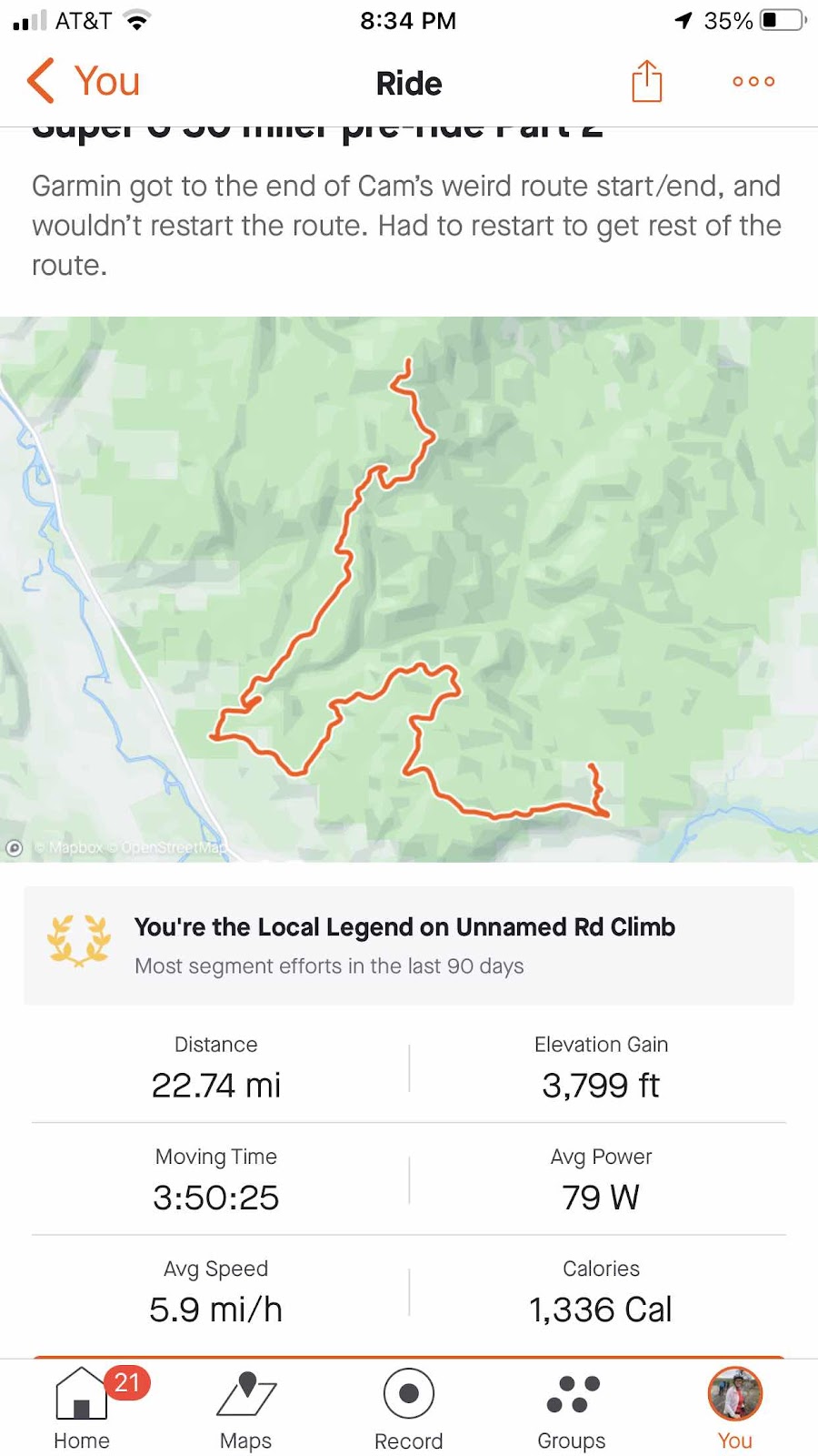
Part 2 started in the lower right.
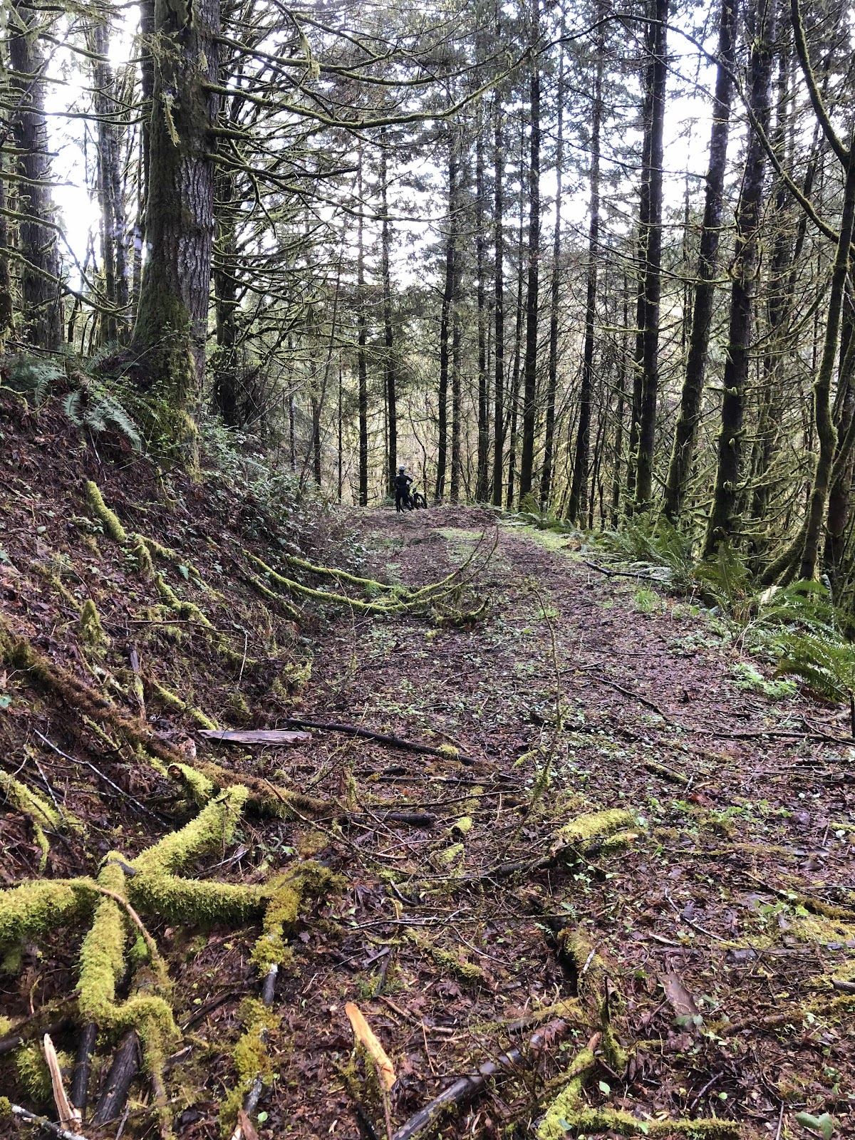
The beginning of Part 2 was some very chunky rock. I let some air out of my tires. The trick with chunky rock is to keep up a little bit of speed. Otherwise, the rocks just push the bike around. Once we got out of the chunky stuff, the road was nice.

This really was a pretty part. The camera doesn’t really do it justice.
Unfortunately, it didn’t last long. The road ended where it looks like they decommissioned it by putting in big ditches for water run-off.
You can just see ahead, one of the ditches where Makaela is.

It’s not possible to ride, so we walk.
Then the road ends at a creek. It’s a tricky crossing that takes both of us to get our bikes across (well, to get my bike across…Makaela is far more nimble than I am).

Makaela beginning to work her way down to the creek.
Successfully across the creek, we hike the bikes up to a road just like what we had come down…more ditches. Then there are downed trees too. Yay, this is fun…not.
Back up. It wasn’t too bad here…it got worse.
We finally popped out to another road made up of chunky rock. I started to ride, but going uphill makes it hard to maintain enough speed to ride over the rocks. Back to pushing.
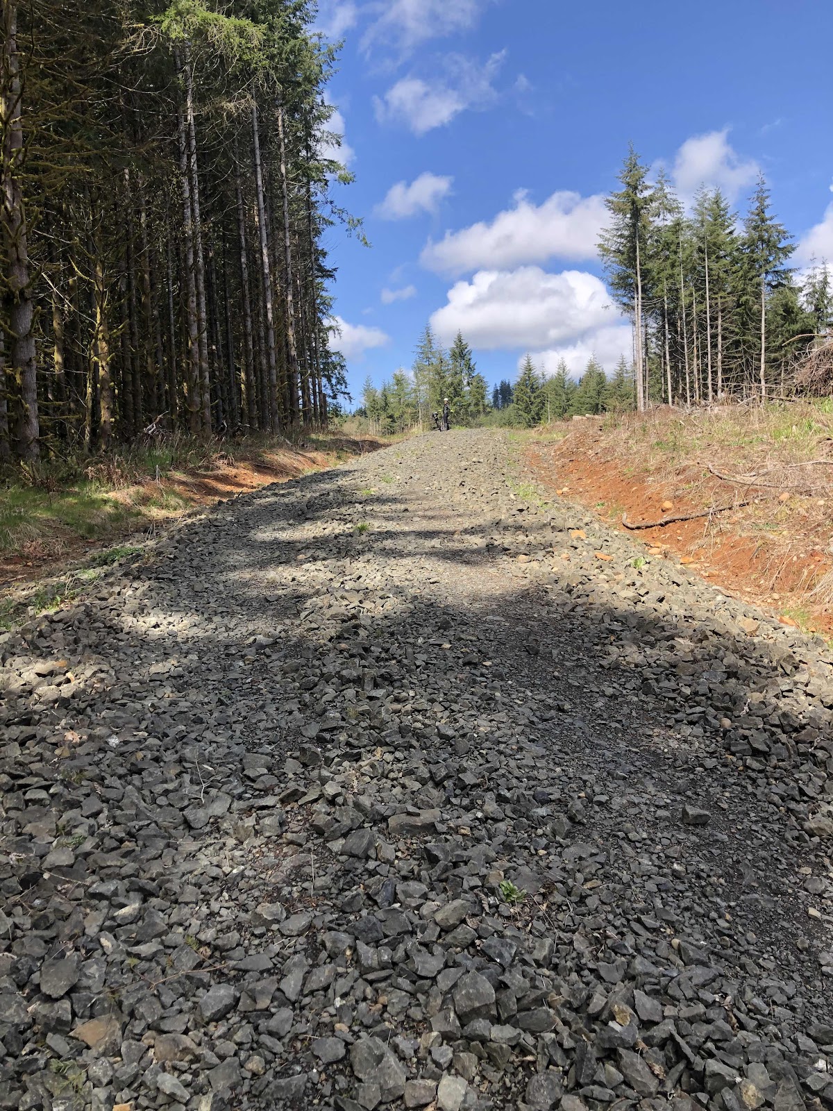
Uphill chunky rock.
Eventually, the rock became more manageable, but the hill remained steep. I still had to walk, even with my awesome low gearing. Makaela did a great job riding up the whole thing. At least we had this view at the top.

Rainer to the left, Adams in the center, and St. Helens through the trees on the right. Even though we had a lot of hike-a-bike, it was a beautiful day.
We were on a good road. Then I recognized where we were. We were back on the E-Line! I told Makaela that we could have avoided that entire hike-a-bike if we had just stayed on the road we were on in the first part.
Sadly, we didn’t stay on it for too long. Oh no, we had to go down a different road. This was a nice road until we had to get on a crudely cut trail through the woods. Great, more hike-a-bike! Did I mention that the “G” in Super G stands for gravel? This was not gravel.
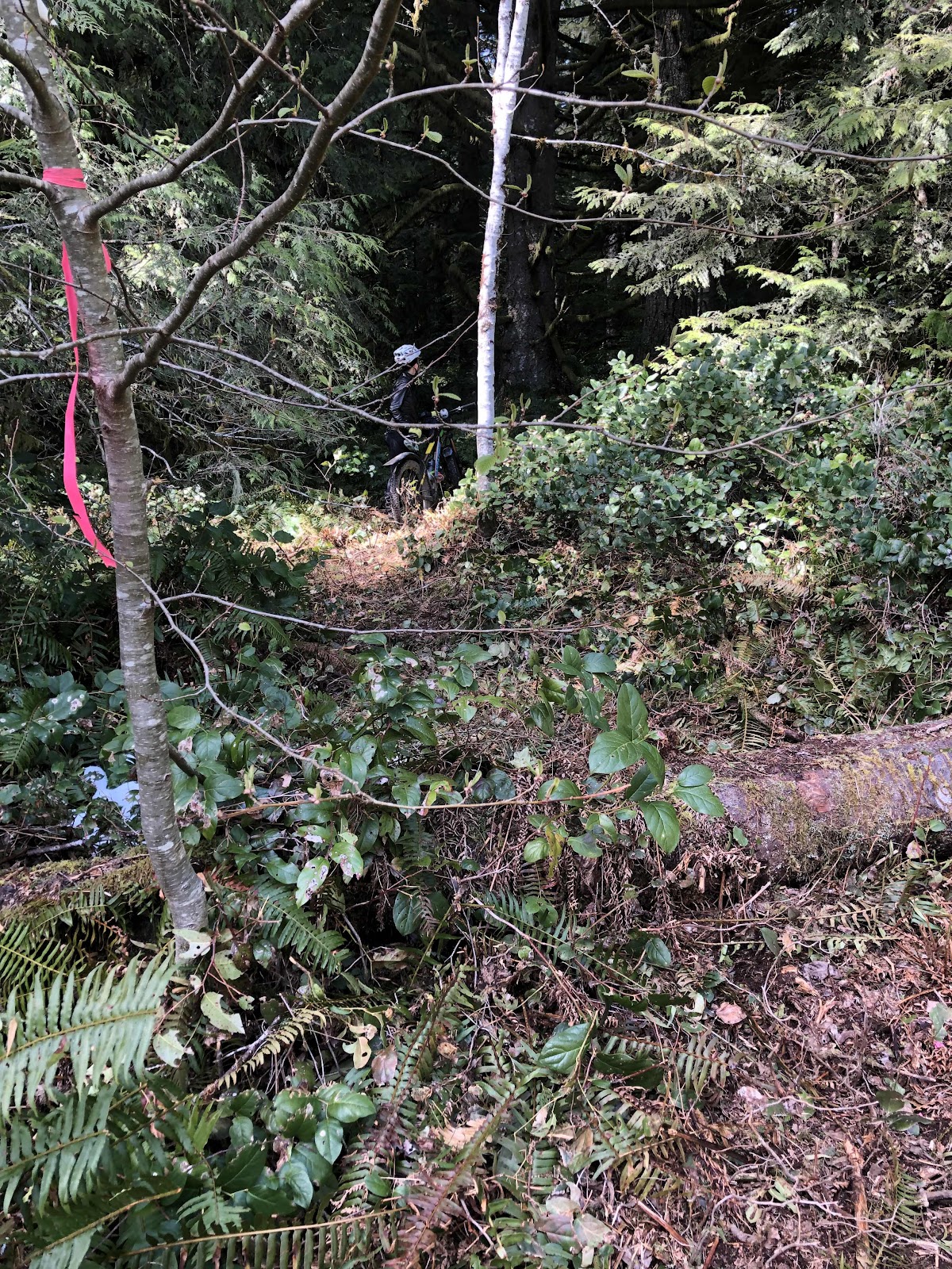
Near the end of the jaunt through the woods, there was a large fir tree down. This looked to be recent. We scouted a way around it, and then hauled the bikes out to the road. That was the last of the intentional hike-a-bikes.
Once again, we popped back out onto the E-Line! This time we stayed on it to the D-Line. At the D-Line, we went across the road to take a break and have some food. Makaela found some nice seats for us.
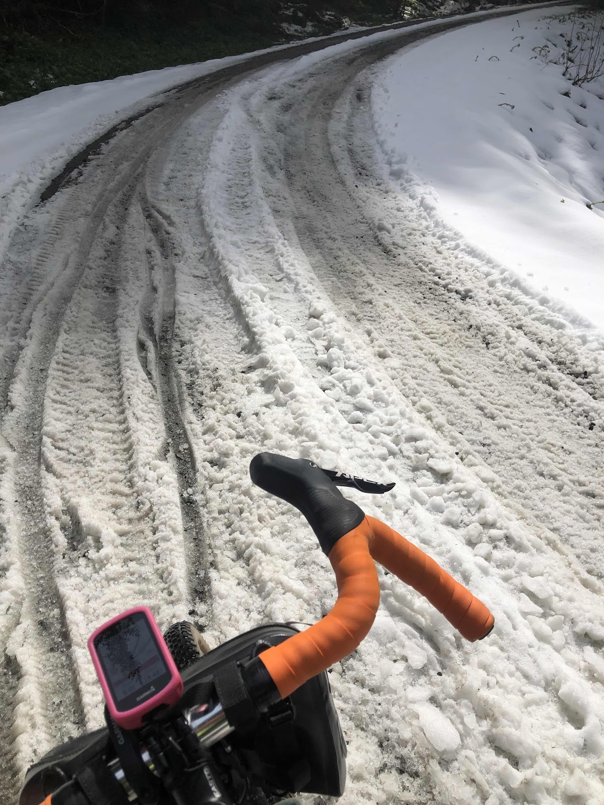
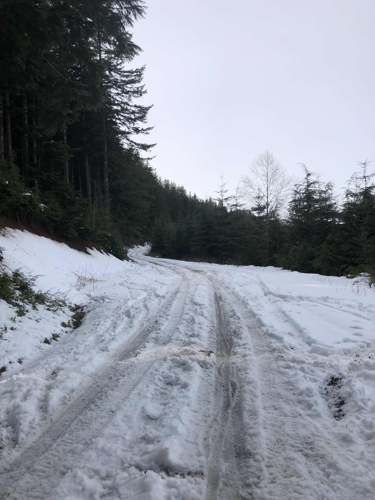
The next big climb was D1000. I had received some intel that there was snow at about 1600 feet. We would be climbing up to about 2000 feet. So, the 7.3 mile climb up D1000 was basically a climb to the snow. Sure enough, at about 1700 feet, we hit snow.
This was just a short bit.
This was a long bit.
It was back to pushing when it was uphill (which was most of it), and riding with one outrigger foot when there was any kind of down.
For some stretches, there was a clear double track, and we were able to ride, but then it would be back to scootering or walking.
Once we made it to the C-Line, there was more double track, and riding was possible for most of the way except at the intersection of C-Line and C4000. A guy in a truck (that I recognized, but can’t remember his name) said C4000 was pretty rough, so when I caught up to Makaela at the intersection, I suggested we continue down the C-Line instead of C4000. We would pick up the route again at D4000. Due to a strange thing in the route where Cam had the start and finish at the D1000/C-Line intersection, my Garmin thought I was done, and was no longer showing the route. Once again, I had to stop, upload, then restart the route.
Part 3-The Route is Merely a Suggestion, Right?
We enjoyed the ride down the C-Line. Just before the turn onto D4000, we passed the road where the route comes out. Then we were back on the route. The rest of the ride was familiar territory. We were both down to our final water bottles, hungry, and just wanting to finish. We followed the route until it turned onto the singletrack McKenney Trail. Instead, we headed back to E9000 where we rode the Mima Falls Trail back to the parking lot.
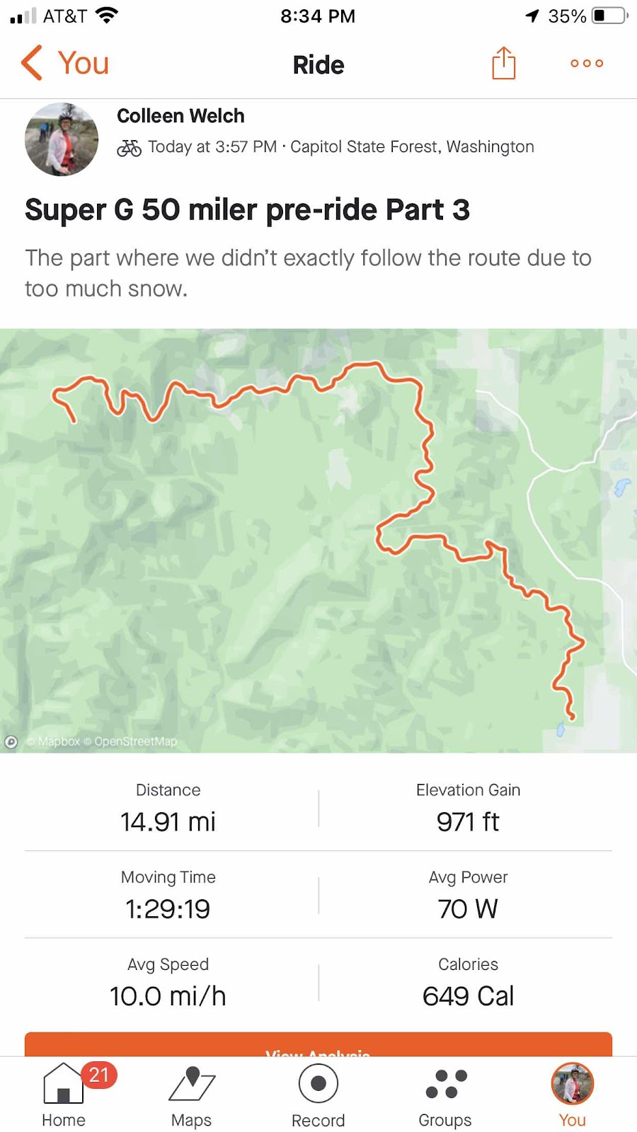
Part 3 started in the upper left, and finished back where we started the day.
It took us over 6 hours of ride time to do just shy of 48 miles. Today was a beautiful sunny day. The forecast for the actual race next Saturday is, so far, not looking as good.
We will take what we’ve learned from today’s ride, and modify our route for the race. We’re not really racing it anyway, so as far as I’m concerned, the route is merely a suggestion.
No comments:
Post a Comment