Monday, July 8, 2013

And Now the Pass


I  wanted to get an early start this morning to get as much of the climb up McKenzie Pass done in the cooler hours. In reality, it didn't matter because the bulk of the climb was among the trees and quite shady. 

I managed to make 7 miles before dropping into Super Granny gear. From then on, it was just keep pedaling! I turned on my Volcano speaker to give me some tunes to pedal by.

Since this is one of Oregon's Scenic Bikeways, there was a plethora of bike signs. Here is a great one:
That's right, bikes can use the WHOLE lane. That is quite helpful on those right hand turns. I didn't have to pedal "out of a hole".

After several miles, I popped out of the trees to the barren lava landscape.
It is really quite surreal. I walked a little in the lava, but my bike sandals with the cleats make it a bit nerve racking. 

I finally reached the 5000 ft. elevation sign so I knew I didn't have much farther to go to get to the summit and the Dee Wright Observatory. As I pulled up to the summit, I saw the Bicycle Adventures van that had passed me on the way up while I was talking to another touring cyclist named Ben (riding from Michigan to the Coast). I pulled over to ask if it was okay if I parked my bike there so I could walk up to the observatory. Not only was it okay that I parked there, but Lori told me to help myself to some lunch! I took her up on the offer! I had some delicious 7 layer dip and tortilla chips and, best of all, watermelon and cantaloupe! They even had drinks--I had a Gatorade.

After chatting with some of the riders and Lori (who happens to be from Leavenworth), I walked up to the observatory. It is a curious structure.
The 360 degree view from the top is, of course, fantastic. Here's some photos.
Mt. Washington to the left, and Mt. Jefferson (barely see it) to the right from the observatory window.
Two of the 3 Sisters.
The way down. The green sign in the center is the summit sign.

After I walked back down I asked Lori if I could take a photo of her (she had taken one of me).

I rode the 15 miles down into Sisters. Now I depart from the Scenic Bikeway and pick up the ACA Sierra Cascades Route. I'm writing this from a McDonalds in Sisters. I was thinking I had to go over Santiam Pass today. Nope, I'll do that tomorrow...thankfully. 

As I mentioned earlier, it didn't really matter if I got an early start (except for less traffic). If I were going the other direction, an early start would be very beneficial as there is not as much tree cover on the eastern side of the pass.

Now I REALLY won't have wifi again until Hood River (and, it turns out yesterday's wifi at Belknap Hotsprings was not the greatest. The blog wouldn't post.).

Back on the road I go for about 10 more miles...
One final photo from the summit.

A Mosey Along the McKenzie

This morning I left Eugene to begin Phase 2 of my Long Way to the Cabin Tour--the Mountain part. I had a nice time in Eugene with Kyle, Mallory, and her family. Due to the house being a Construction Zone, I sampled many of the restaurants Eugene has to offer, including three visits to Sweet Life Patisserie (I highly recommend everything they make!).

It was very easy getting out of Eugene. I rode through the U of O campus one last time. There were bike lanes all the way through Springfield. It was a very quiet Sunday morning.

Pretty soon, I was pedaling alongside the McKenzie River. I crossed it once, then it was on my right until the town of McKenzie Bridge.

I went through a number of small towns with names like Waterville, Nimrod, and Rainbow. I noticed there were a couple of dams on the river. At one of them, I could ride across it.


The dam was not the road I needed to take, but I crossed (then recrossed) anyway. I did the same thing a few more miles down the road at a covered bridge. The bridge was called the Goodpasture Bridge.

It was a lovely covered bridge.

After going through the town of McKenzie Bridge (where I crossed the river again), I didn't have too much farther to go. My destination for today was Belknap Hotsprings. The tent sites are expensive at $25, but there is a hot spring-fed pool (think giant jacuzzi without the bubbles--yes, it's that hot!), and wifi. The source of the Hotsprings is across the footbridge on the way to the tent sites. 

After setting up my camp, I donned my swimsuit and headed for the pool. I had a good soak in the hot water, and was wishing for a nap afterward! Instead I took a shower. Here's a couple of photos from the pool

This shot is taken half in the water, half out. Cool, huh?

Tomorrow I backtrack about a mile to get to the road over old McKenzie Pass. I am now on the McKenzie Pass Scenic Bikeway!

It's unlikely I will have wifi again until Hood River. That will be four passes from here (McKenzie, Santiam, Blue Box, and Bennett)! Yep, it's time for the Mountain Phase!


Thursday, July 4, 2013

A 4th of July Ride to a Winery

Not just any winery, but the winery where my oldest son will be getting married in November!

Happy 4th of July!

I wanted to do a ride today, so I decided to ride out to Sweet Cheeks Winery. I figured the winery would be closed for the 4th, but I wanted to do the ride anyway. I Google-mapped the route and it gave me three options, so I used two to make a big loop.

Although Eugene itself is pretty flat, it is surrounded by hills. To go south, I first had to climb a ridge on Lorane Hwy. It was about a mile long climb, but it was shady and really quite nice. I came down the other side into a valley, so it was pretty flat...for awhile. Then I had to turn onto Briggs Hill Rd. Not surprisingly, it was another climb. Since I didn't have any bags on Betsy, I decided I would not allow myself to utilize super granny. Afterall, I need to work on my hill climbing anyway! I made it to the top. Coming down I could see the winery up on the hillside.

I reached the gates at the bottom of the driveway, and, as suspected, they were closed. 

I double-checked my route and headed back. At one point, I was back on Lorane Hwy, but in a different place. There were some pretty sections of sweet peas along the road.
Notice the couple on the tandem. There were lots of cyclists out today.


I turned onto Fox Hollow Rd. I figured I would have to climb back over the ridge. Sure enough, climb I did! It was a long climb on Fox Hollow, but a nice view near the top.

Coming down the other side, I hit my maximum (and maybe all-time max) speed for this trip of 40 mph! The Da Brim was flapping up and down if my head wasn't angled just right. It is only rated to 25 mph! Still, it was fun!

I just had one more short climb on Willamette before I was nearly back to the house. 

It was a very pleasant 30 mile ride for the 4th of July!

The Hazards of Staying in a Construction Zone

I'm staying at my son and soon-to-be daughter-in-law's house in Eugene. The thing is, they just moved in a couple of days before I got here, and...well, the remodel of the house is not exactly finished.

The washer and dryer are not hooked up, and I really needed to do a full-scale clothes washing. Since I was planning to ride with Mallory to campus, I thought I would quickly ride down the road to the laundromat and wash my clothes so I could get them hung up to dry. They weren't open. I guess that would have to wait until later. 

Mallory and I rode onto the U of O campus. I left Mallory there and went to Starbucks to post the previous two blogs (yep, cable and wifi not hooked up yet). From there I went to REI to get more fuel and Tenacious Tape (I used the remainder of my tape in the ER repair). 

I came back to the house and, again, took my skanky clothes to the laundromat. This time I was successful. On my way back, I realized I had a flat rear tire. Fortunately, it is just a few blocks between the house and laundromat. 

After I hung up my clothes, I turned to fixing the flat. Upon inspection, I discovered a piece of wire in the tire. Since the back porch is part of Construction Zone Central, it is likely I picked up the offending wire there. Well, there are worse places to get a flat tire!


Wednesday, July 3, 2013

From the Temperate Coast to Toasty Eugene

It was a little chilly and foggy this morning when I woke up. However, I looked at the weather and saw it was going to be 91 in Eugene. I would soak up the coolness as much as possible! I rode the 3 miles back into Florence to Hwy 126--aka the Florence-Eugene Hwy. 

Hwy 126 followed along the Suislaw River until Mapleton. 


It was pretty flat and the shoulders were wide. Very pleasant riding conditions.

At Mapleton, the road briefly departed from the river and I did a little climbing. Pretty soon I was doing some significant climbing. This climb lead to a tunnel where there was the ever-present button for cyclists. 
It has become kind of strange that for each tunnel I have gone through I have not had a single car pass me! It's not that there are cars going slow behind me. There are no cars at all.

After the nice downhill on the other side of the tunnel, I eventually came to the town of Walton. I pulled off at a farmstand mostly to use the potty shack. I felt bad just using the potty (even though it was just a sani-can), so I got a blueberry/banana milkshake and an apple pastry. The gal told me I still had a big climb ahead of me. Turns out it wasn't bad. It topped out at 769 ft. 

The rest of the ride into Eugene was pretty hot. I finally had to stop at a gas station for some Gatorade.  I was PARCHED (and water wasn't cutting it)! 

I rode a couple more miles and then got on the Fern Ridge Trail. I got off the trail at Bike Friday so Betsy could visit her birth place.
She was so excited, she fell over.

I rode the rest of the trail into town and worked my way to Kyle and Mallory's new house. They weren't home yet. The dogs were barking. I sat down and ate my bagel with peanutbutter and Nutella. Just as I was ready to pull out my chair, Kyle and Mallory rolled up.

Now I am here until Sunday. The house is pretty much a construction zone, but it's gonna be fun!


Evil Rodent Strikes Again!

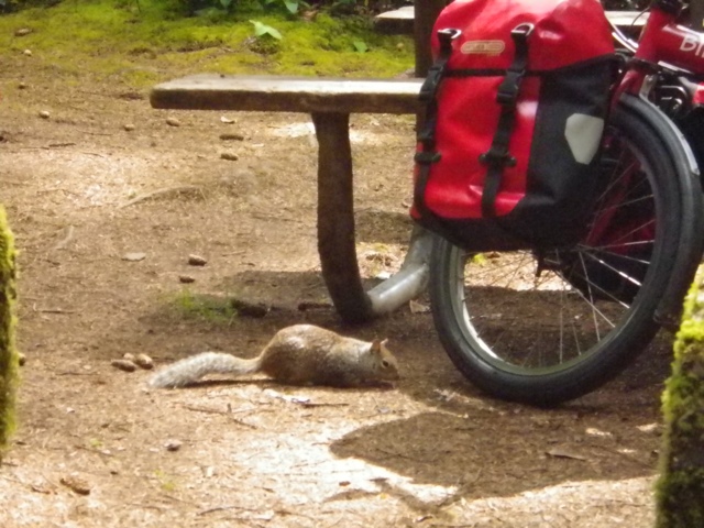
Once again a pannier has been the victim of the evil squirrel! Dang! As usual, I'll get to that story shortly (honest, I will!).

After another night of no other cyclists, I left Carl G. Washburne shortly after 8:00. Just a couple of miles up (literally) the road was Heceta Head. I rode down to the beach, parked Betsy and hiked up to the lighthouse.


As you can see, it was a beautiful day! There weren't very many people there as it was relatively early.

After the lighthouse, I continued the climbing, going across the Cape Creek Bridge and through the tunnel. This is another tunnel with the button to push to alert drivers of a bicycle. As I did at the Arch Cape Tunnel, I made it through without any cars passing me.

I pulled off after the tunnel at a place where I could look down and see the sea lions and Harbor Seals on the rocks below. 

There were also several hawks (or they could be turkey vultures) floating on the the updrafts. 

I passed the tourist attraction of the Sea Lion Caves (where you can pay to ride an elevator down to the caves, see Sea Lions, and smell the horrific stink--no thanks).

Coming down from Heceta Head, I stopped to check out this view of the Dunes.

I rode into Florence, stopped at Fred Meyer for a few groceries to tide me over until I reach Eugene tomorrow, stopped at Safeway for wifi, then road to Old Town for lunch at Mo's. I had my favorite Slumgullion (clam chowder and shrimp) and garlic toast. This was my first meal in a restaurant for this trip. It was delicious!

After I left Mo's, I saw this duck walking down the street. I asked I I could take a photo of "Ducky" with Betsy. Ducky's handler offered to take the photo with me and Ducky (and Betsy too, of course).

After crossing the bridge, it was just a couple more miles to Honeyman State Park where I checked in and set up my camp before heading over to the dunes. There were no other cyclists here, but I didn't expect any as I was quite early--1:30.

I hiked up to the top of the dune by the day use area on Clearwax Lake. It is hard work--half a step back for every step forward. I stopped to watch the sand boarders (picture snow boarding--only on sand). Seemed like a lot of work for short rides part way down the dune before crashing. The ones that seemed to get the longest ride were sitting instead of standing.

I came back to the H/B site and found a critter (I suspected the evil squirrel) had chewed a hole in the side of one of my front panniers. The hole is about the size of an old silver dollar. I patched it with duct tape and Tenacious Tape. As usual, the critter didn't get any food (too much plastic bags). 

Before I went to take a shower, I hung the panniers and trash bag in a tree. When I got back, the trash bag already had been gotten into. I put the bag on the picnic table and sat down to read. Pretty soon, the evil squirrel returned. He jumped up on the table. I shooed him away. I went back to my book. He came back. This time I threw a rock, but I missed him. I moved the bag to a log and gathered more rocks. I sat in my chair and waited for the Evil Rodent to return. Sure enough, he came sneaking up on the log. I waited patiently for him to come near the trash bag. As soon as he did, I threw another rock at him--DANG! Missed again! The ER returned quickly. This time when he got close to the bag, I threw the rock and knocked the bag off the log. I don't think I actually managed to hit him, but I haven't seen him since! I'm sure he is out there though--plotting his revenge! Meanwhile, I will gather more ammunition!


Monday, July 1, 2013

So, Who Was Carl G. Washburne?

No one seems to know...

Day 7, and another leisurely start. I figured I had about the same distance as yesterday--30+ miles. It was a little foggy this morning, but not cold. As I was packing up my stuff, some people were setting up for a wedding next to the Hiker/Biker site. I told Mary and JR they should invite themselves to the reception!

I stopped at Seal Rock (Secret Question seen on the viewing platform--Is there a rock that looks like a seal? Answer--No). I went to use the restroom and mistakenly went into the Men's. Probably wouldn't have even realized my mistake, except there were two guys in there. Oops!

Next town down the road was Waldport. Just as I came to the outskirts, I saw a market. I also saw that the market had free wifi. Sweet! I stopped in and posted yesterday's blog. The guy who owns the place was really nice. Told me if I needed the restroom, there was one down the hallway. He also warned me about Cape Perpetua. Didn't really need the warning, but I thought that was nice of him. 

As I rode through Waldport, I saw they now have a Subway! However, I didn't stop. 

Between Waldport and Yachats, I passed two other cyclists going north. They were both on folding bikes! I think one was a Tern, and I'm pretty sure the other was a Bike Friday. I said, "Hey!" They didn't stop, so I didn't either. Would have liked to talk to them (kind of hard when they are going the other direction on busy 101).

I rolled through Yachats and began the climb over Cape Perpetua. Actually, this is probably the second easiest Cape next to Cape Kiwanda. Coming down the other side I stopped at Devil's Churn. 
Talked to a gal there for a bit, then continued on to Spouting Horn and Cook's Chasm.
Not much spouting happening out the horn.

Cook's Chasm was...well...chasmy. 

I was getting hungry, so I pulled off at Neptune Beach to have some lunch. Due to the fantastic weather, there were lots of people at every Beach and Wayside along the coast. Lots of picnics.

It wasn't too much further to Carl G. Washburne State Park, my destination for the day. The park is located across 101 from the beach. The Hiker/Biker site is nice enough, especially since I am the first (and maybe only) person here--I was able to choose a flat tent site--there are not many. The shower/restrooms are close, and the showers are good and hot. I just have one question...Who was Carl G. Washburne? Perhaps I'll have to Google him when I have wifi.

After setting up my tent, I walked across 101 to the beach. I walked all the way south to the rocks at the base of Heceta Head (I'll ride to the lighthouse tomorrow). As I was walking down the beach, I heard a belching sound. I looked out in the waves and saw a sea lion "surfing" the waves then bobbing up and barking. It was as if he was calling for someone. I even got this photo!
He barked several times, then headed back out to sea. Maybe he was looking for the Sea Lion caves that are on the other side of Heceta Head???

So, after 7 days on, perhaps, the most popular bike tour route in the country, I have made an interesting observation. It seems that if one is not following the book (Bicycling the Pacific Coast), and is staying in other State Parks, one does not see as many cyclists. There was the group at Devil's Lake who are also not following the book, but at South Beach and here at Washburne, there are no other cyclists. That's a bummer, but I did want to try out some other parks...Tomorrow night I will be at Honeyman which IS on the BPC route.

Here are a couple of Tidepool photos from my stroll along the beach.